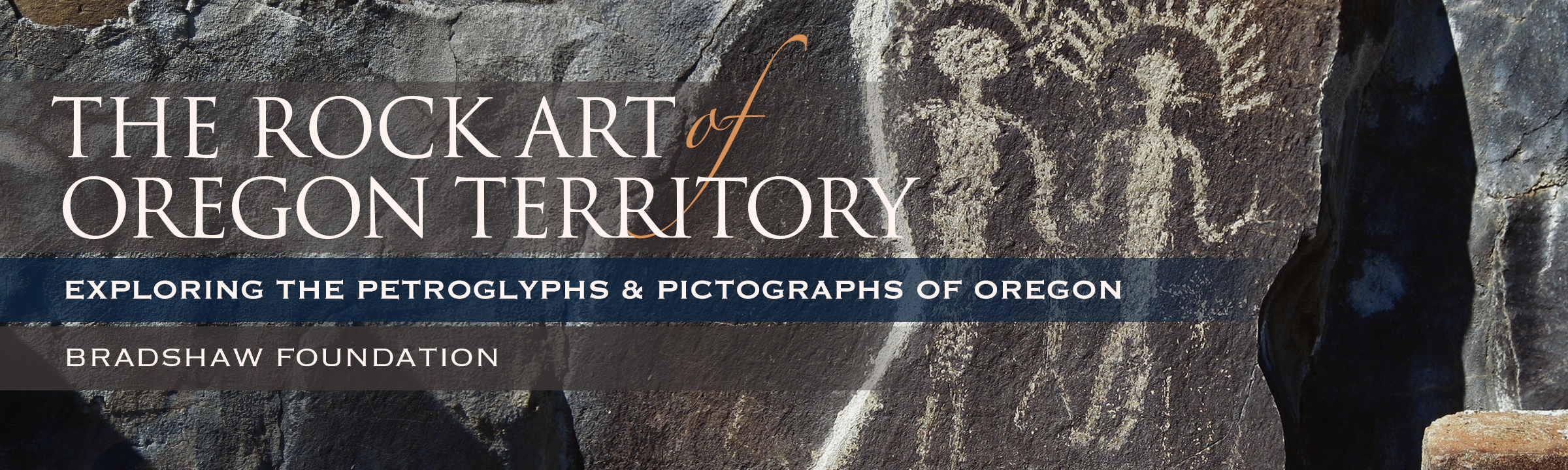
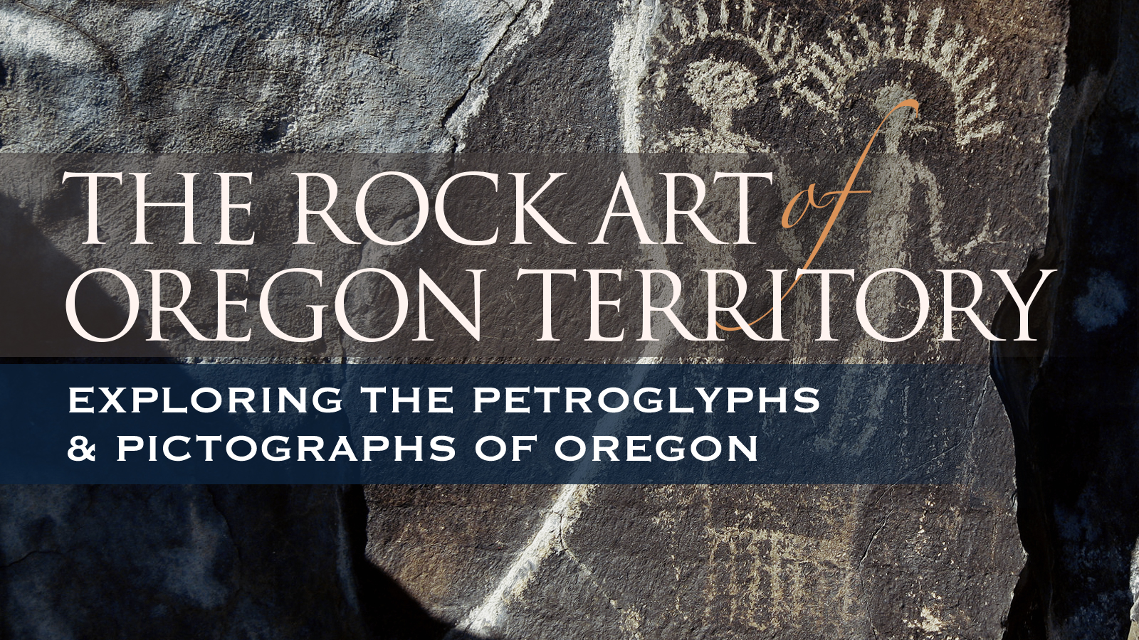
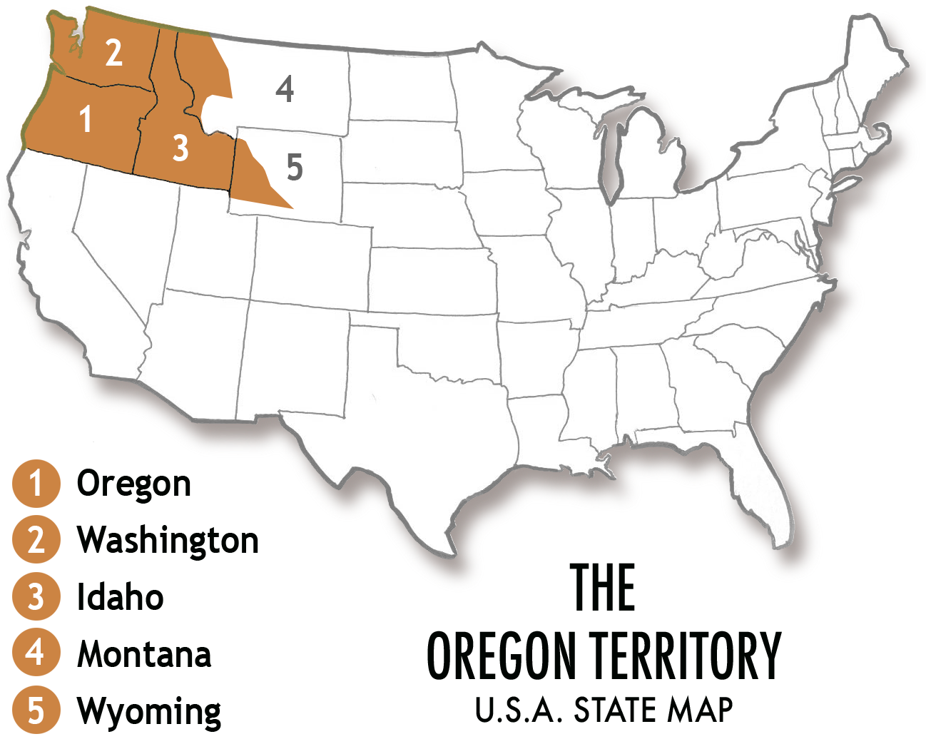
For purposes of exploring rock art in the Oregon Territory it is convenient to divide it into four basic areas: the Pacific Coast Area, the Klamath River Area, the Columbia River Drainage Area, and the Great Basin Area. These are related to the water features in the region, and as with any arbitrary division of land areas, there are places where there is some overlap.
Micnhimer and Johnston feel that with digital photography these sites can be thoroughly recorded visually, preserving a record of them for future study. And that by sharing that record via the world wide web on the site they built & maintain, www.oregonrockart.com access to the petroicons becomes available to a wide range of researchers. As of 2010 there are approximately 10,000 pictures on the site arranged in about 250 galleries. Johnston has compiled nearly twenty large albums of printed copies of several thousand photographs, matching the images with drawings made by previous researchers where possible.
While professional recording of rock art sites is the ideal, it requires a great deal of time and resources. Those are often in short supply. Given the fragile nature of this cultural heritage, Micnhimer and Johnston feel their efforts contribute inestimably to the body of knowledge connected with rock art in the Oregon Territory. Their work is mostly self supported although several small Loring and Loring Grants from the Oregon Archaeological Society have supplemented their efforts. Some of their research has been published by the OAS in Rock Art of the Oregon Country: Honoring the Lorings' Legacy and they have published a number of articles in the prestigious OAS Screenings newsletter. They have shared their findings with the Oregon Archaeological Society and the public at several OAS monthly meetings.
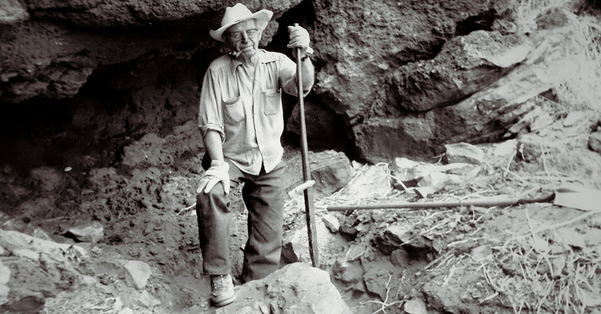
In 1982, avocational archaeologists J. Malcolm Loring and his wife, Louise, published a two volume monograph titled Pictographs & Petroglyphs of the Oregon Country. In 1960 they became active in the Oregon Archaeological Society. They served on a committee within that organization whose task it was to survey and record Oregon rock art. In 1963 Malcolm retired from the U.S. Forest Service and by that time the committee number had dwindled to just the two of them. From 1964 through 1967 they traveled, by their own account, at least 43,000 miles discovering, photographing and recording rock art sites. In 1967 and 1968 they recorded petroglyphs along the Columbia River that were flooded by the John Day Dam in 1968. They took color 35mm slides, black and white print film photographs, made hand drawn sketches and made rubbings of much of what they observed. The monograph contains the drawings they made and site descriptions for over three hundred sites.
Researchers in Washington and Idaho made similar surveys, although in much smaller areas. Professional and avocational archaeologists continue to record and study sites throughout the area.
In 2001, avocational archaeologists D. Russel Micnhimer and LeeAnn Johnston, inspired by copies of the works mentioned above, began visiting rock art sites in Oregon and Washington during summer vacations. They have photographed what they have seen at over one hundred sites as of late 2010. They have discovered and photographed a number of sites that were not included in the Lorings' inventory. Russel has developed www.oregonrockart.com to show case those photographs. New photos are added as sites are visited. LeeAnn has developed twenty (and counting) albums with over three hundred pages containing 5x7 color prints and copies of the Lorings' drawings correlated with the elements in the photos. Their work has been personally funded with small subsidies for five years by Loring and Loring Grants from the Oregon Archaeology Society.
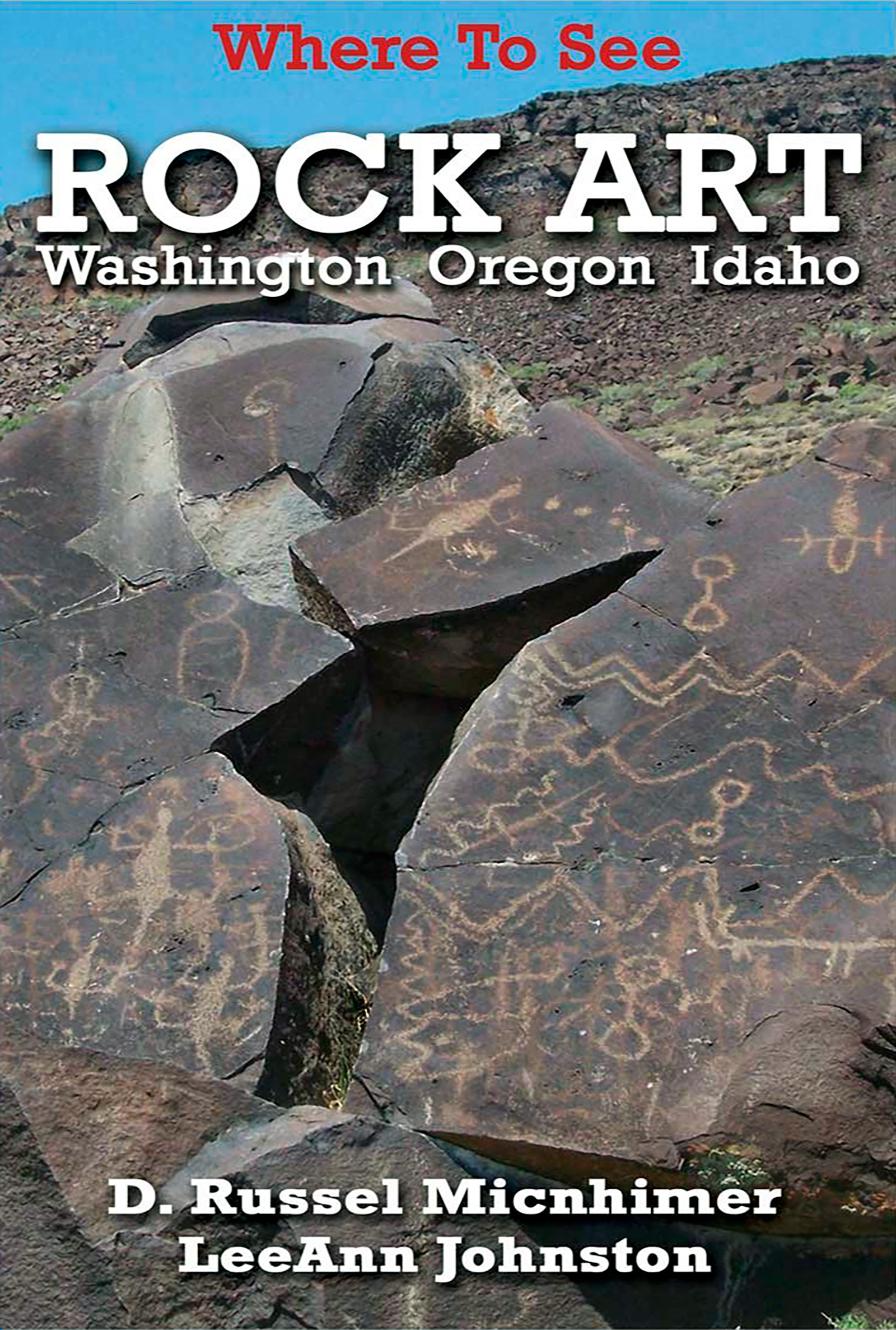
They presented accounts of their work to the OAS at meetings in 2005, 2006 and 2008 and have published several articles in that organization's newsletter, Screenings. A record of some of their most important site research was also included in the OAS volume, Rock Art of the Oregon Country Honoring the Lorings's Legacy. They feel their work will help serve as a condition check of Oregon rock art by comparing their records with earlier ones. As well as their work in the field, they continue to study the literature of many other researchers in the field and actively seek information on previously unrecorded sites. Their recently published Where to See Rock Art in Washington, Oregon & Idaho provides information about rock art in general and directions to sites where rock art can be experienced first hand. They hope their work will contribute to the body of knowledge concerning these valuable and irreplaceable communications from the past.
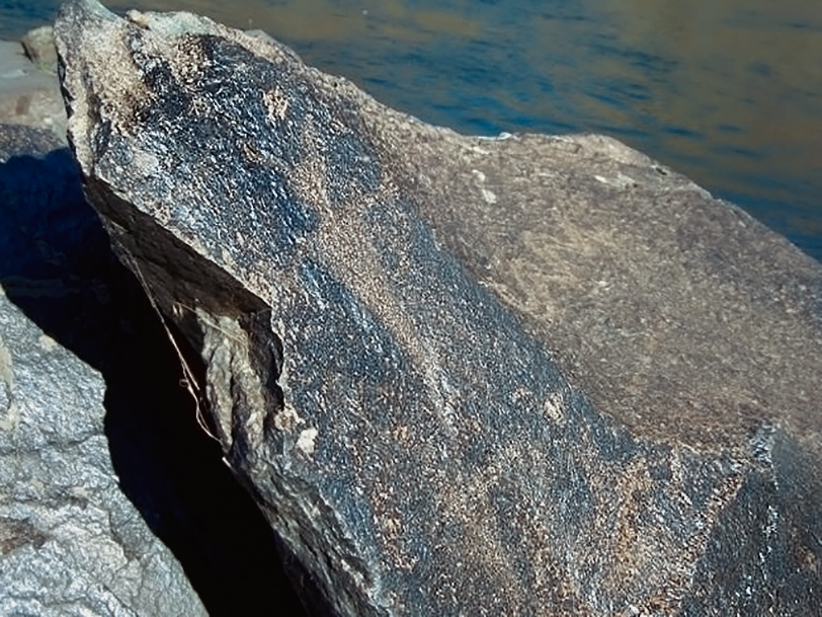
The Pacific coast area forms the western boundary. There are relatively few rock art sites in this area compared to the others. This may be due to several reasons. In the past during periods of advanced glaciation, sea level was much lower than it is at present. Therefore, if as some believe, humans migrated down the coast from Asia during that period, evidence of their passing would now be below sea level.
Since the coast is quite prone to rapid erosion, rocks upon which glyphs may have been created have tumbled into the sea. Due to the abundant rainfall on the coast, all kinds of vegetation thrive and form a thick layer that may obscure rock art. Due to the difficulty of physically moving across the landscape, the area is less well surveyed than others. Contrastingly, on the Canadian Pacific coast many rock art sites have been discovered, so it may be that sites still await revelation.
Between the Great Basin area and the the Columbia River drainage area is the Klamath River drainage in south central Oregon.
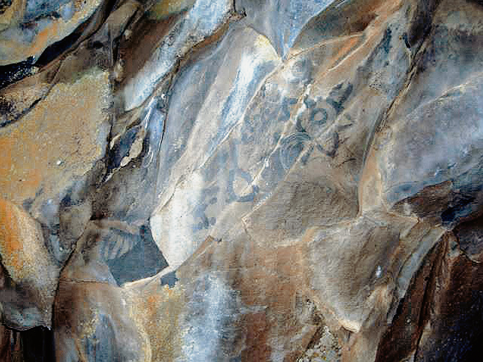
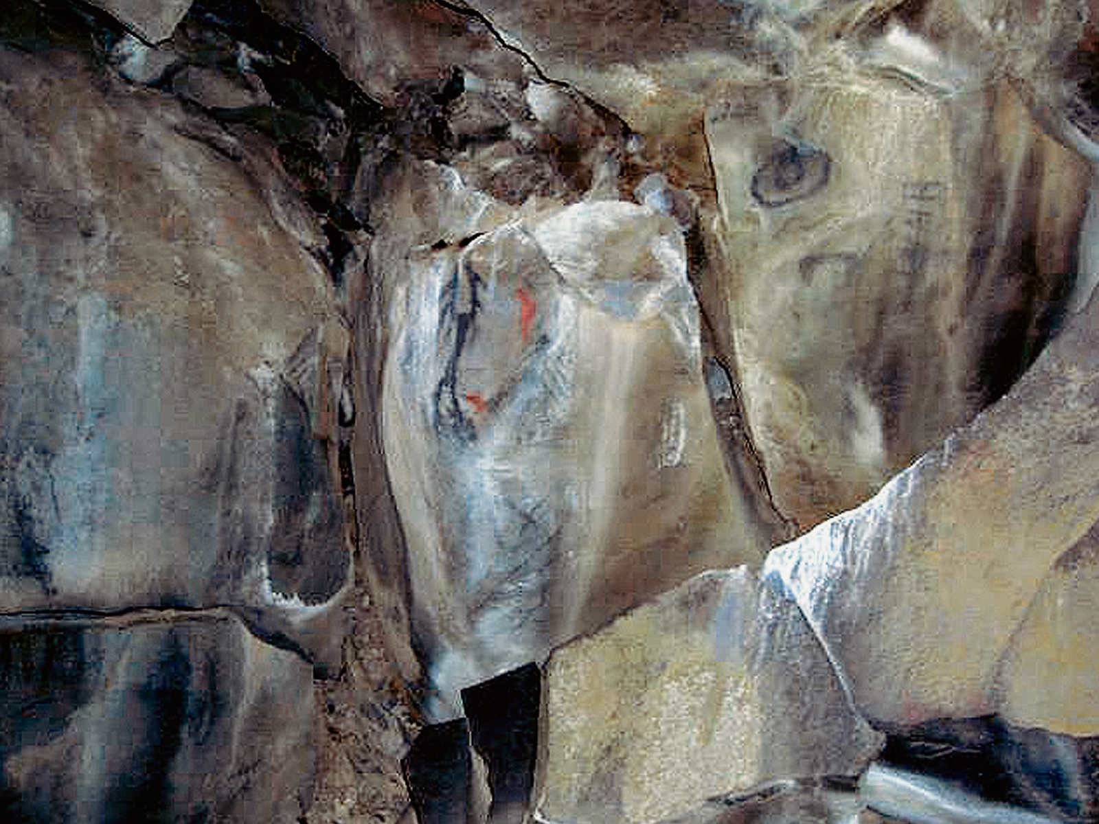
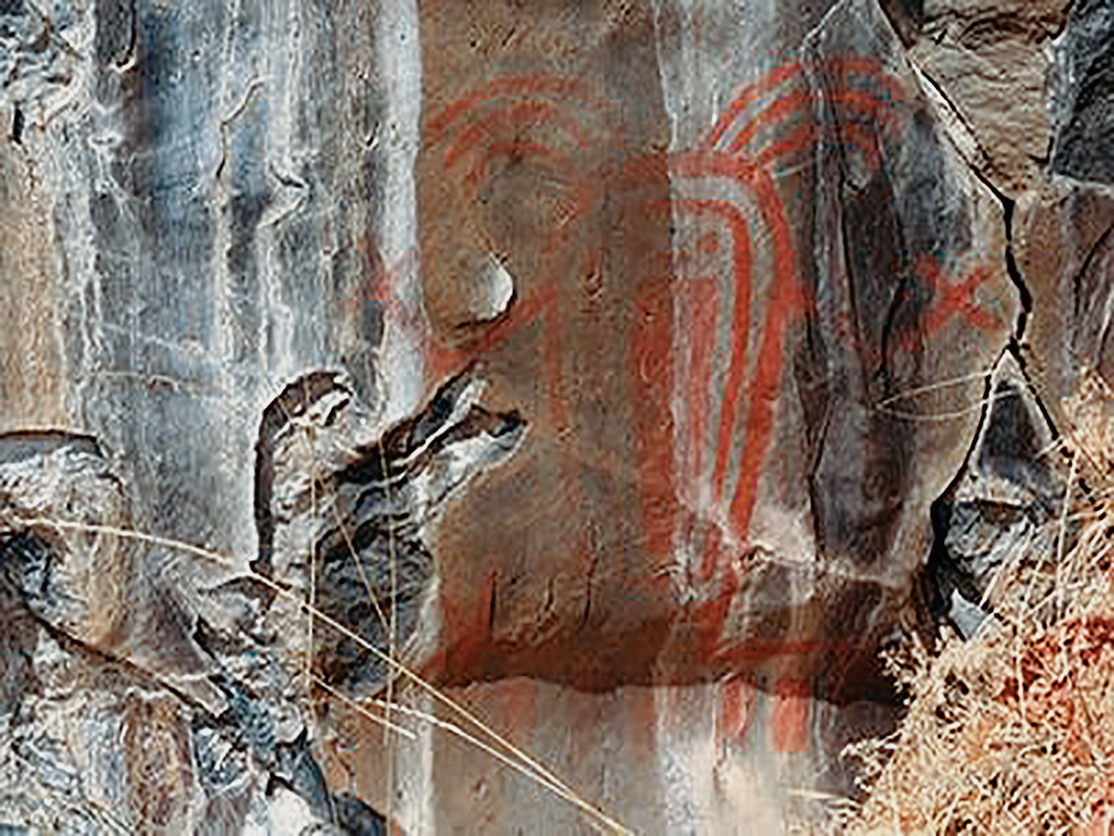
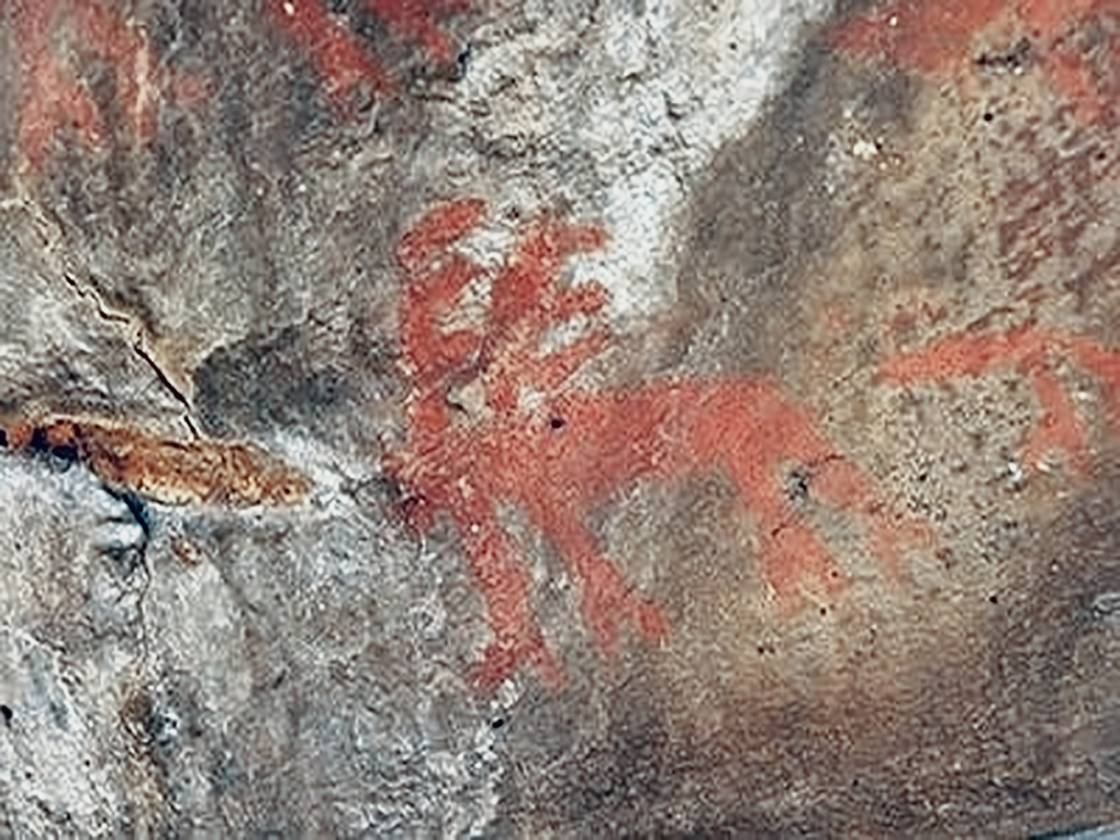
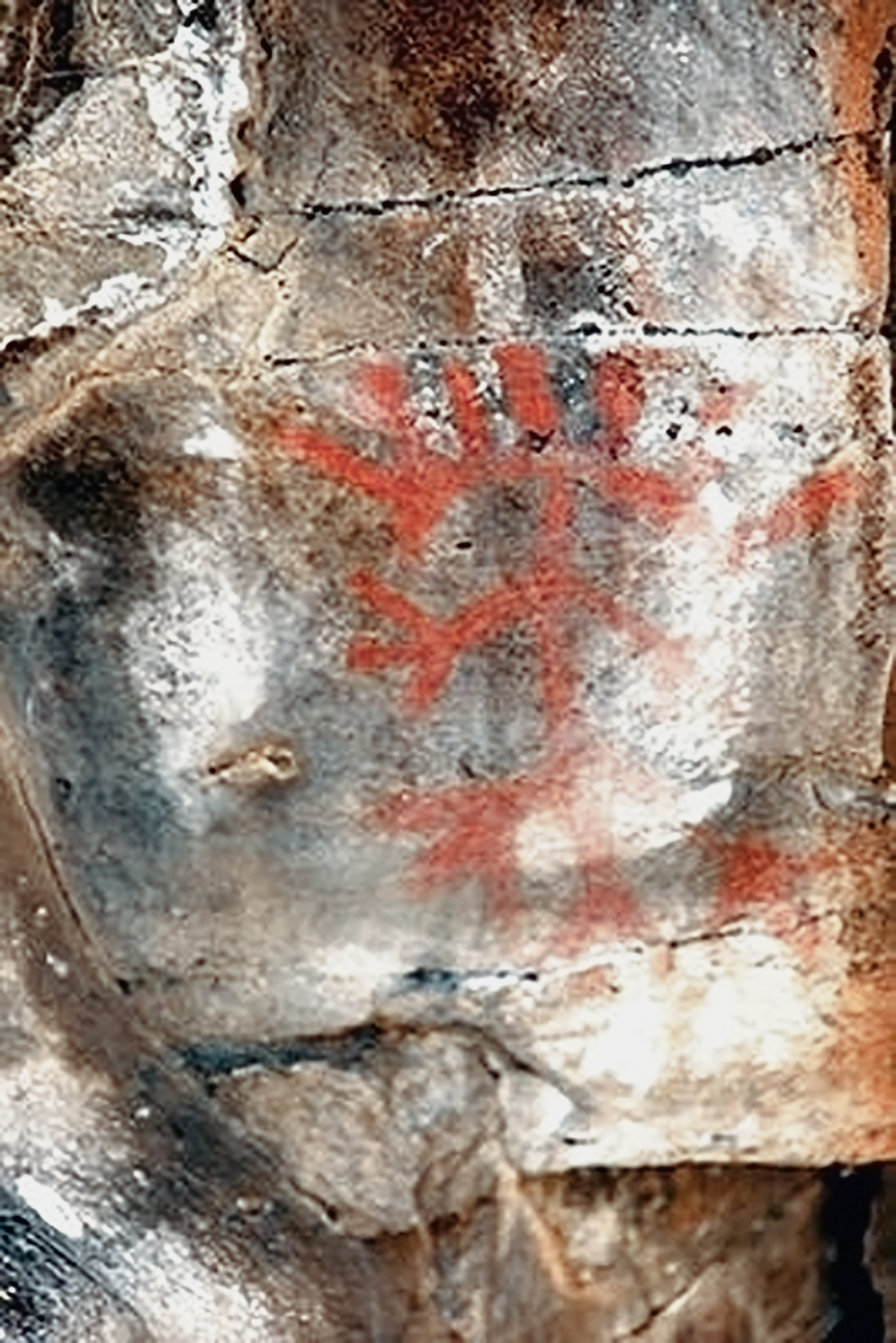
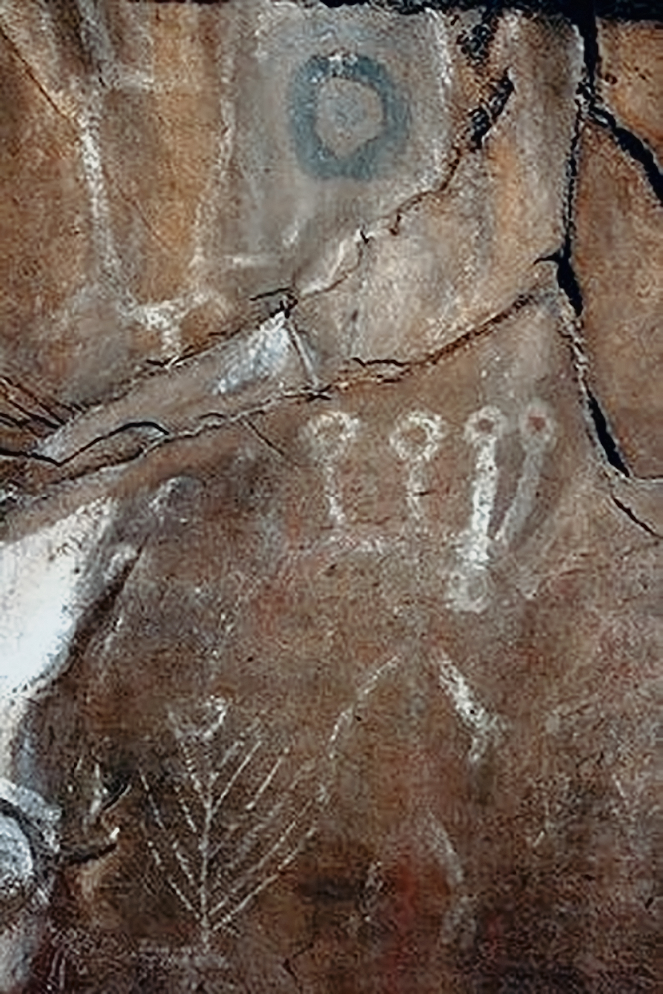
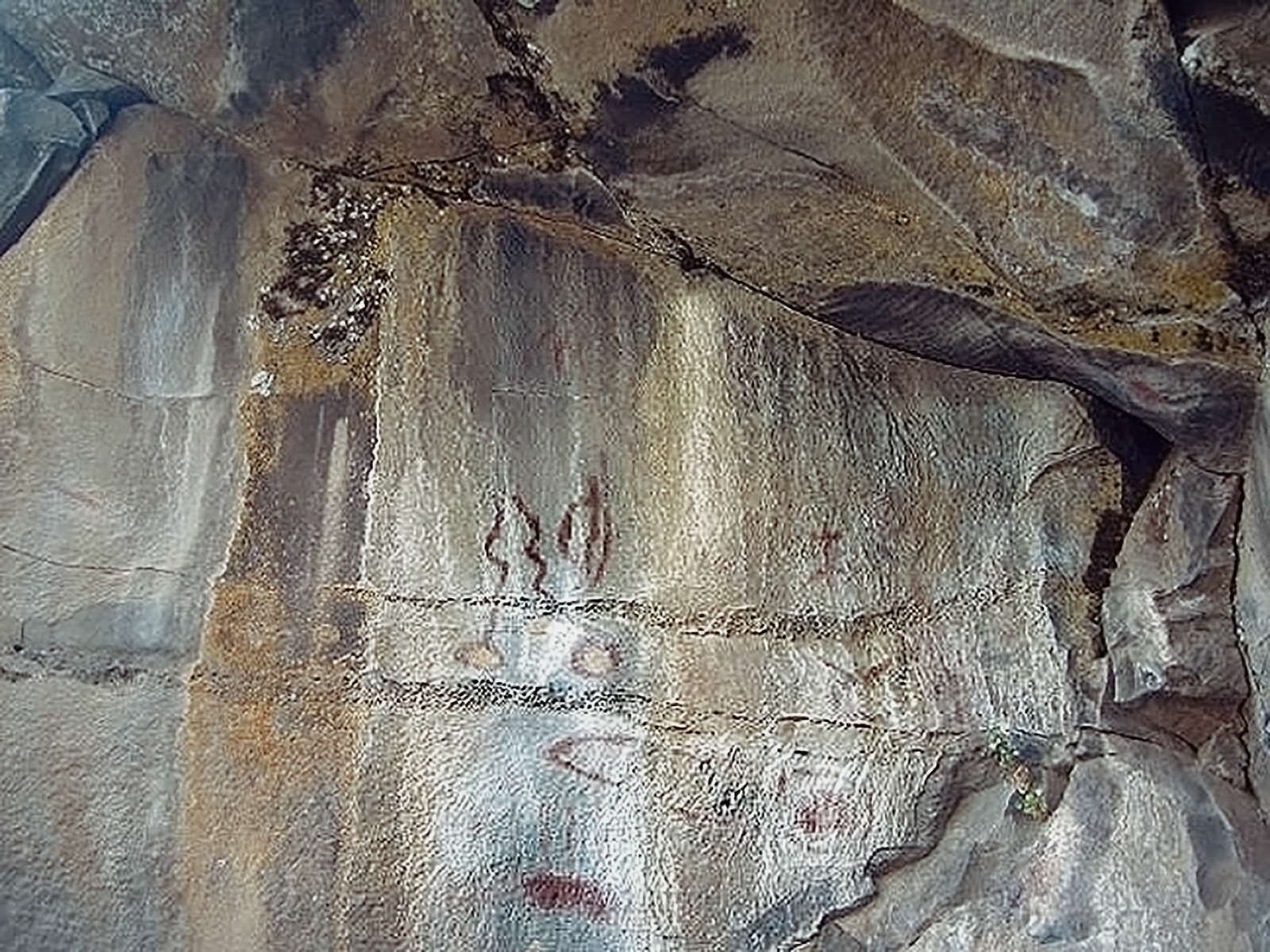
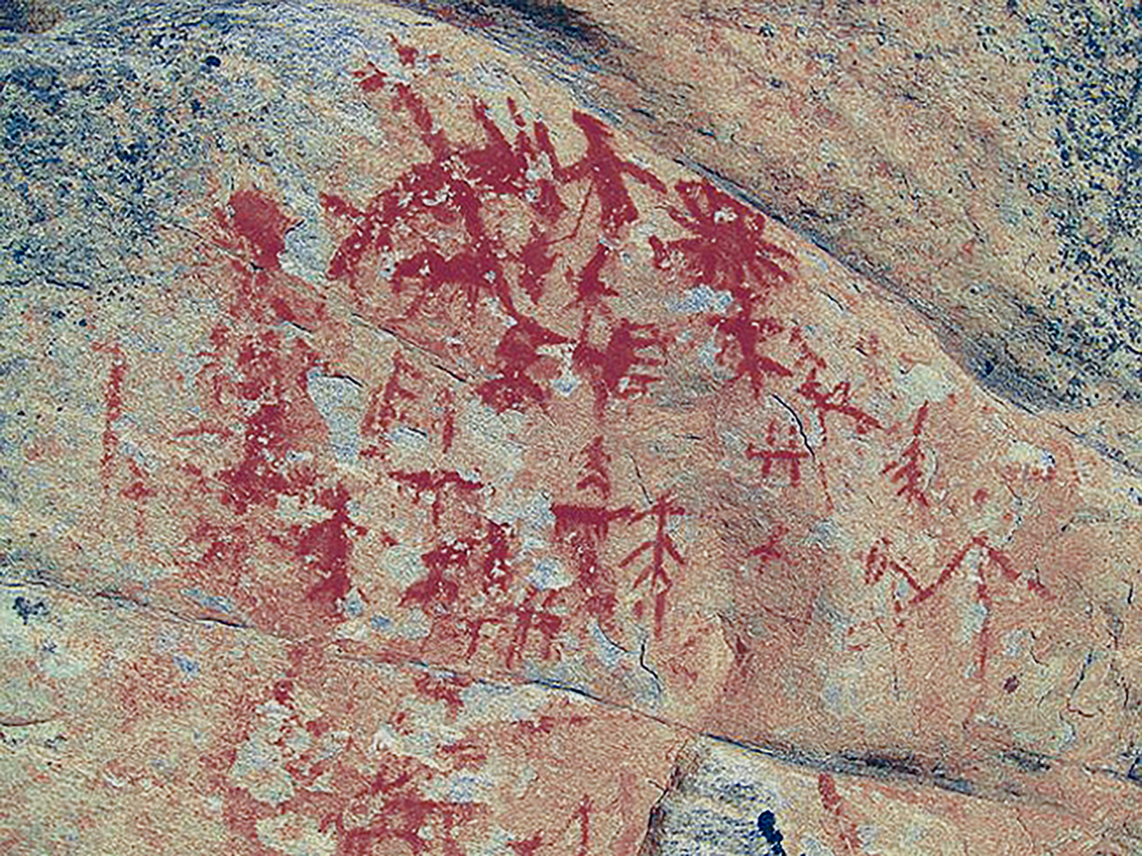
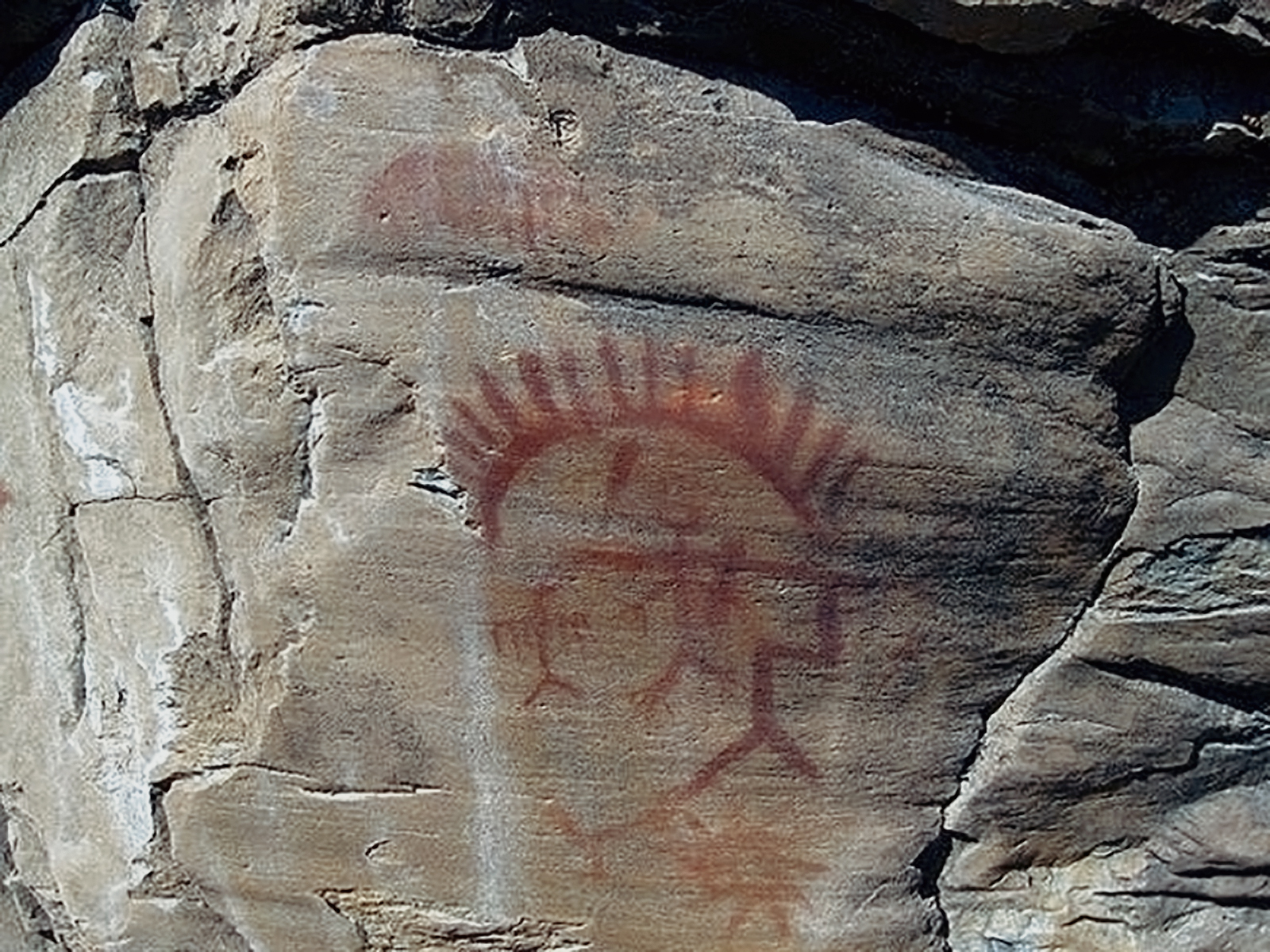
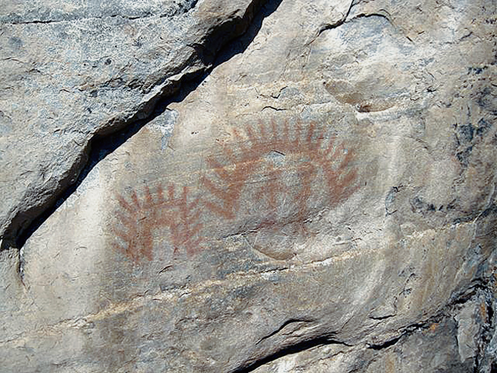
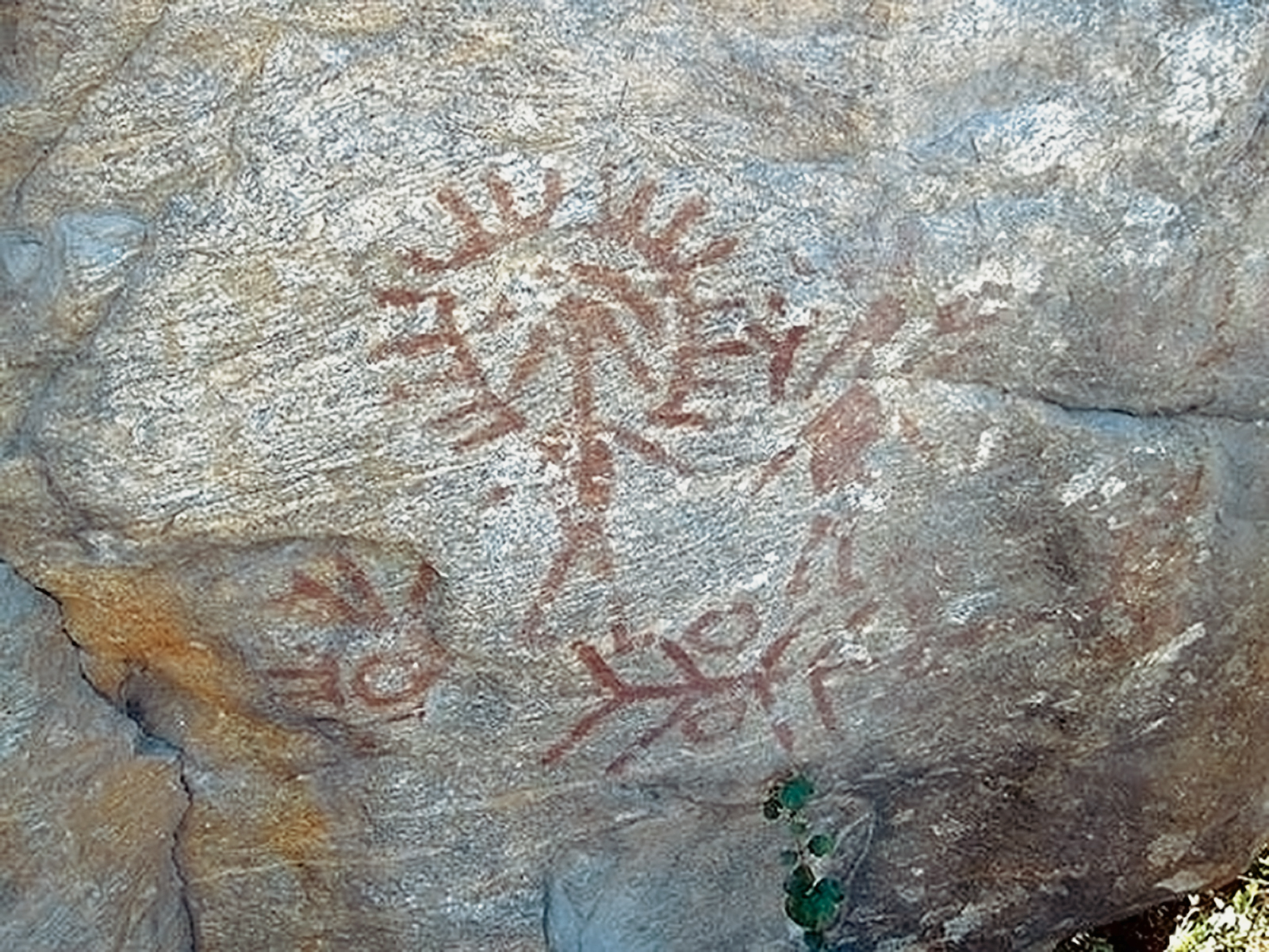
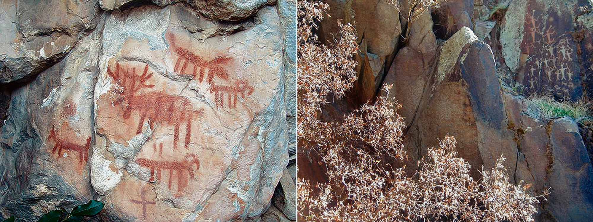
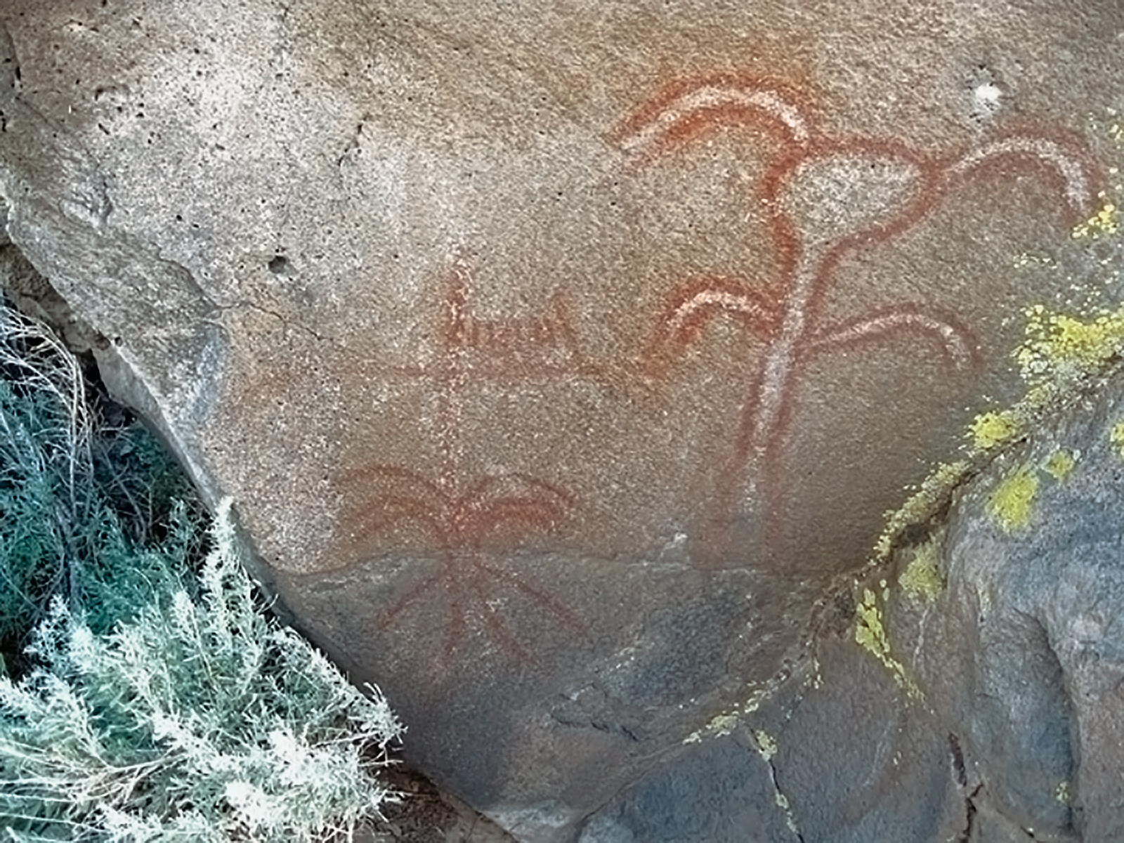
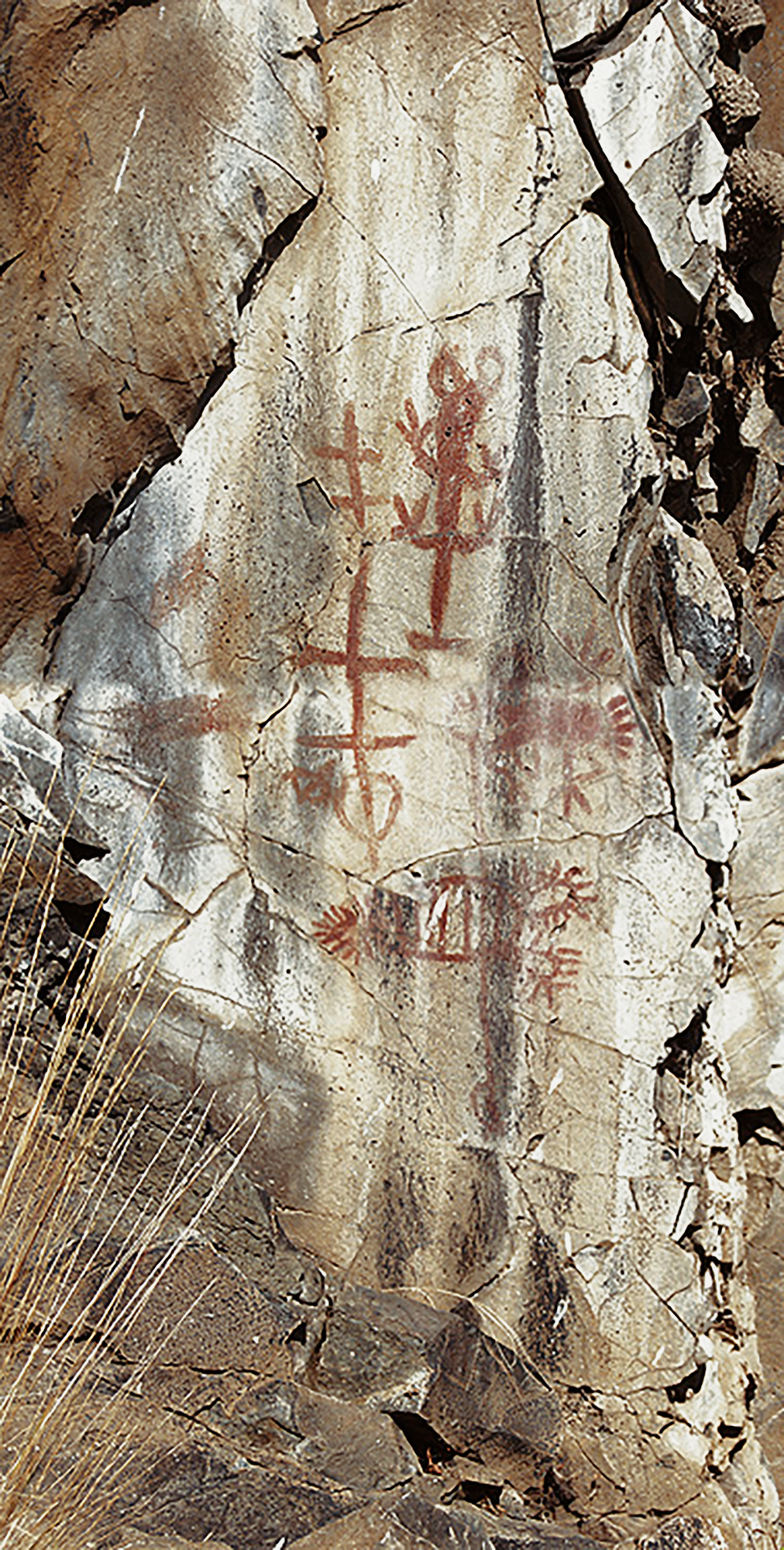
This river flows generally south and westward until it flows into the Pacific in northern California. Native Americans in this part of the territory still revere rock art, consequently images for rock art in that part of the territory are rare. Polychromatic pictographs predominate.
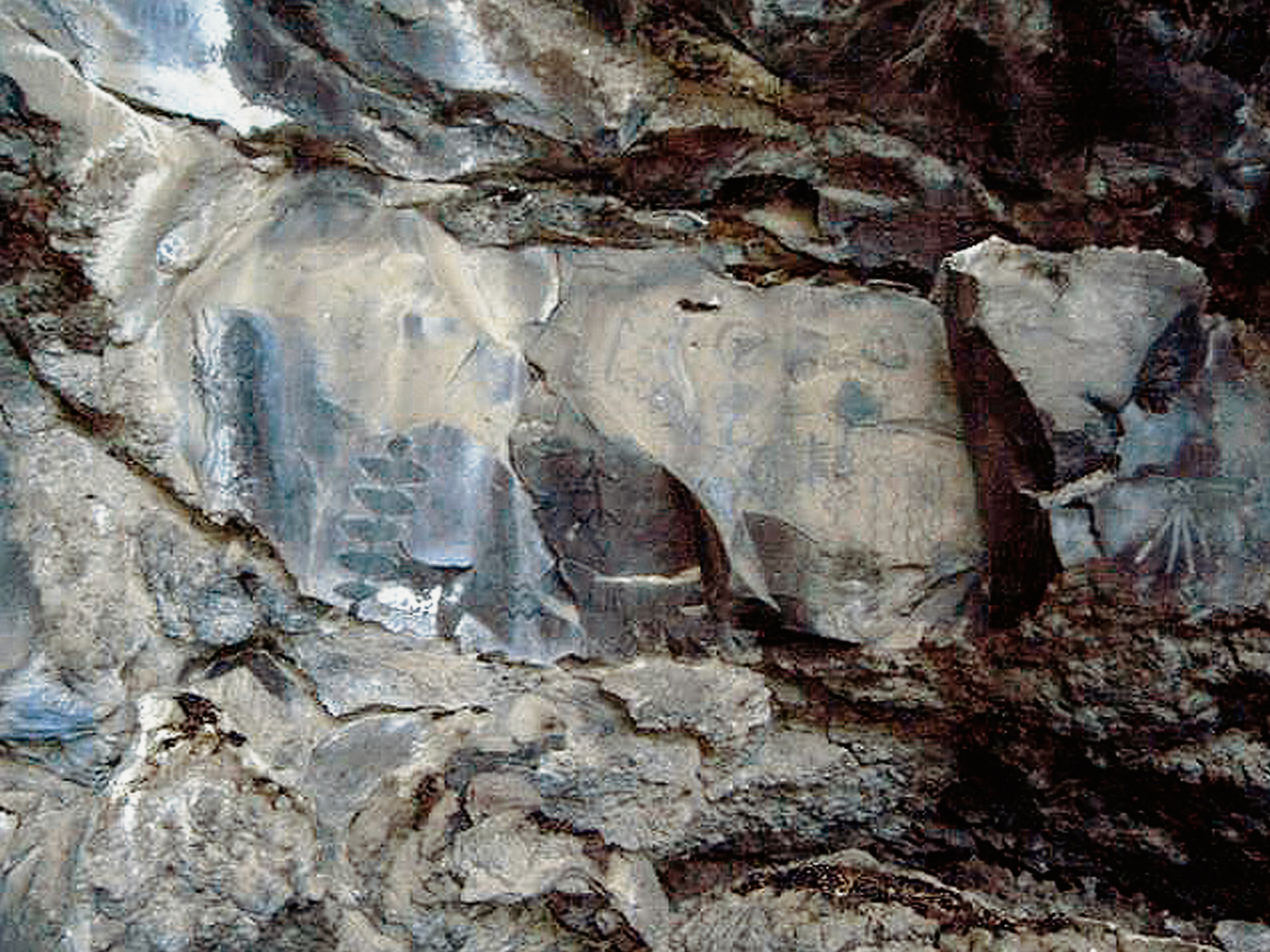
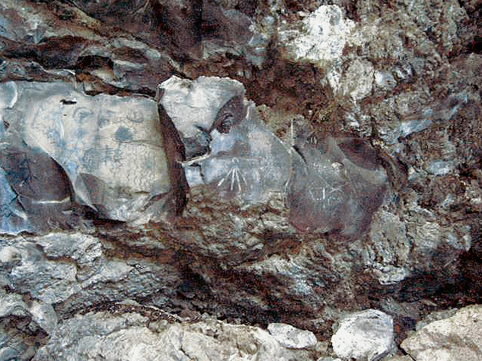
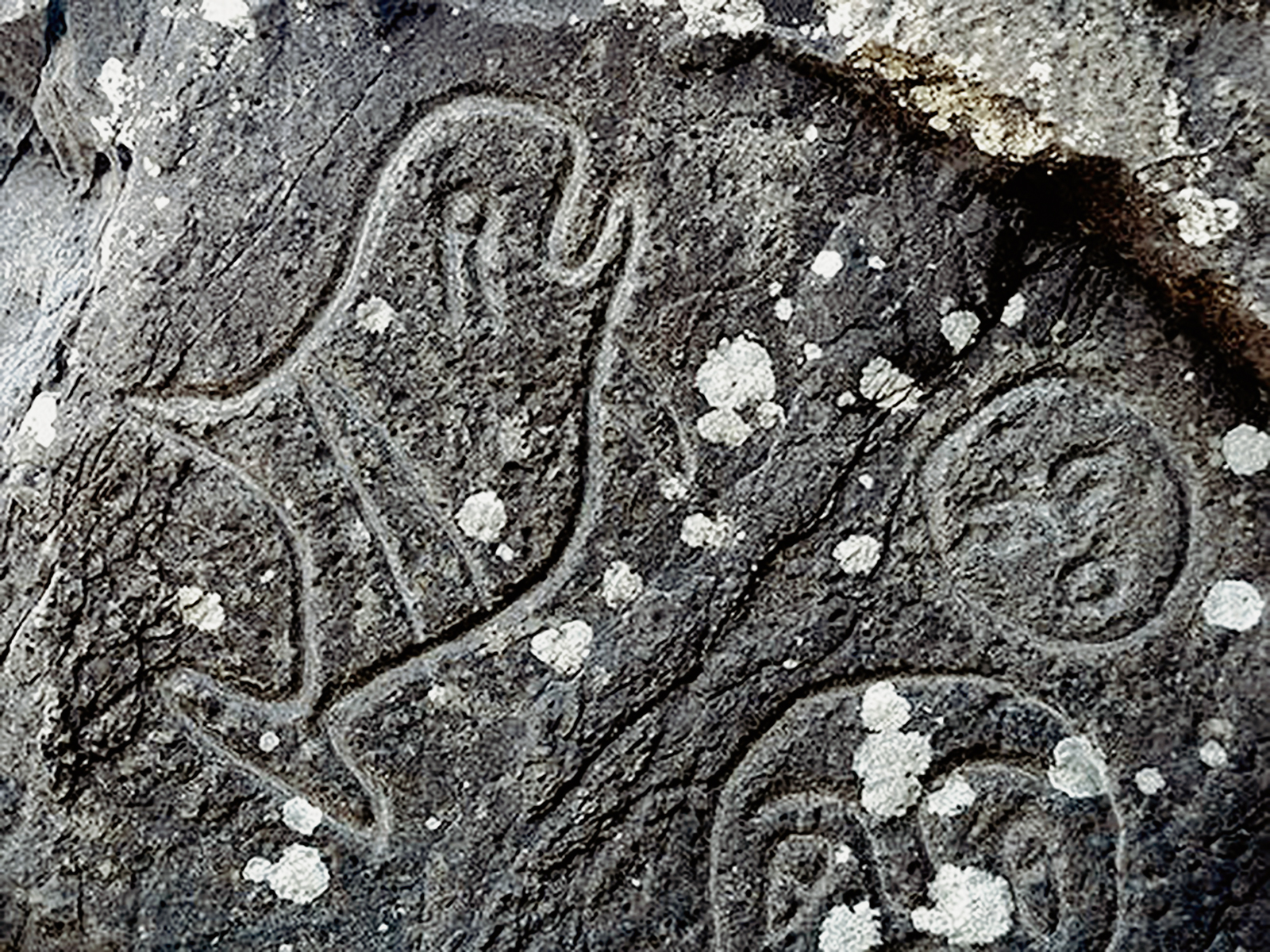
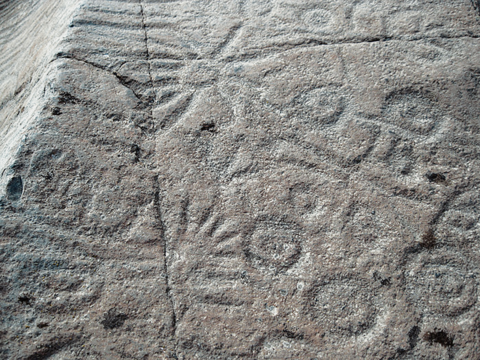
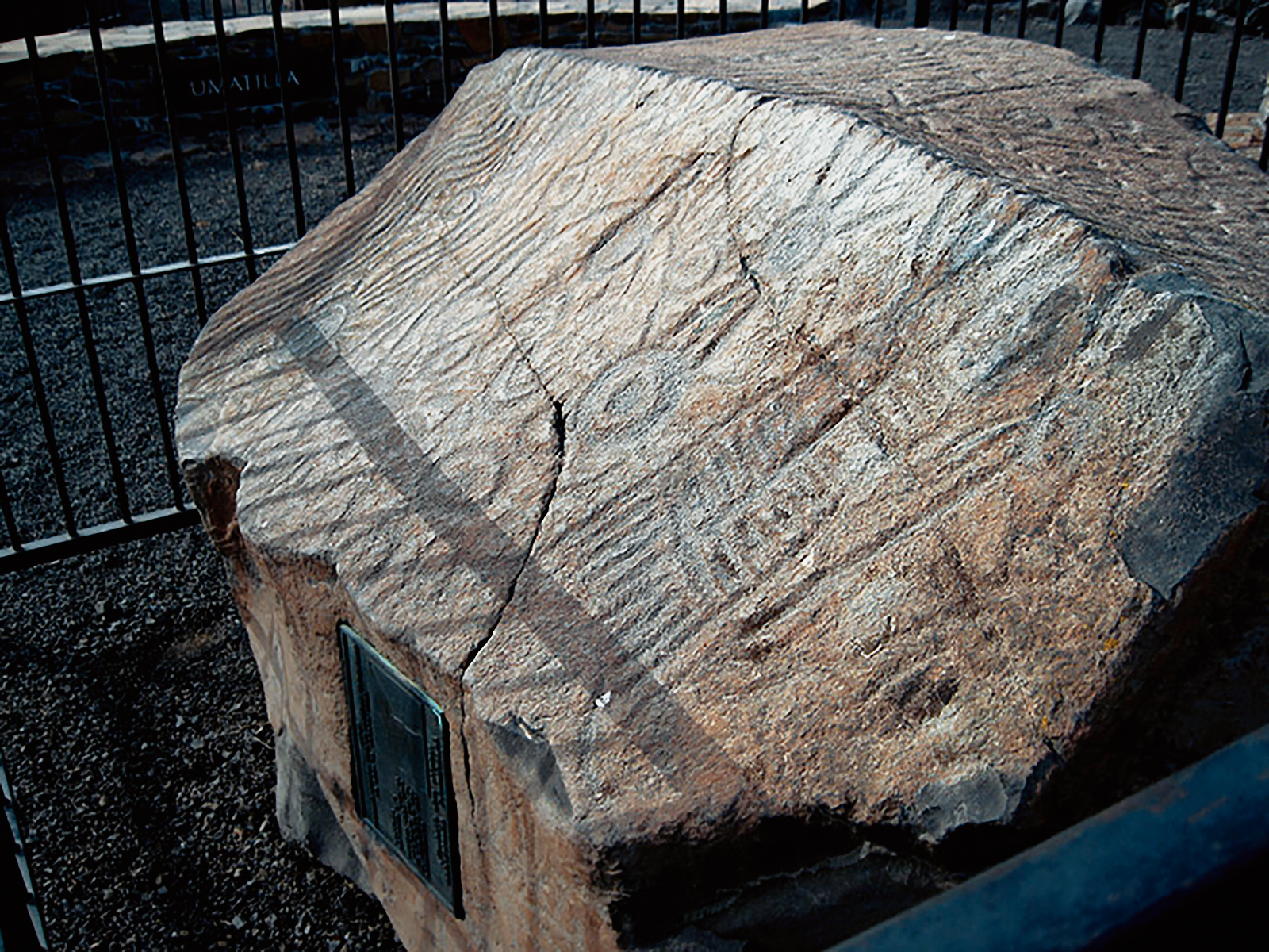
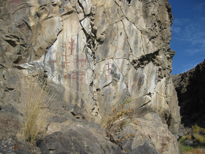
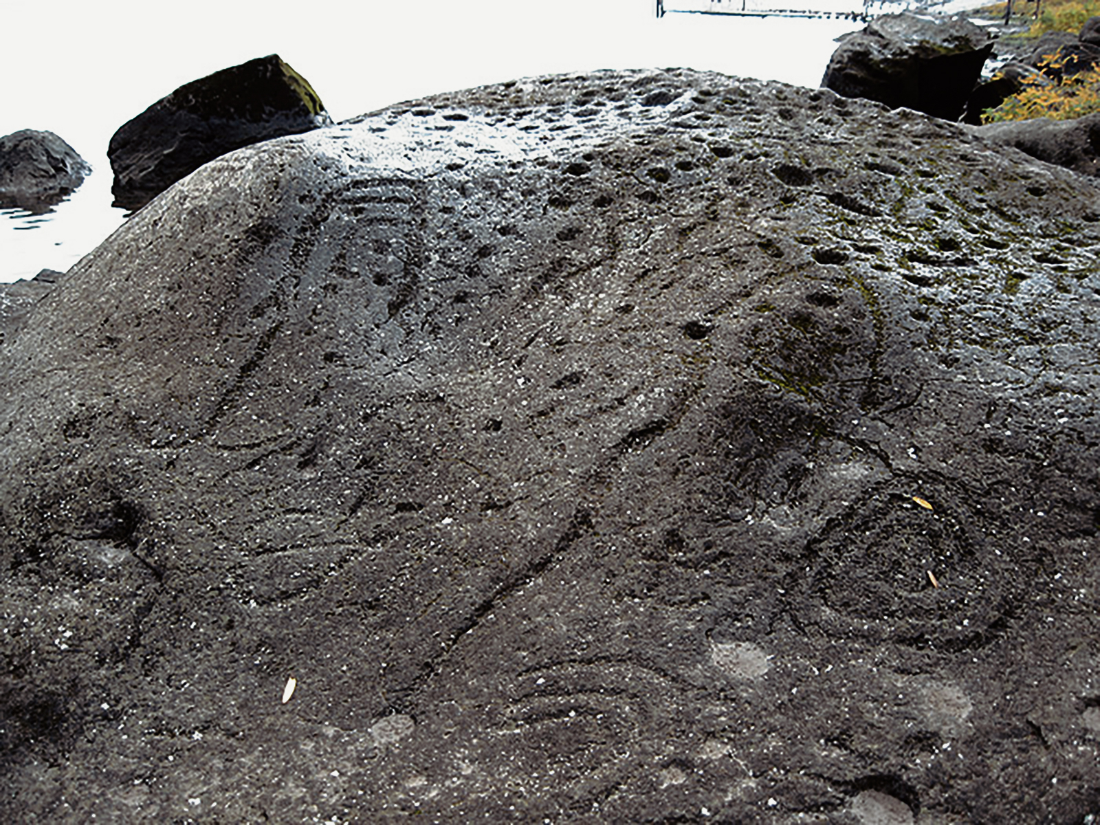
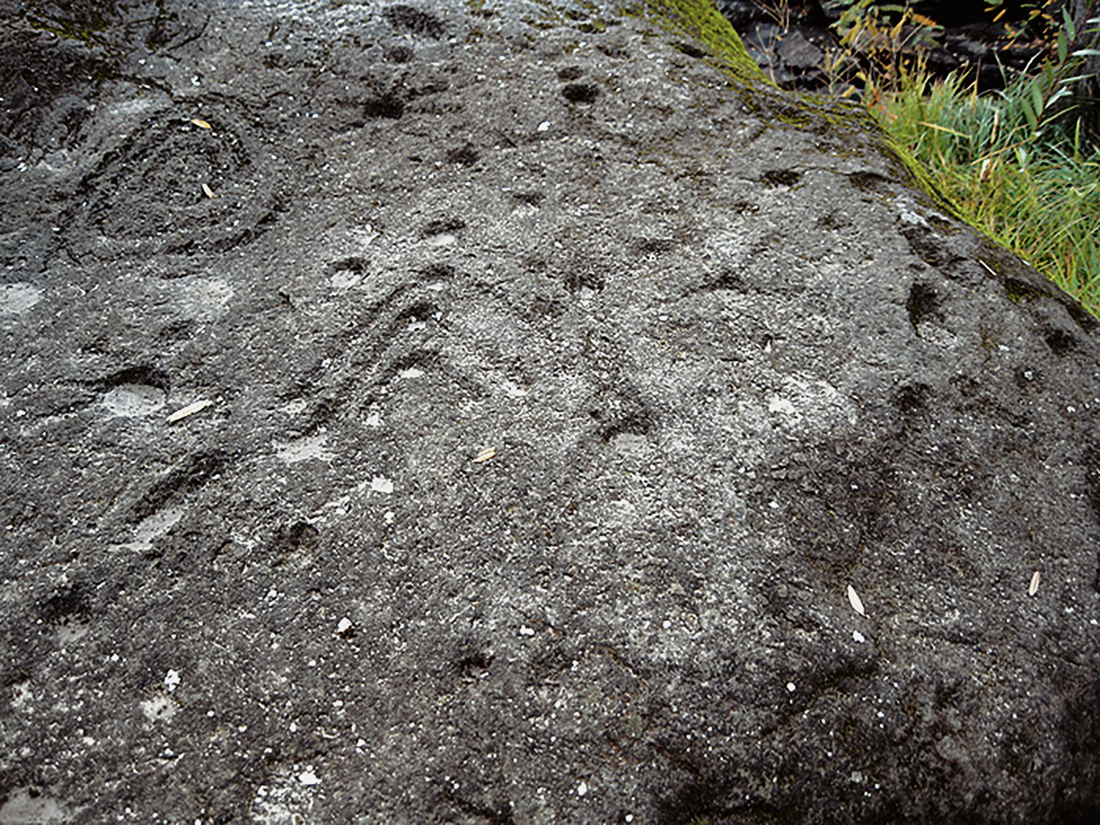
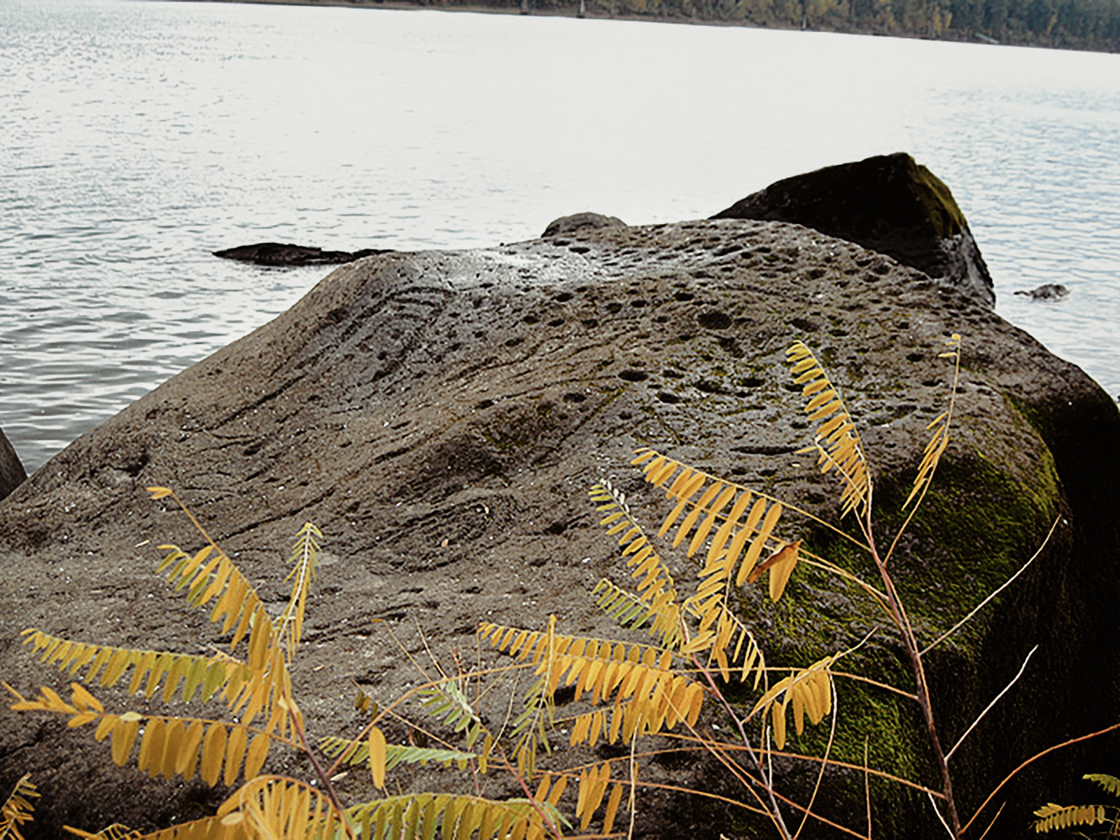
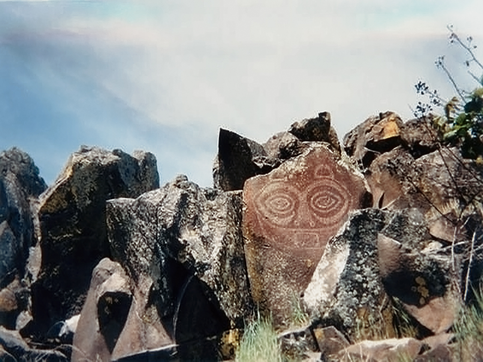
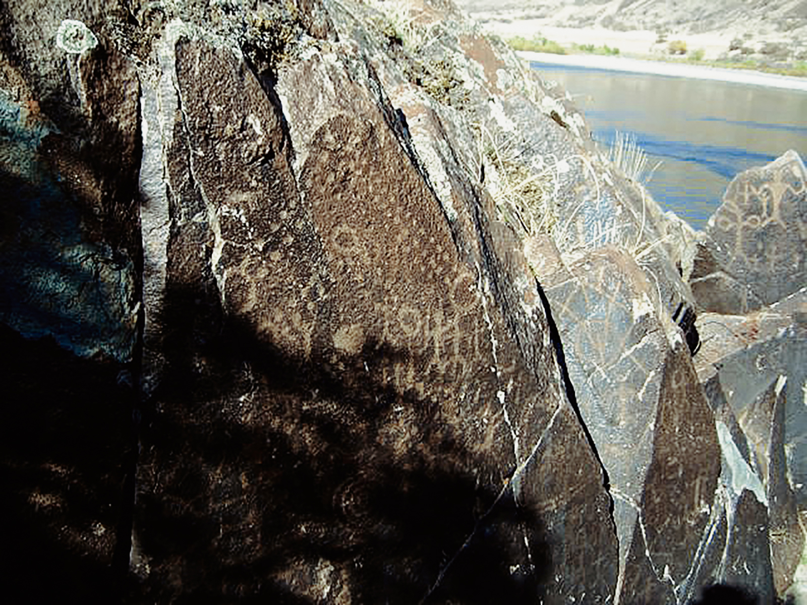
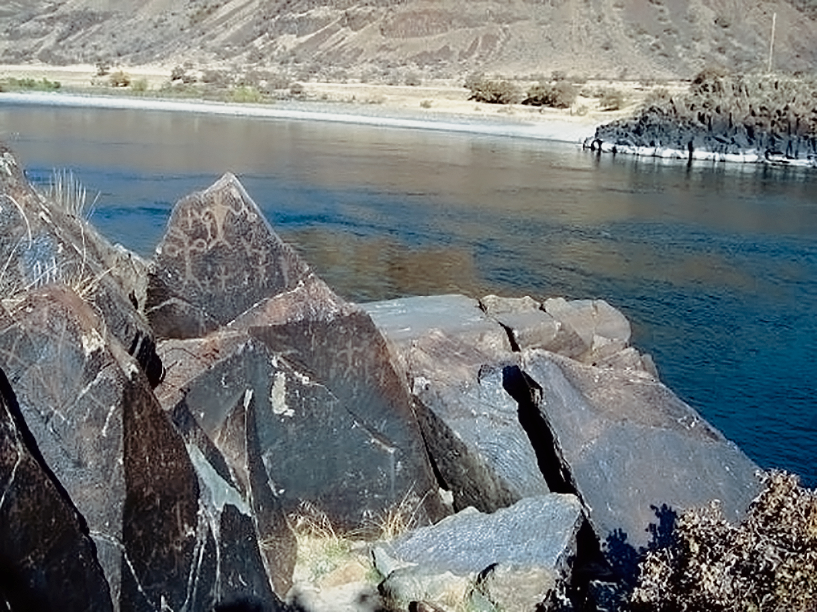
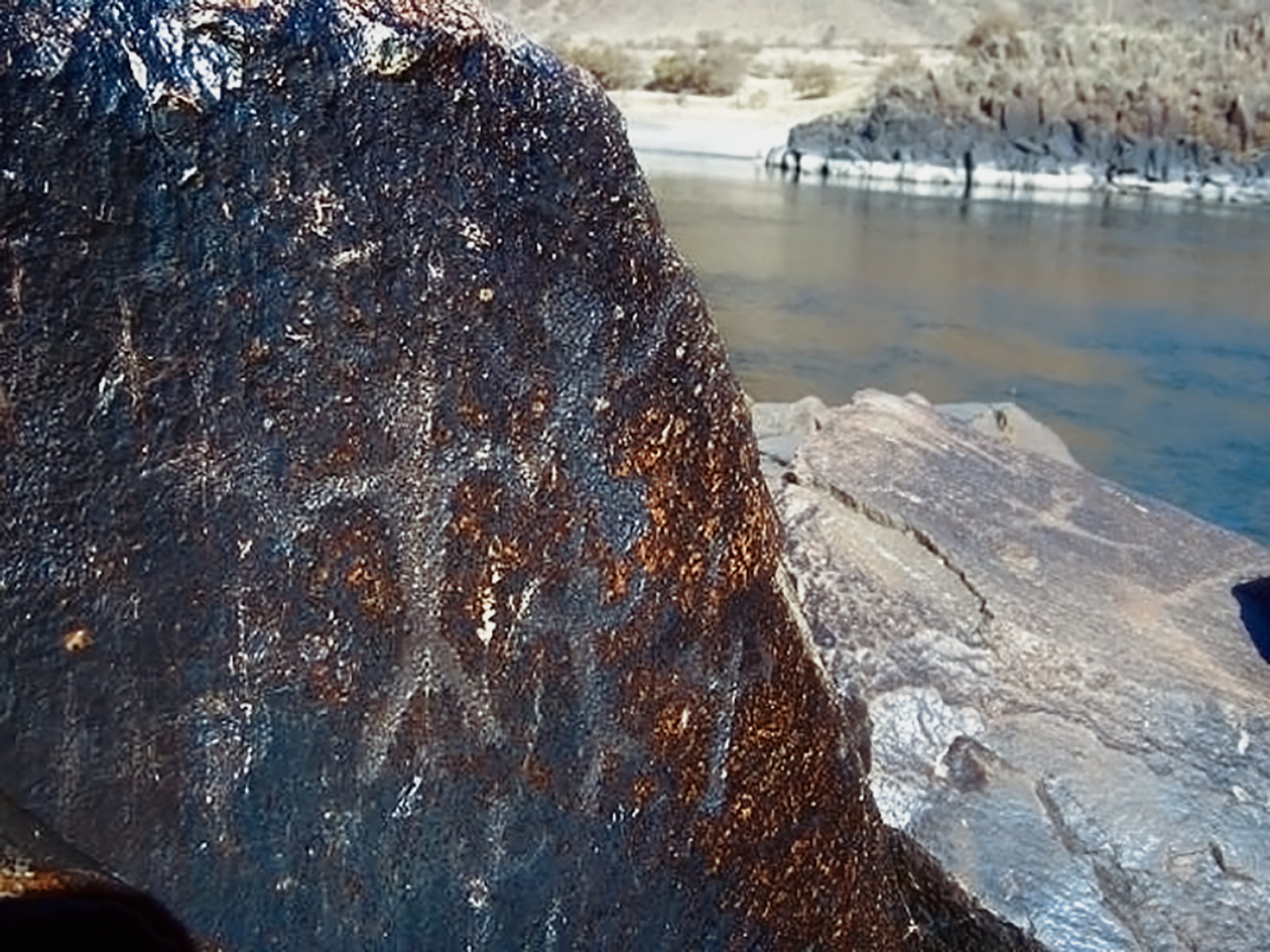
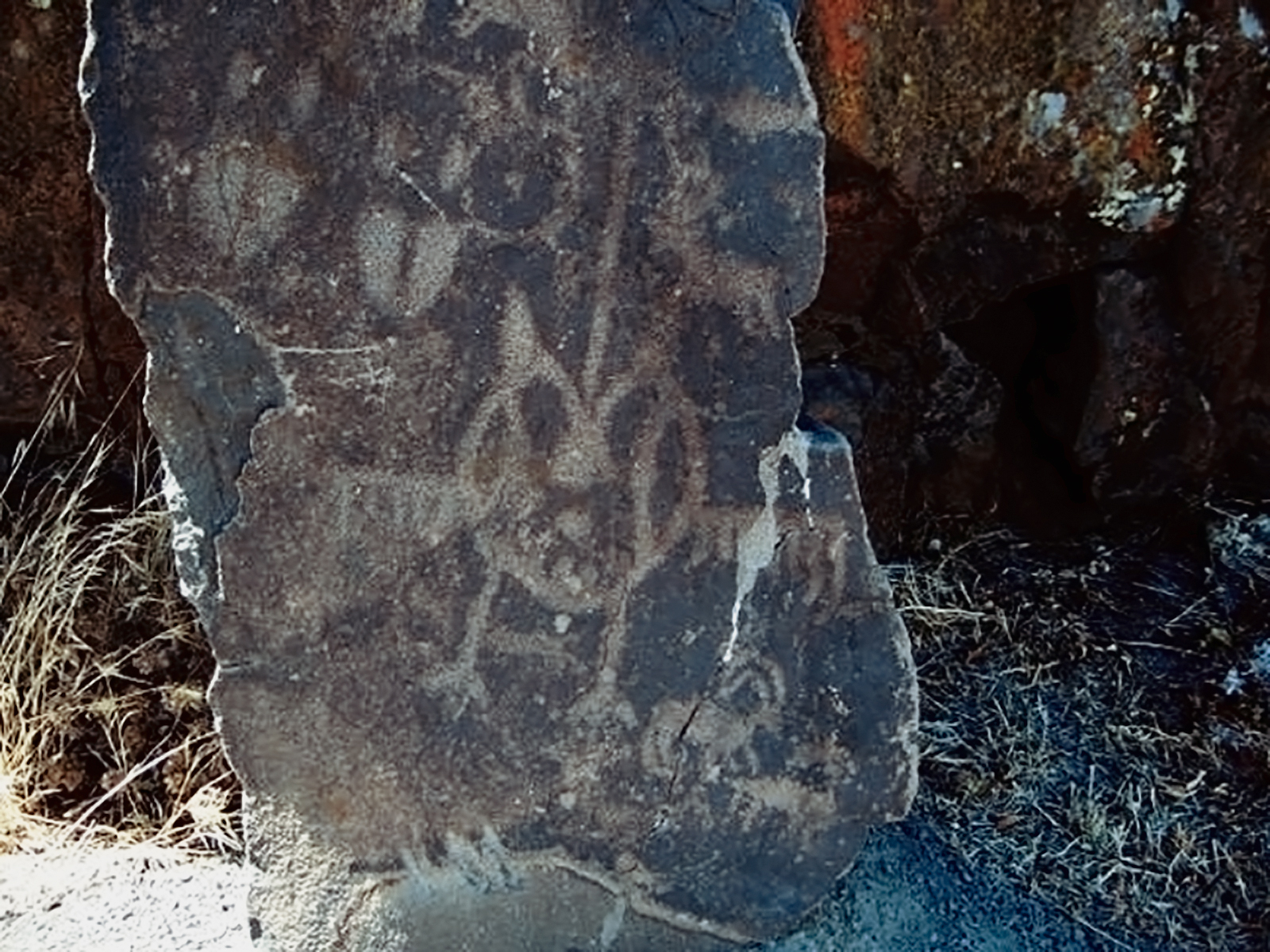
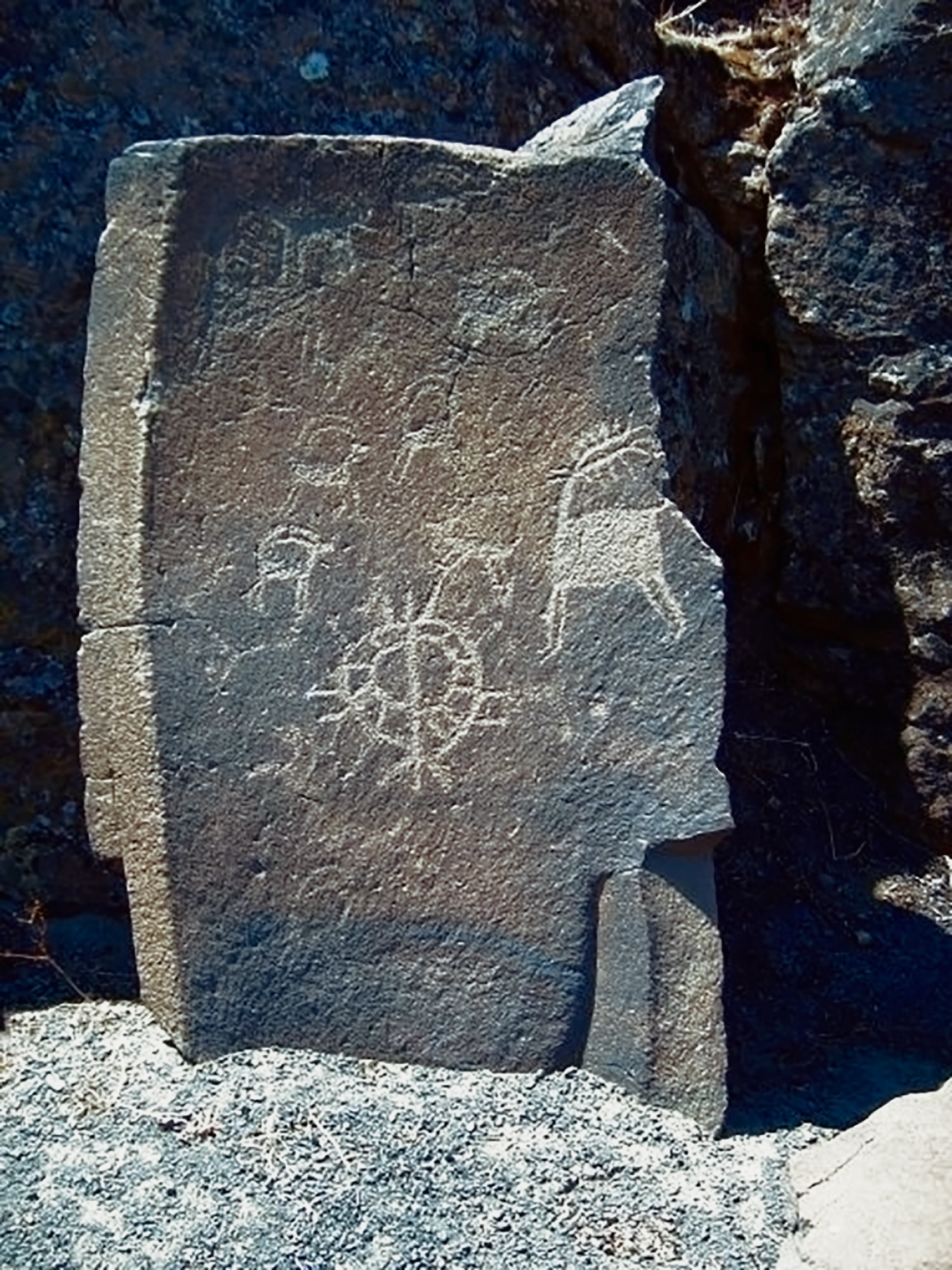
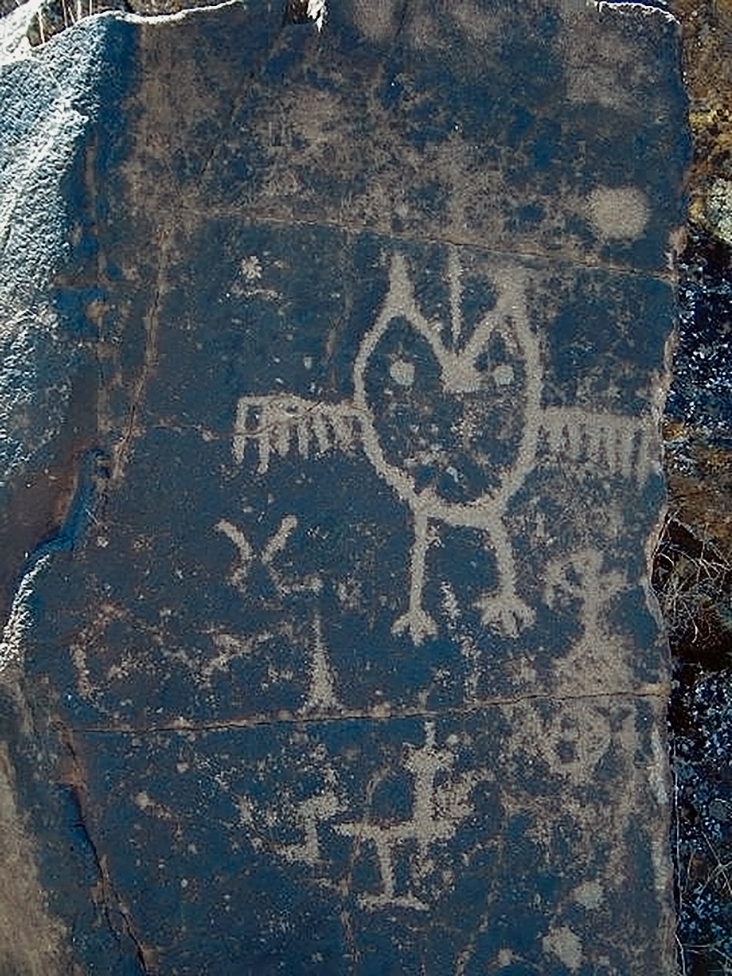
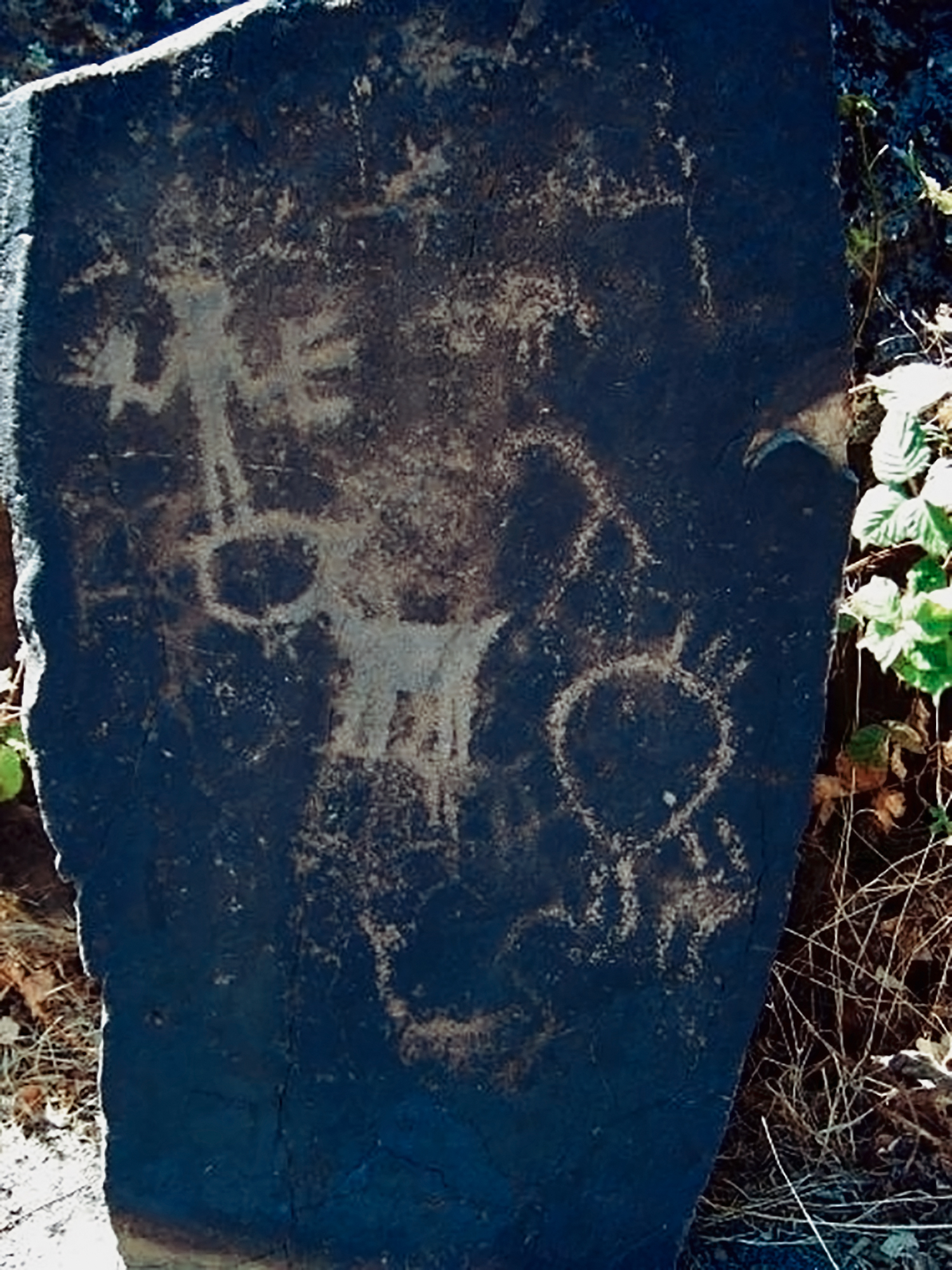
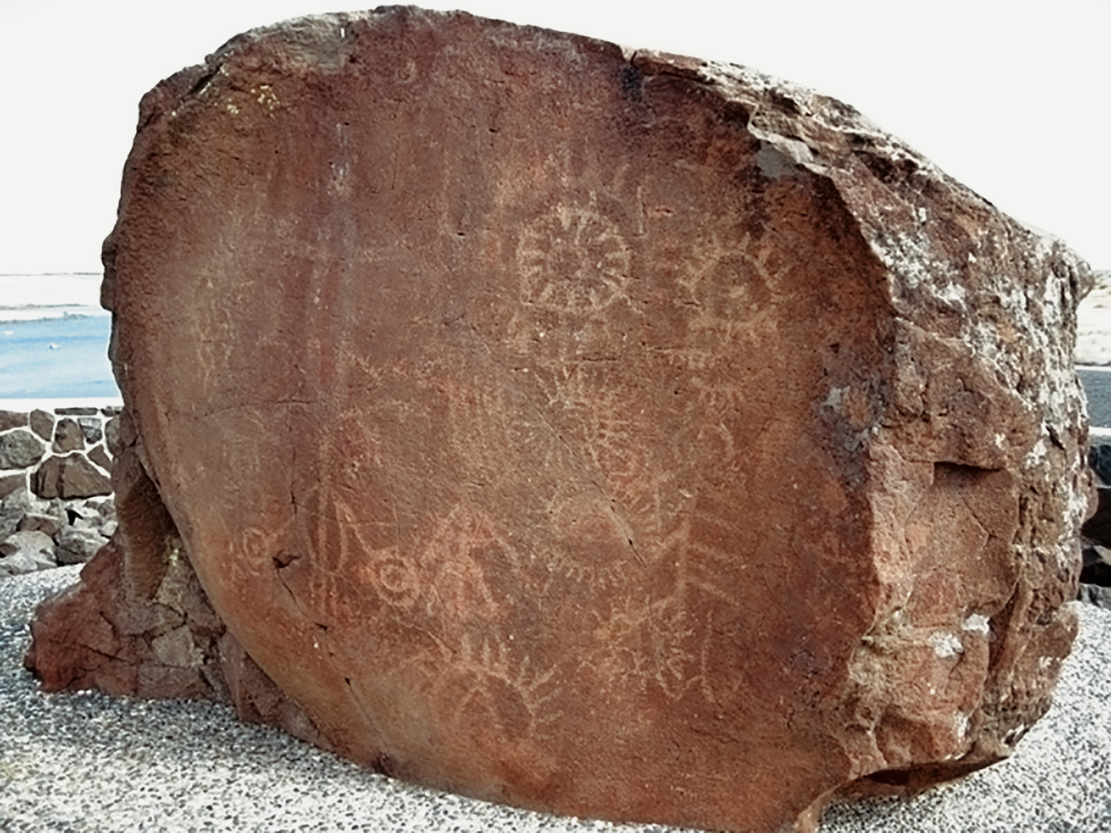
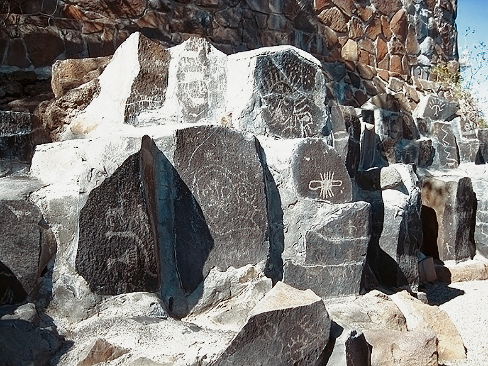
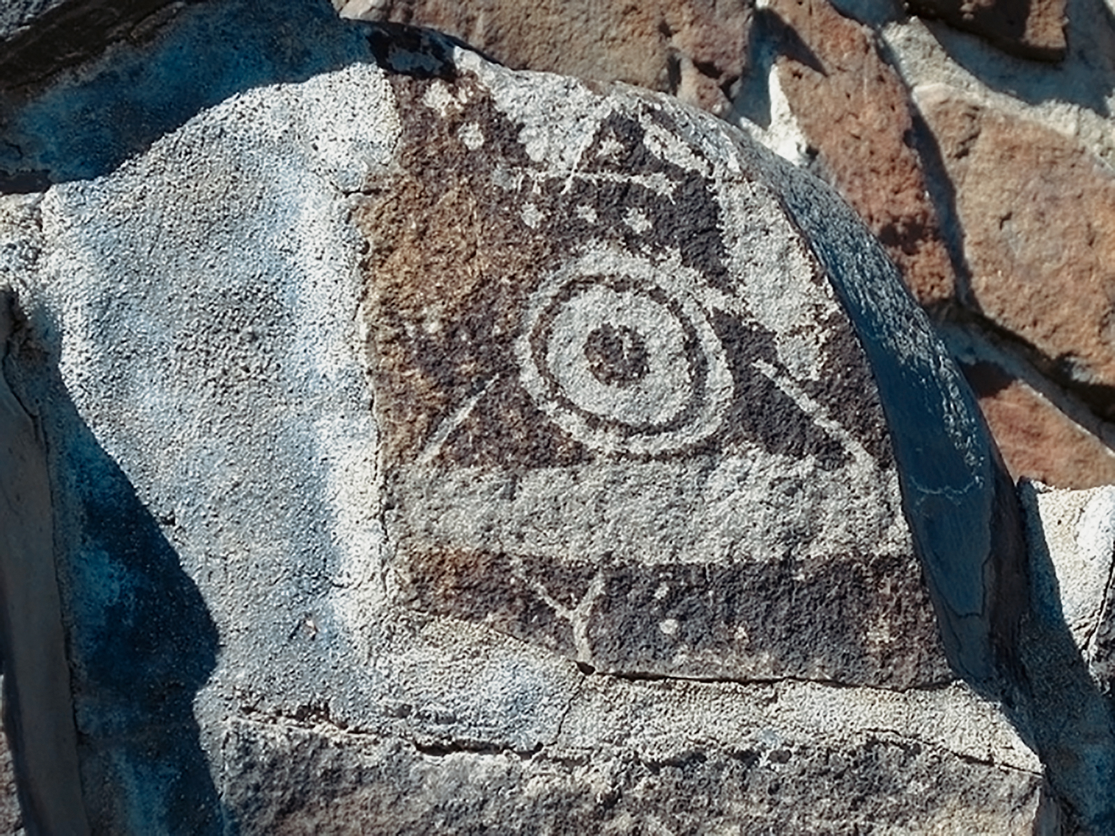
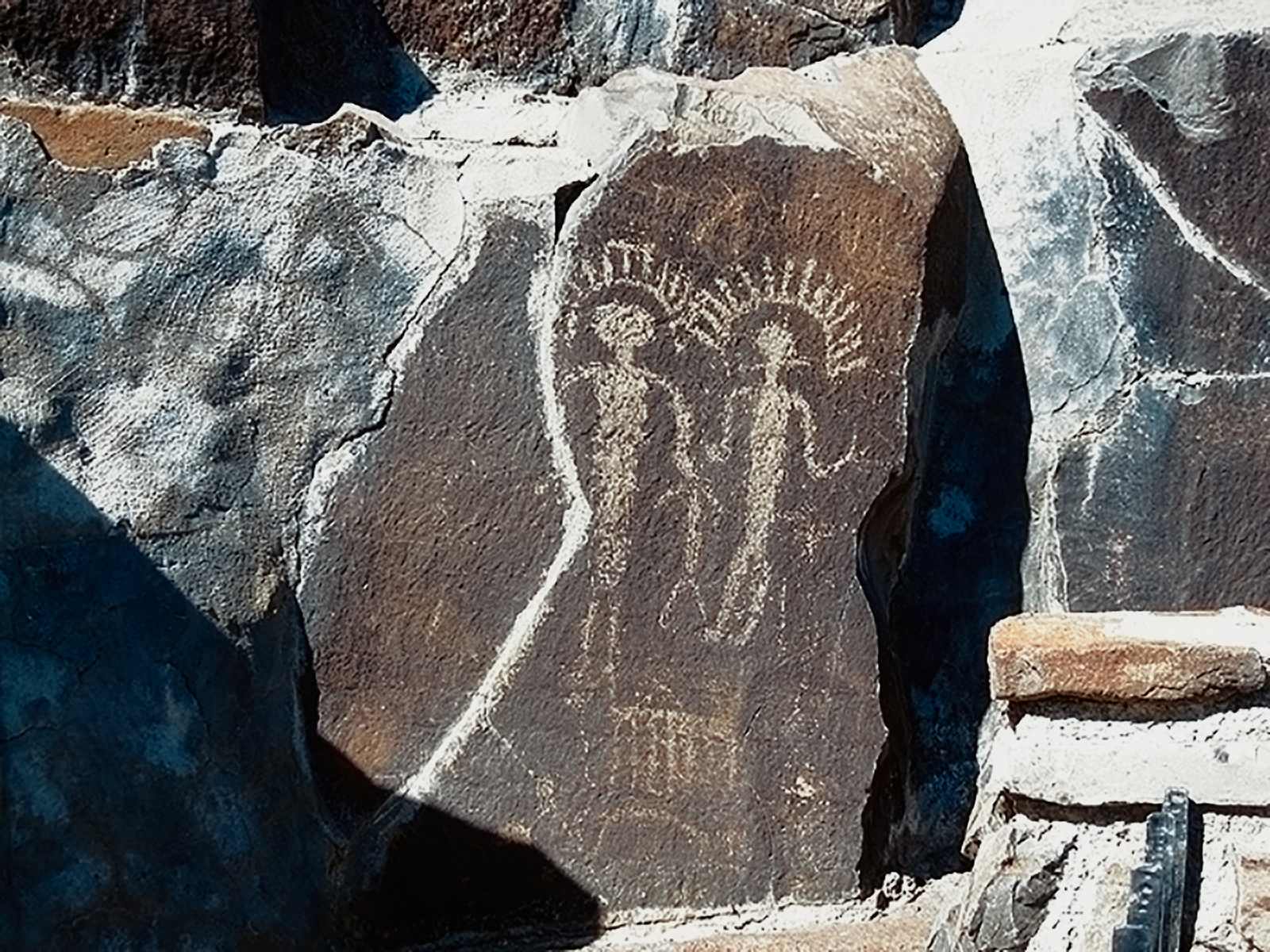
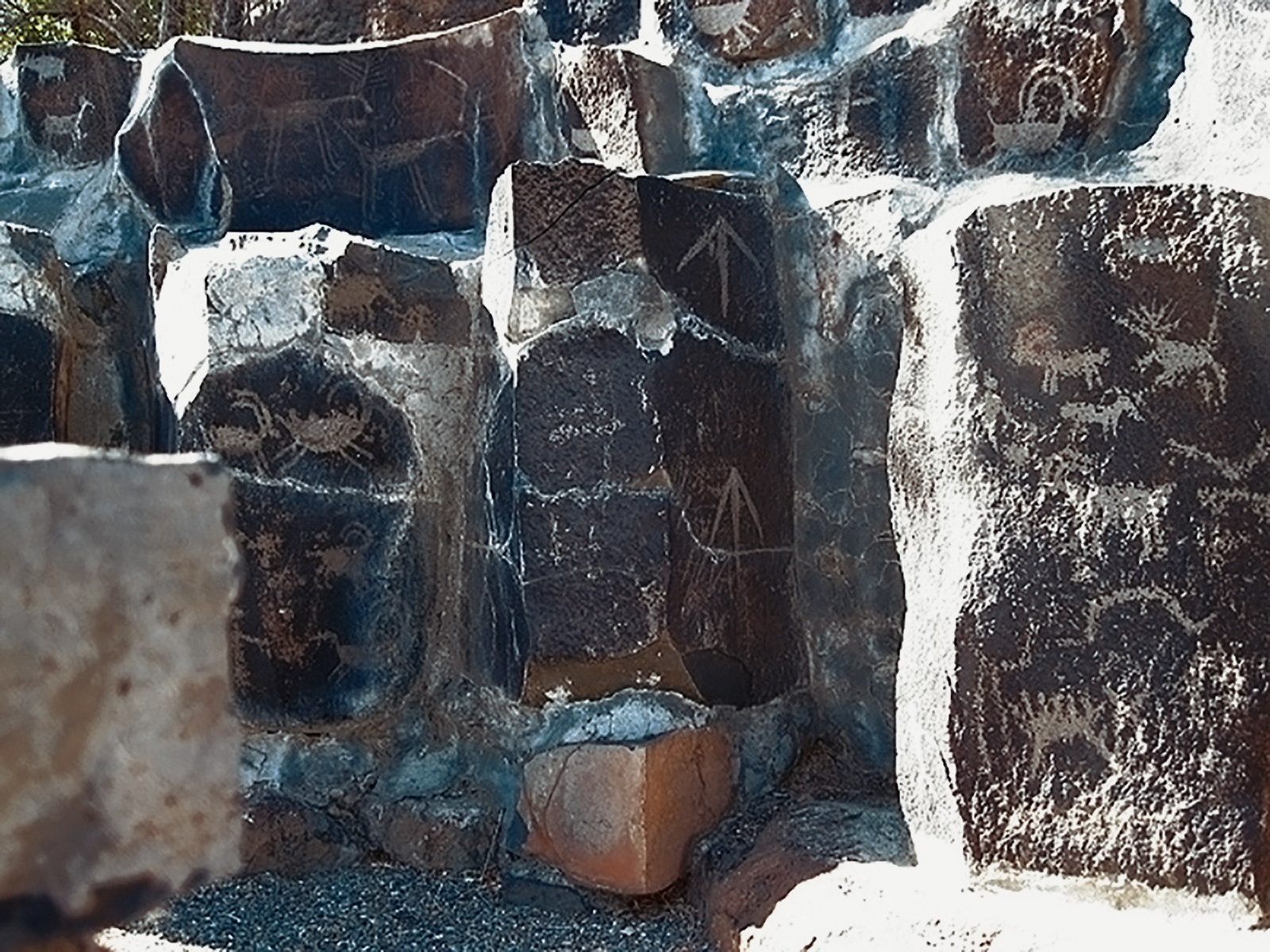
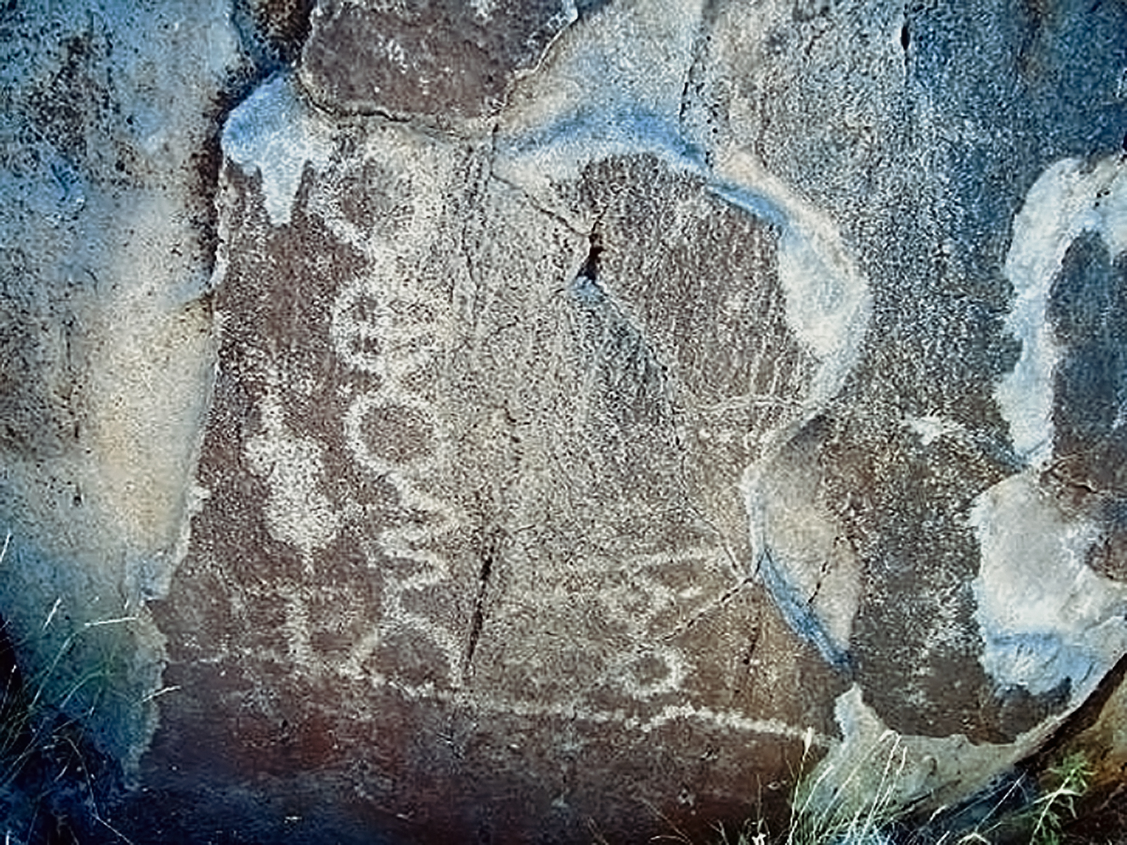
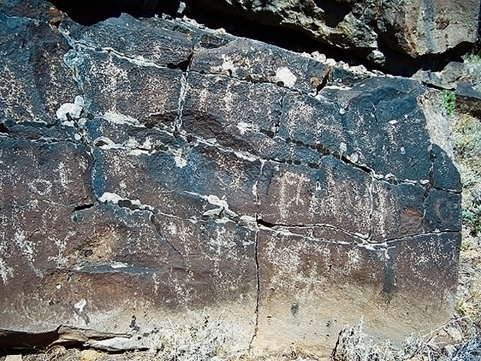
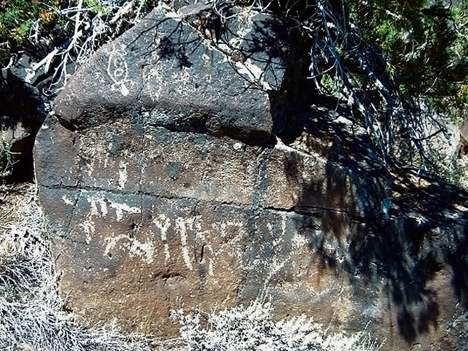
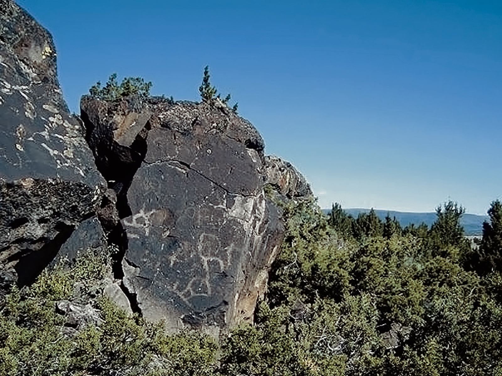
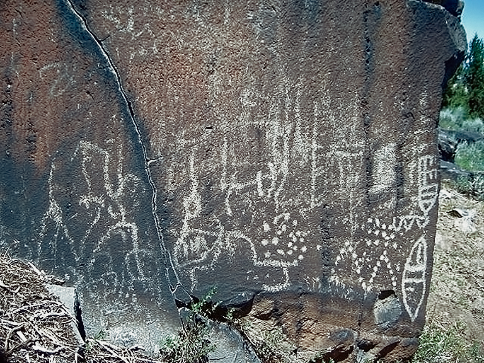
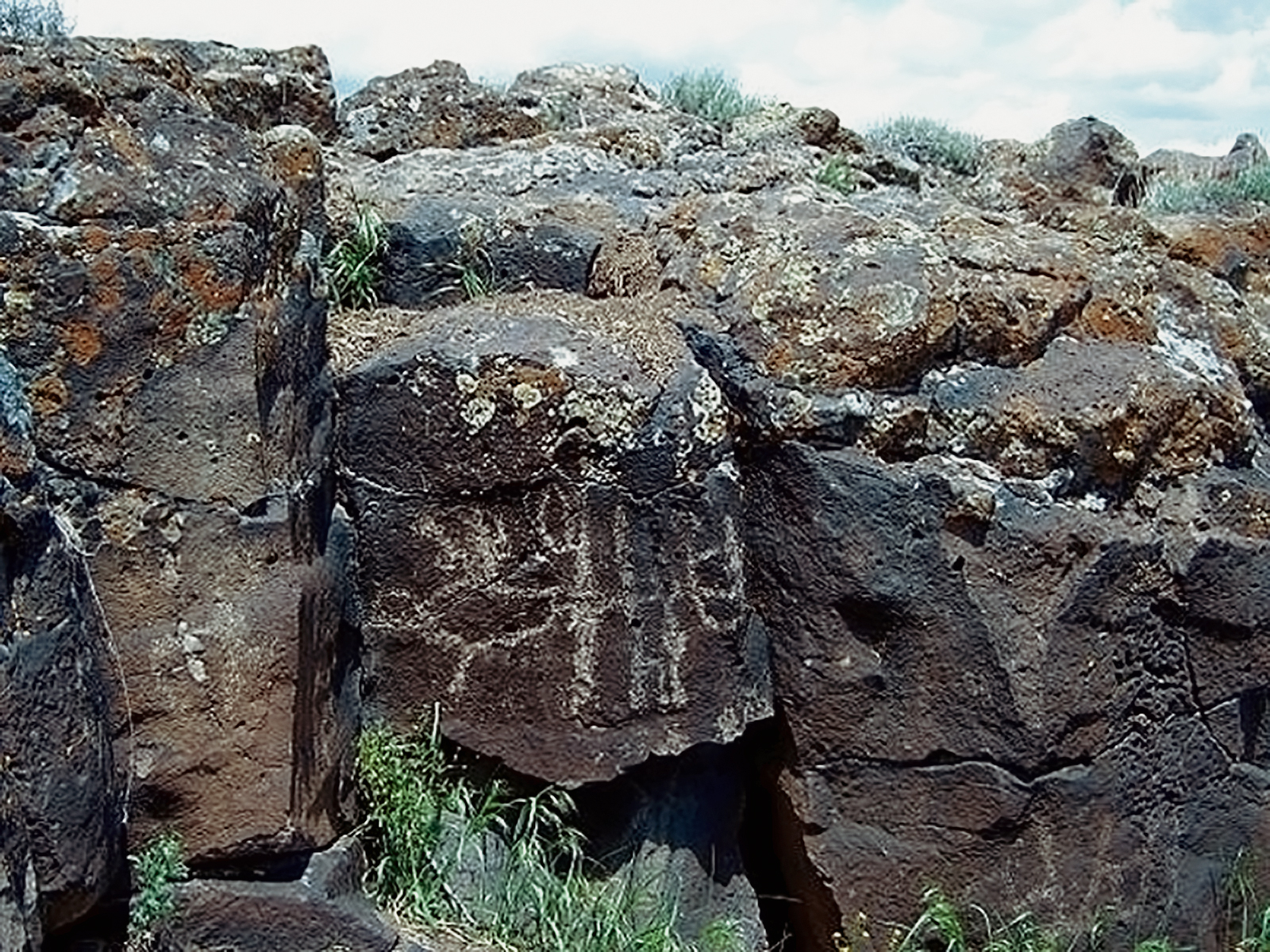
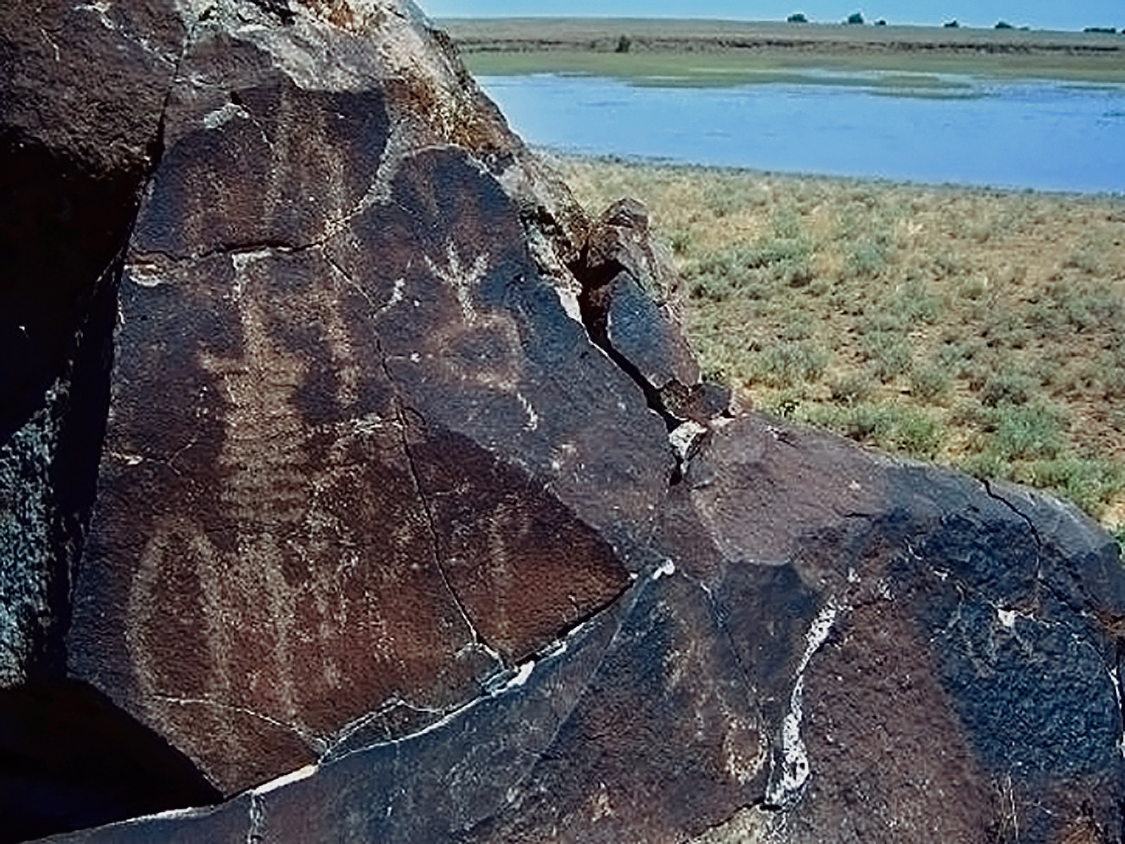
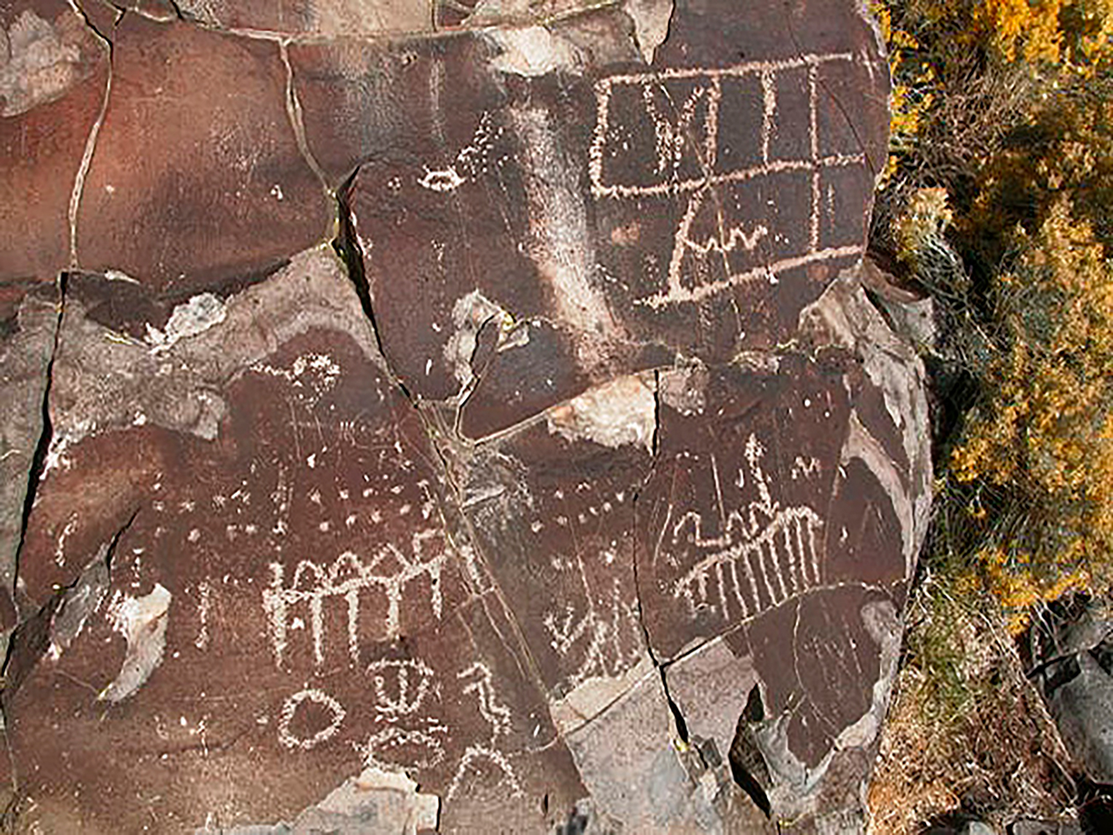
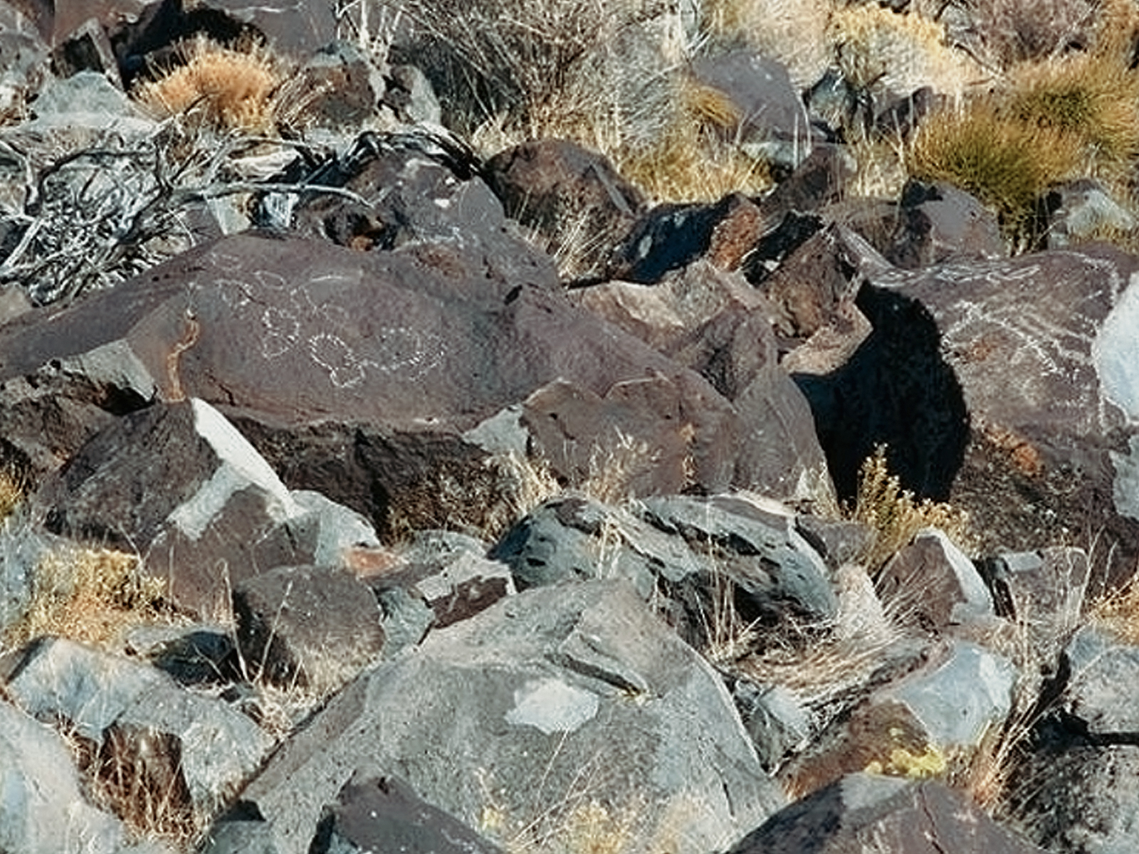
The Columbia River drainage encompasses most of the Territory. The major course of the river originates in Canada and flows southernly through the state of Washington and then turns westward to form most of the border with Oregon before emptying into the Pacific. Many major and minor tributaries flow into it along the way. Chief among these are the Spokane, Snake, John Day, Deschutes and Willamette. Rock art sites are abundant throughout this drainage, not only near the banks of these waterways, but frequently in the plateau and mountain areas that abut them. Both petroglyphs and pictographs are encountered, occasionally images produced by both methods are present at the same site. The insertion of hydroelectric dams in the drainage has raised water levels in many areas obscuring many sites beneath the elevated water levels. Fortunately many of these now invisible sites were recorded by concerned avocational archaeologists such as Malcolm and Louise Loring; small portions of others were removed prior to inundation and placed in protective locations such as museums, state parks and interpretive centers at the dams. Previously unreported sites are constantly coming to light to diligent researchers, although with the huge amount of wilderness areas and private land holdings, it will be long before the inventory of rock art sites approaches completeness.
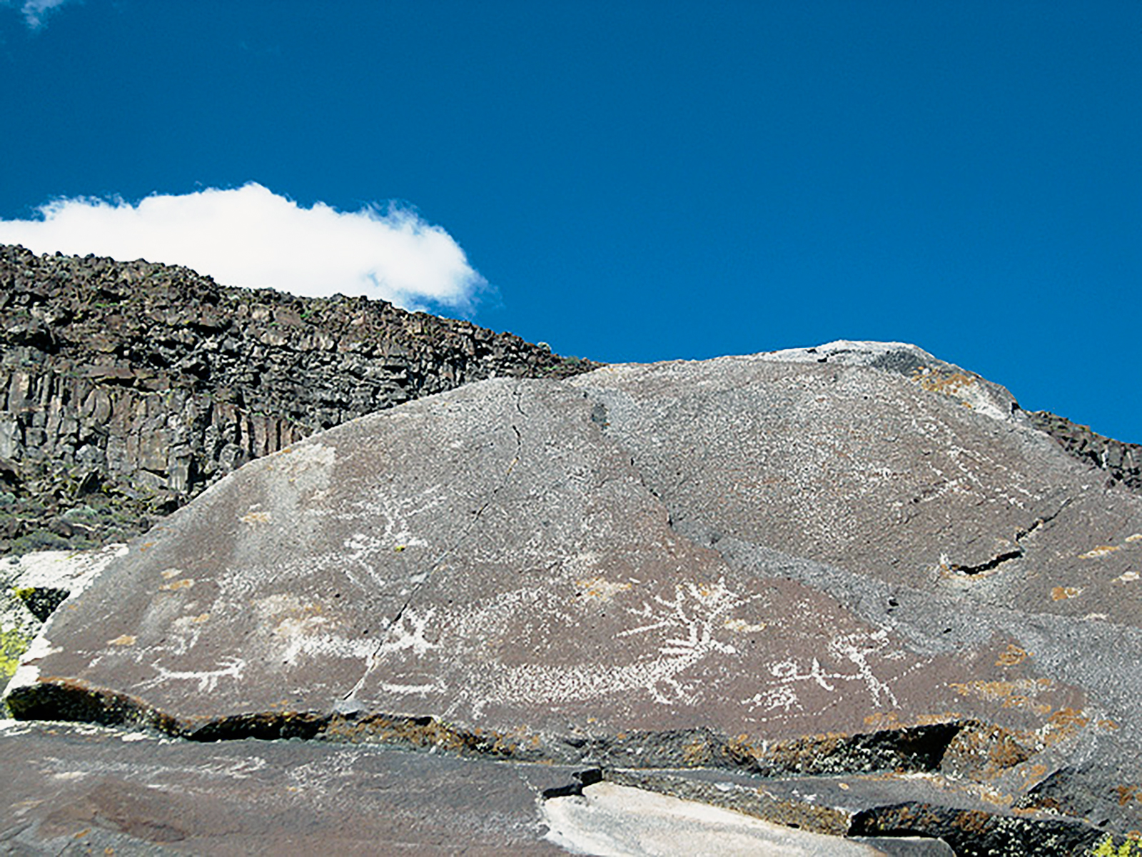
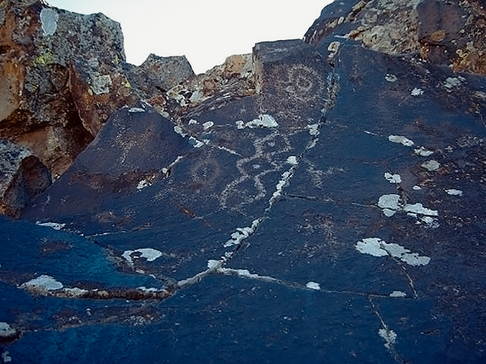
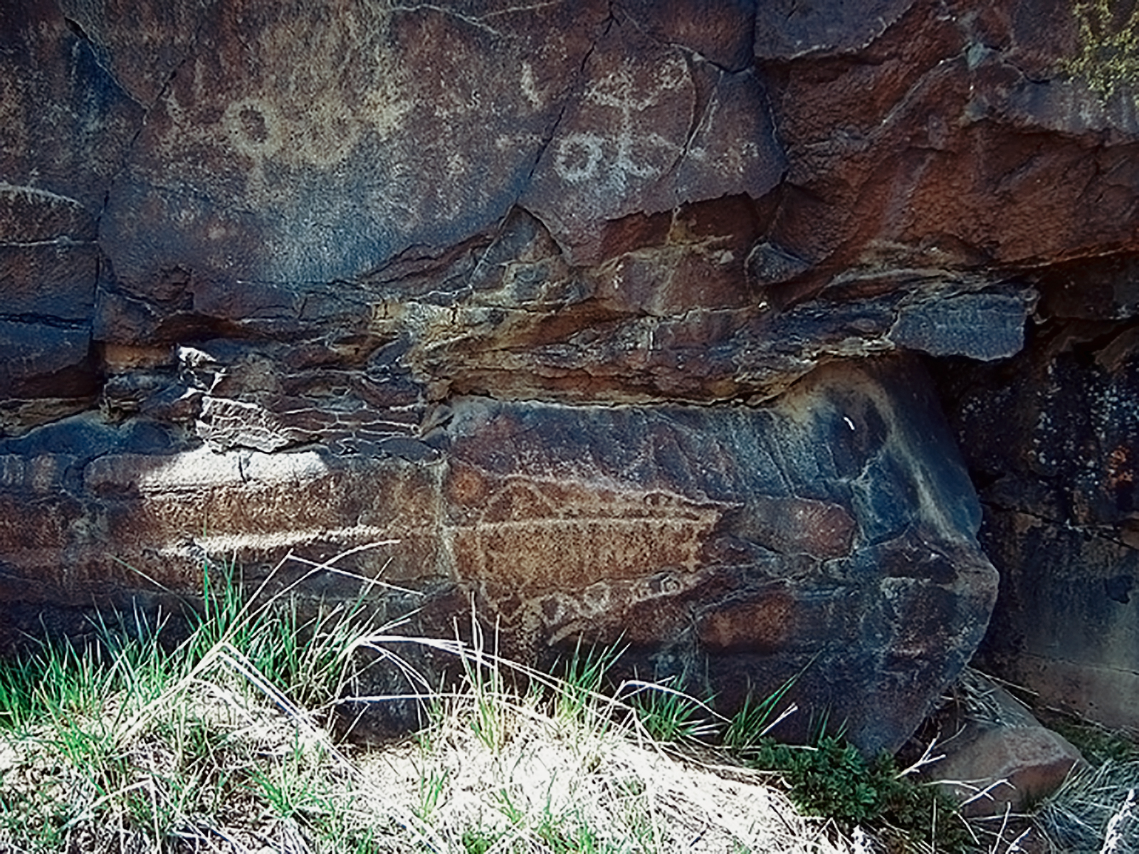
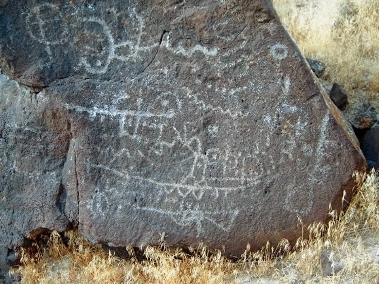
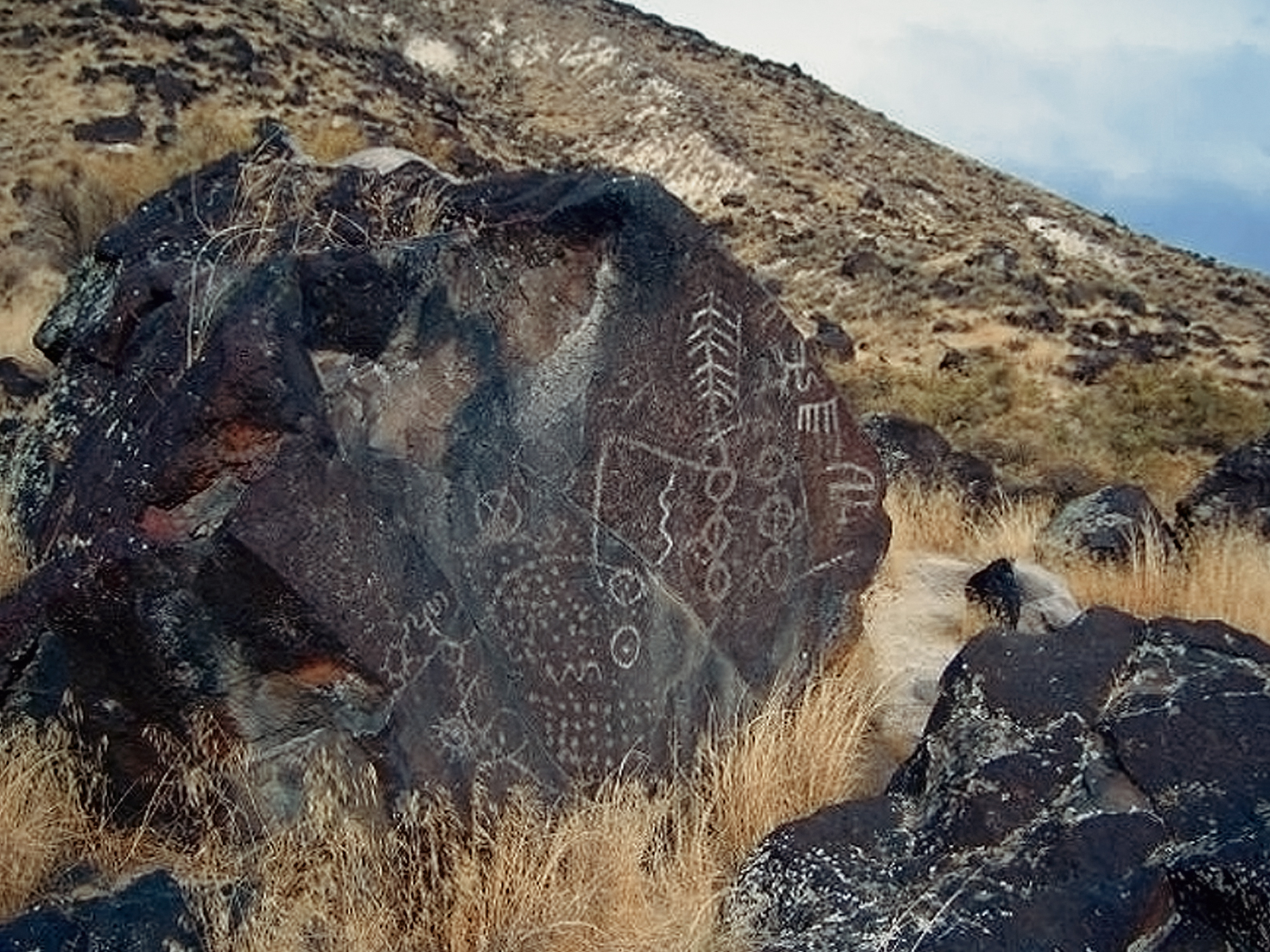
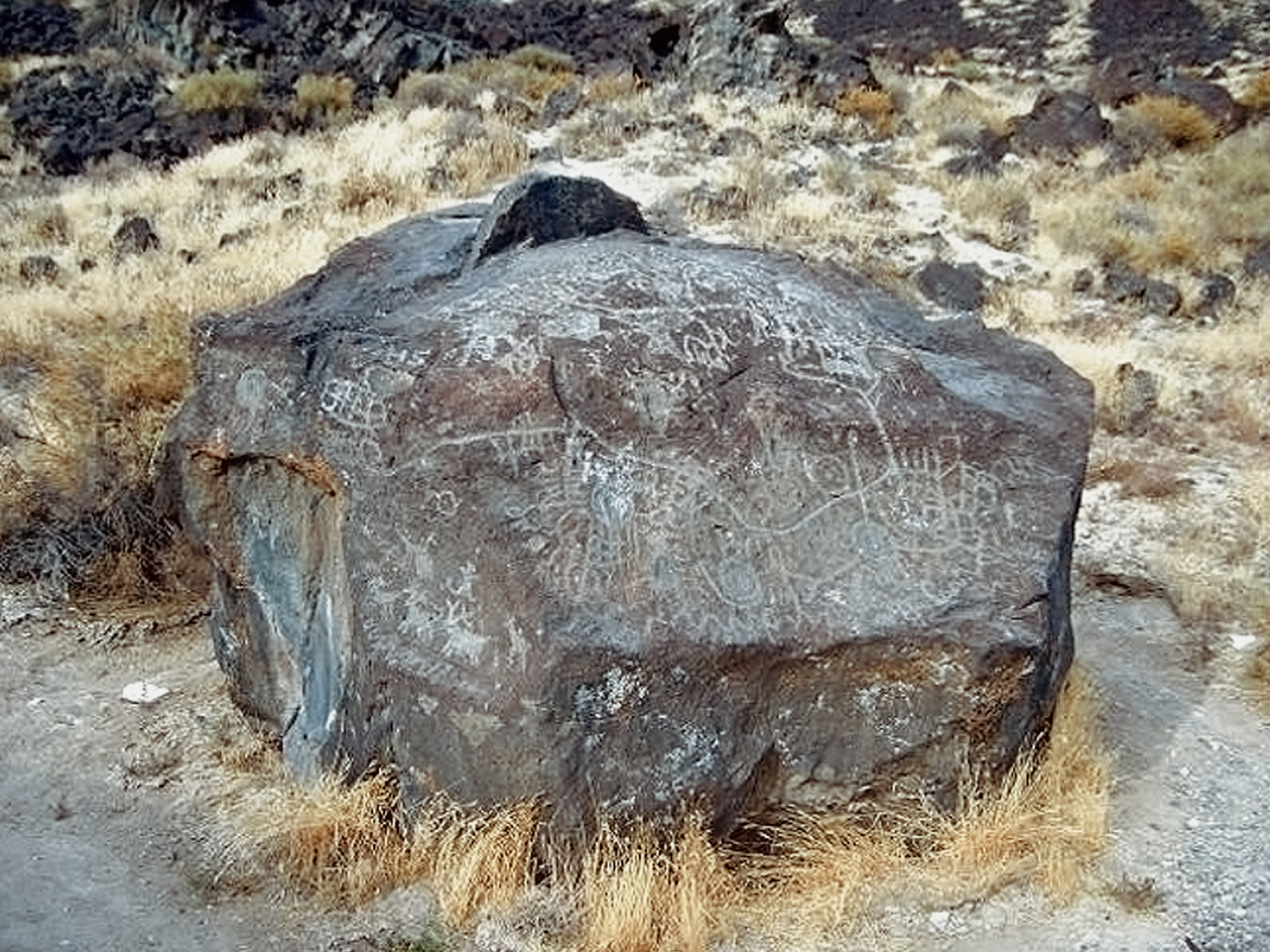
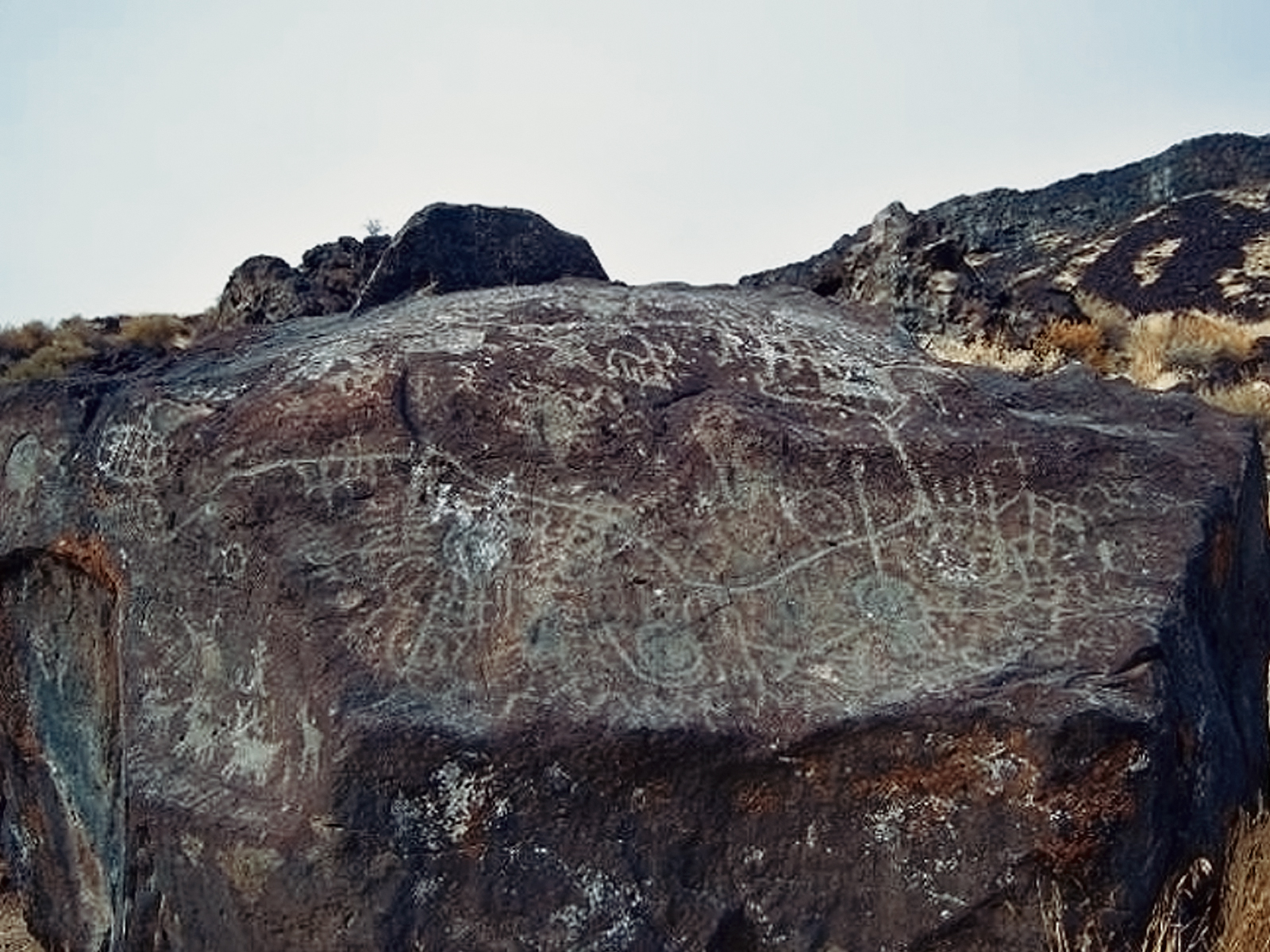
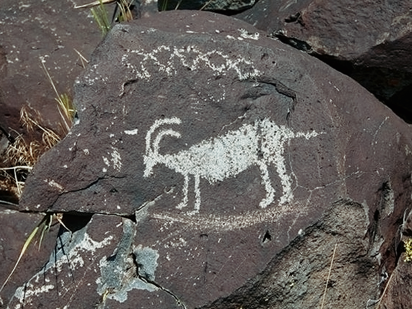
The Great Basin encompasses most of the present state of Nevada, the eastern half of Utah and portions of southern California. South central and eastern Oregon and southern Idaho are located on the northern boundary. The Great Basin area is an area where precipitation has no outlet to the ocean. Lake Bonneville, existed around 14,500 years ago and covered more than 20,000 square miles in Utah and parts of Idaho and Nevada. The water level of Lake Bonneville maintained a fairly constant level for hundreds of years until the water level in a singular event dropped approximately 400 feet when part of Red Rock Pass, which was holding back the water, eroded. The ensuing floodwaters flowed down the Snake River and joined the Columbia River near the Tri-Cities. For a short period of time, the resulting floodwaters from Lake Bonneville increased the size of the Snake River and the Columbia River by more than 20 times their normal flow. After the flood occurred, the water levels of the Great Salt Lake eventually subsided close to where they are today. The area once occupied by the lake and other similar bodies of water is now known as the Great Basin.
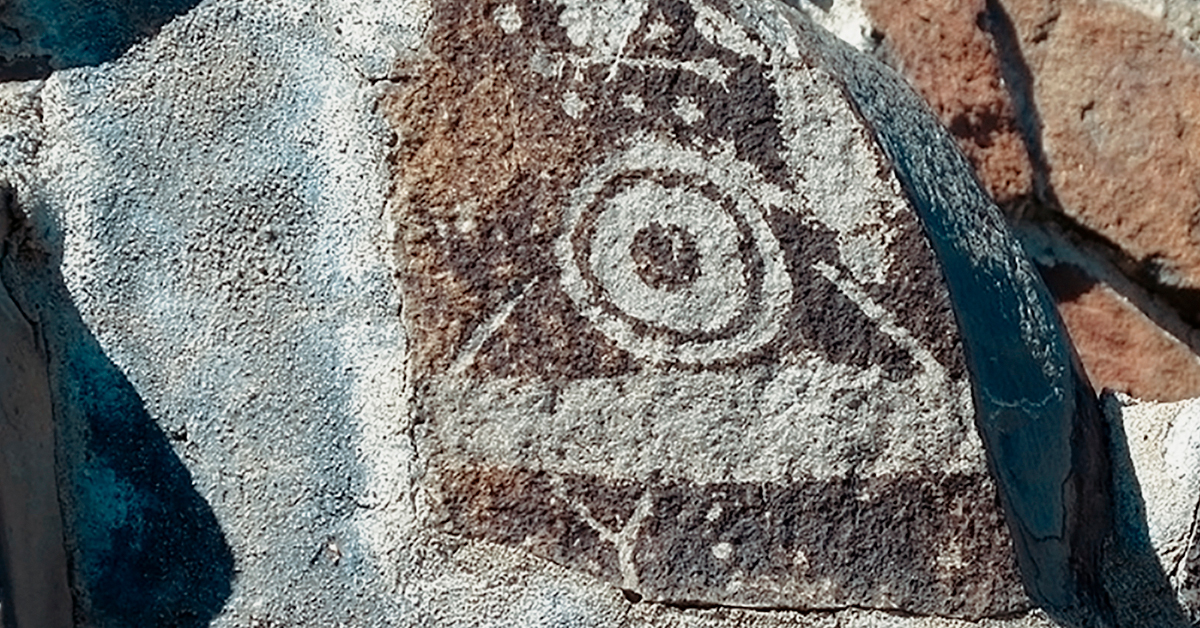
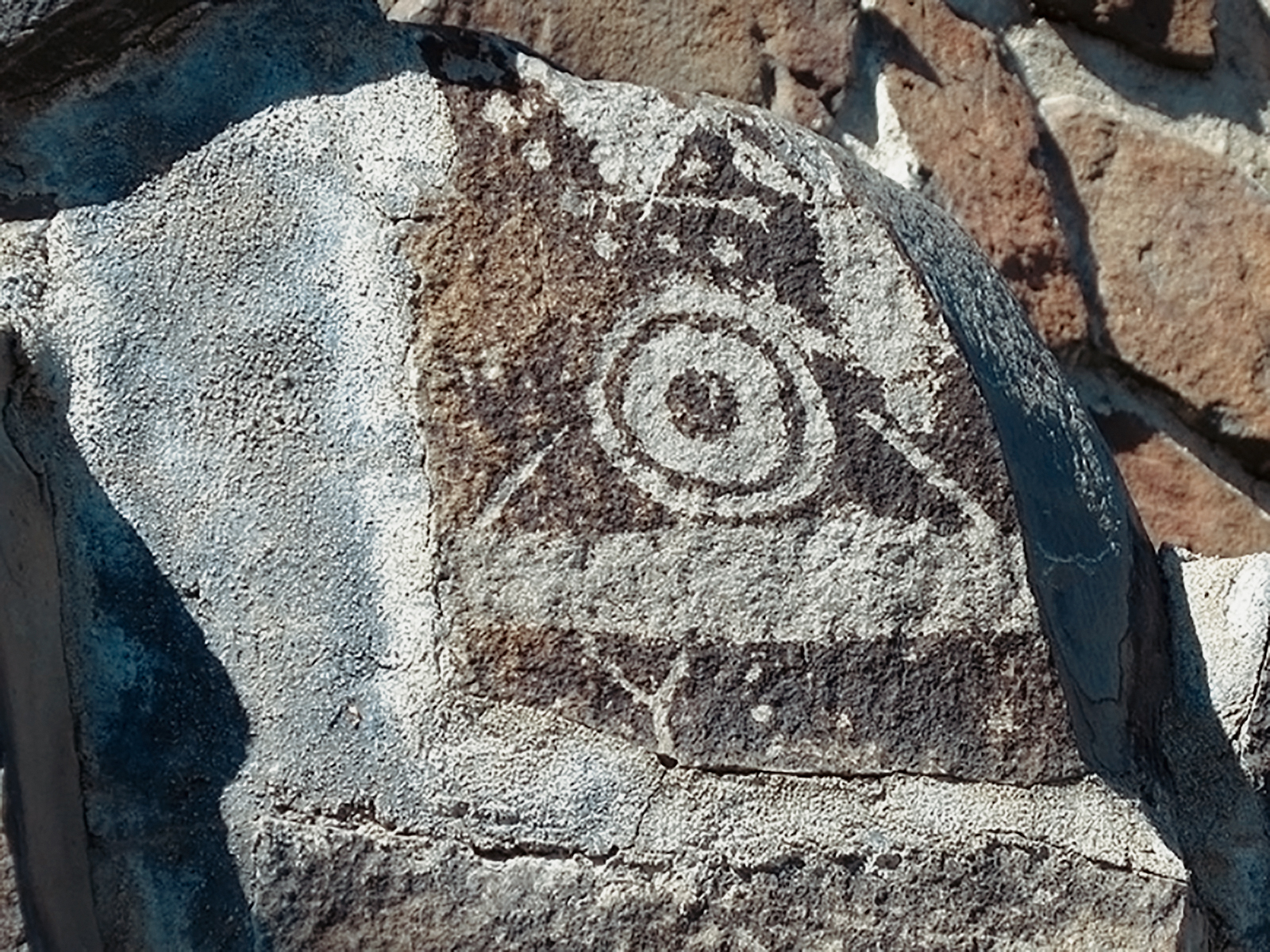
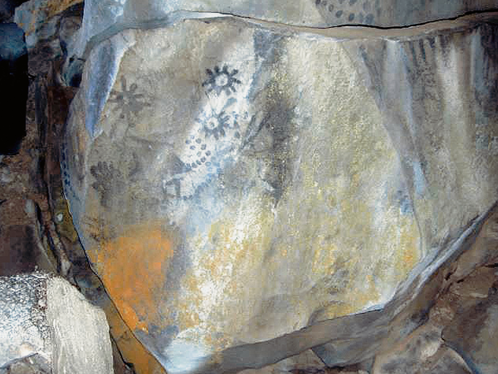
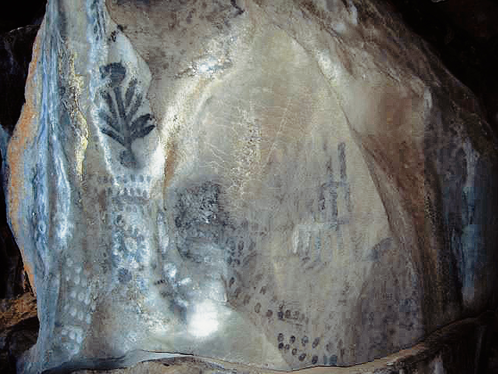
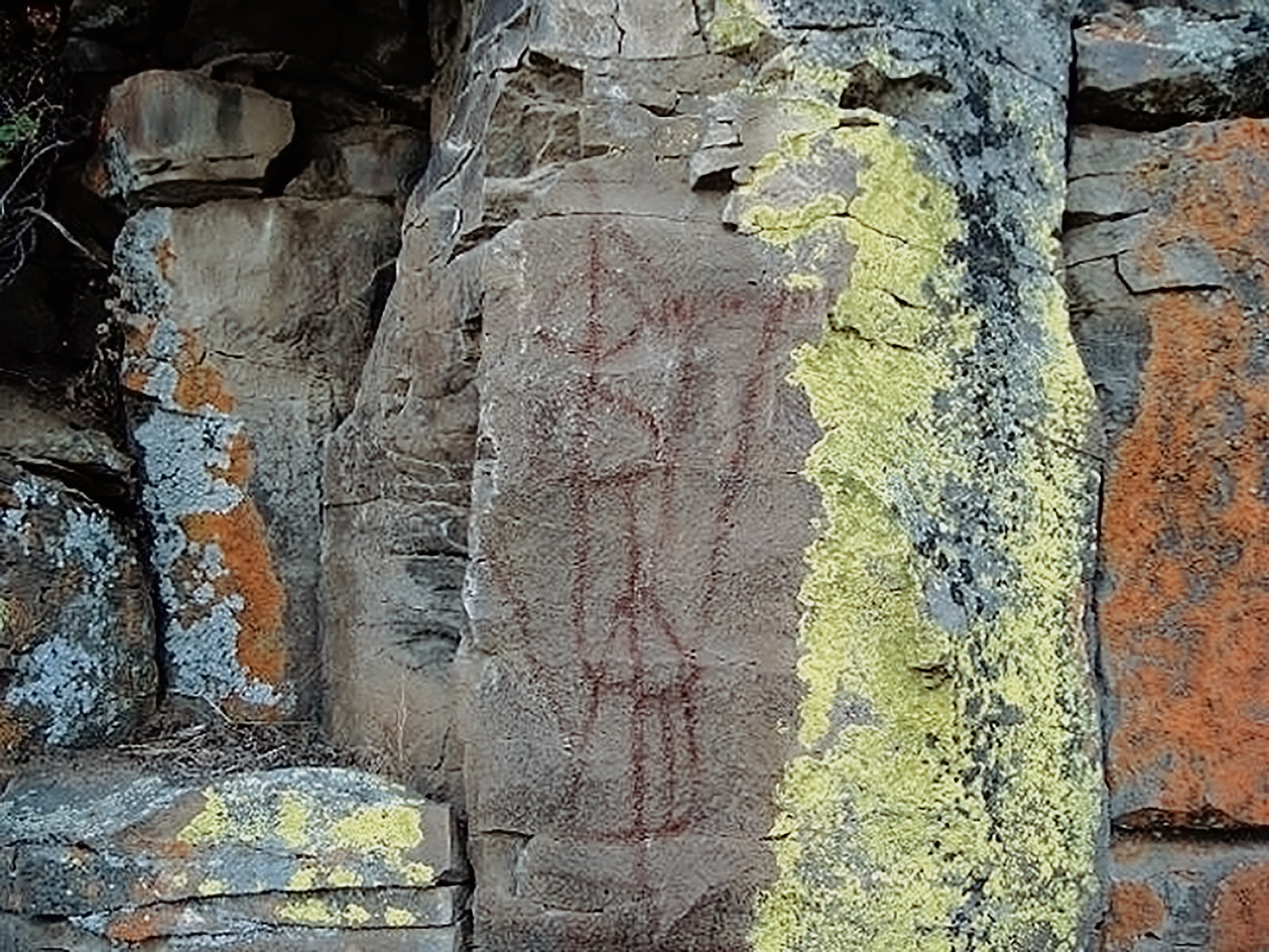
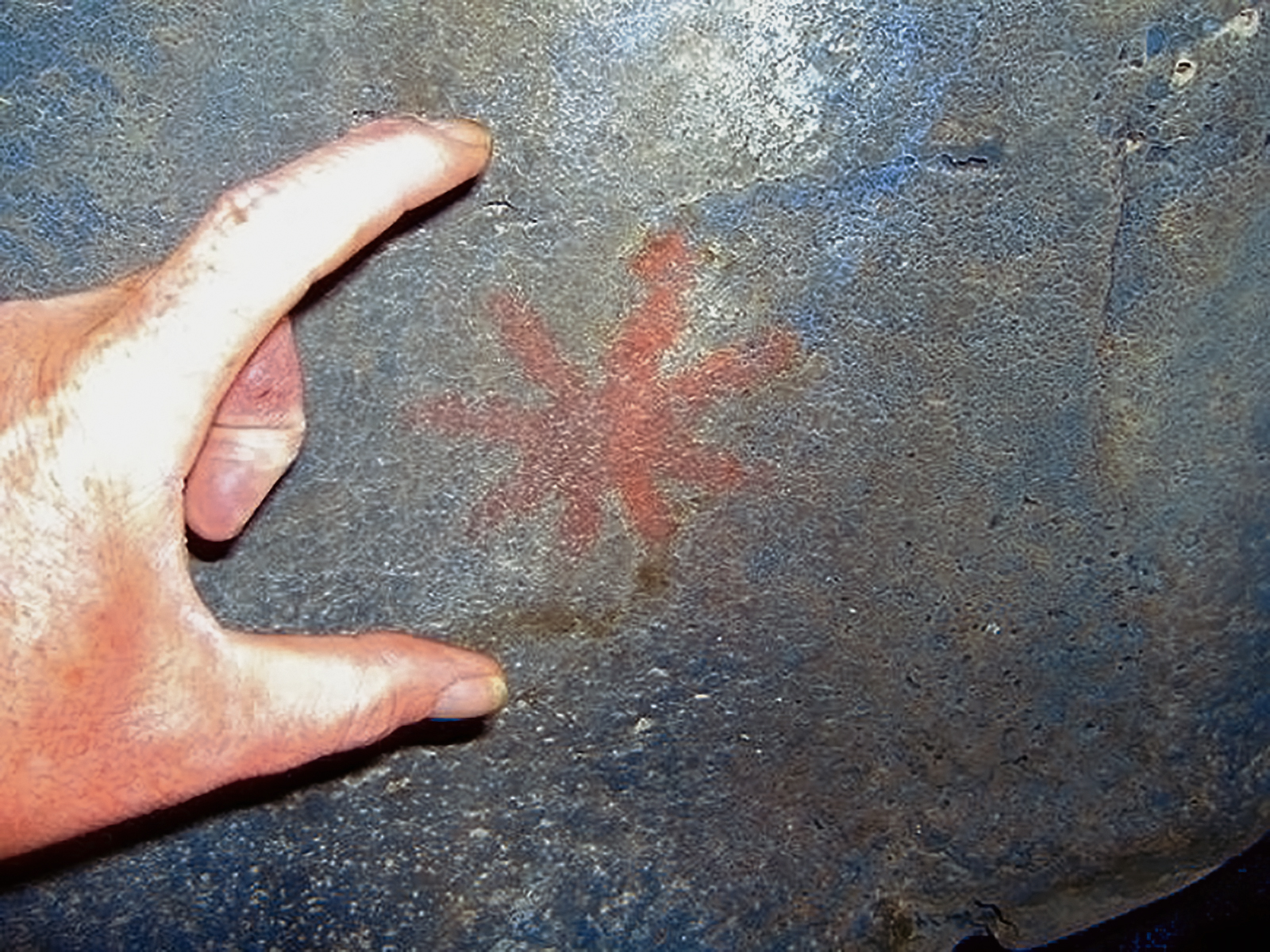
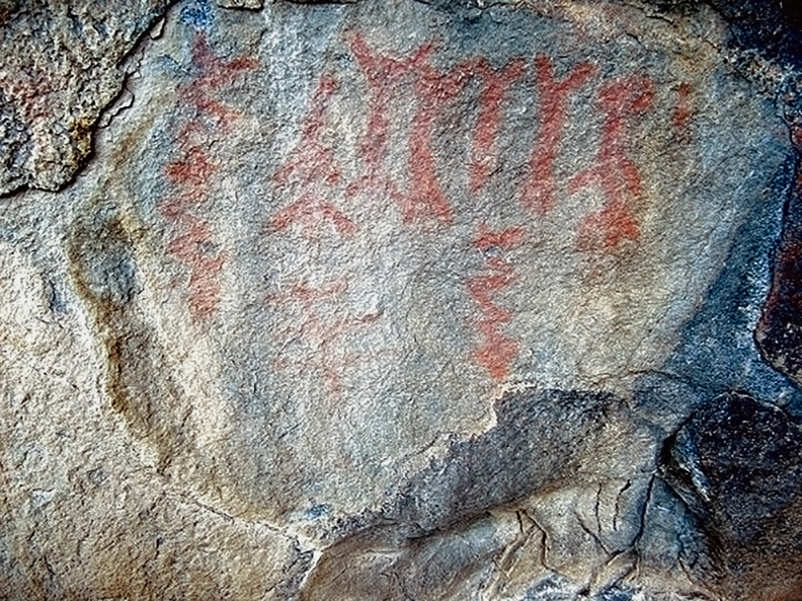
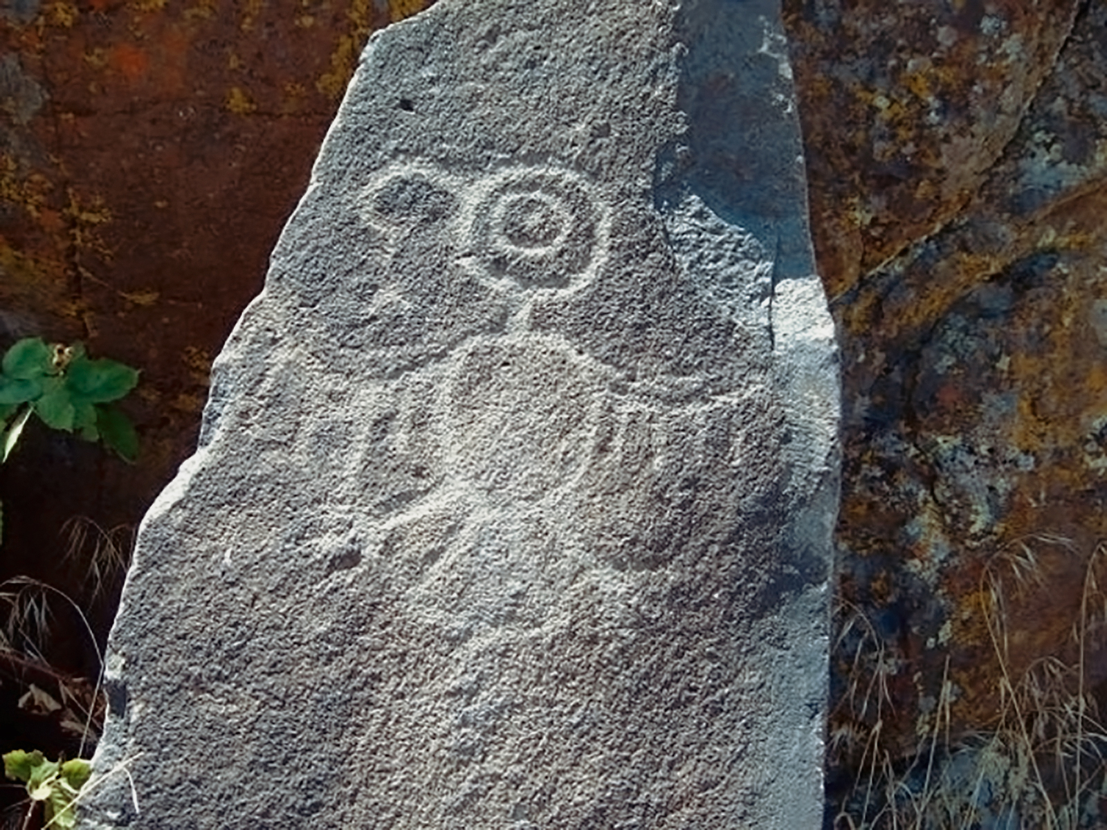
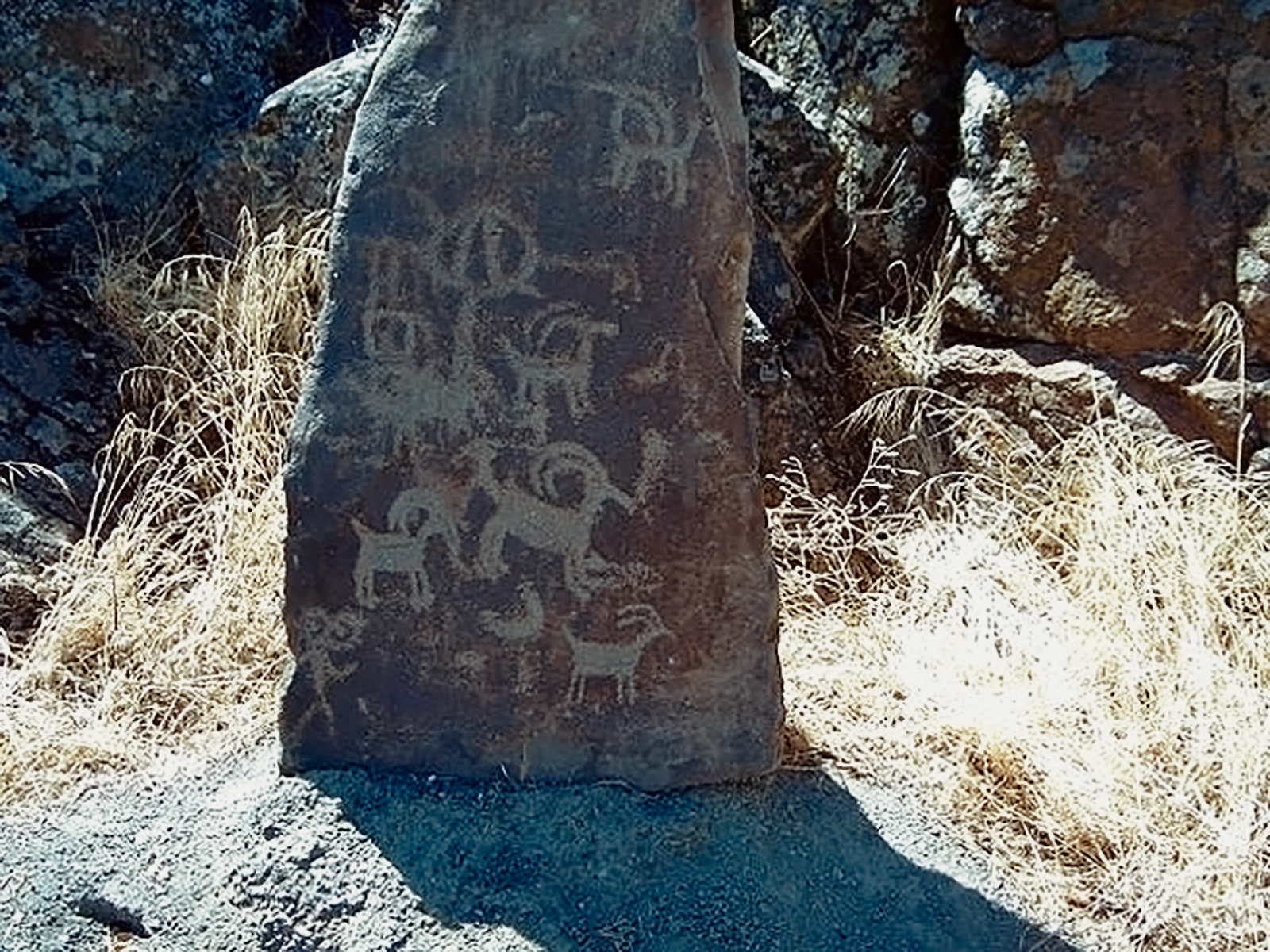
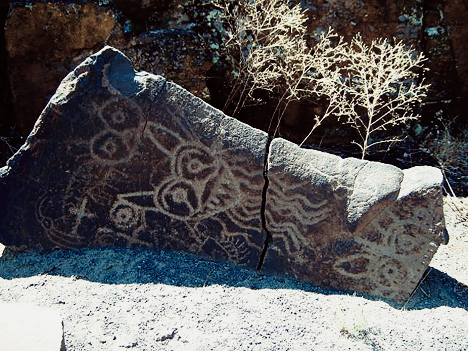
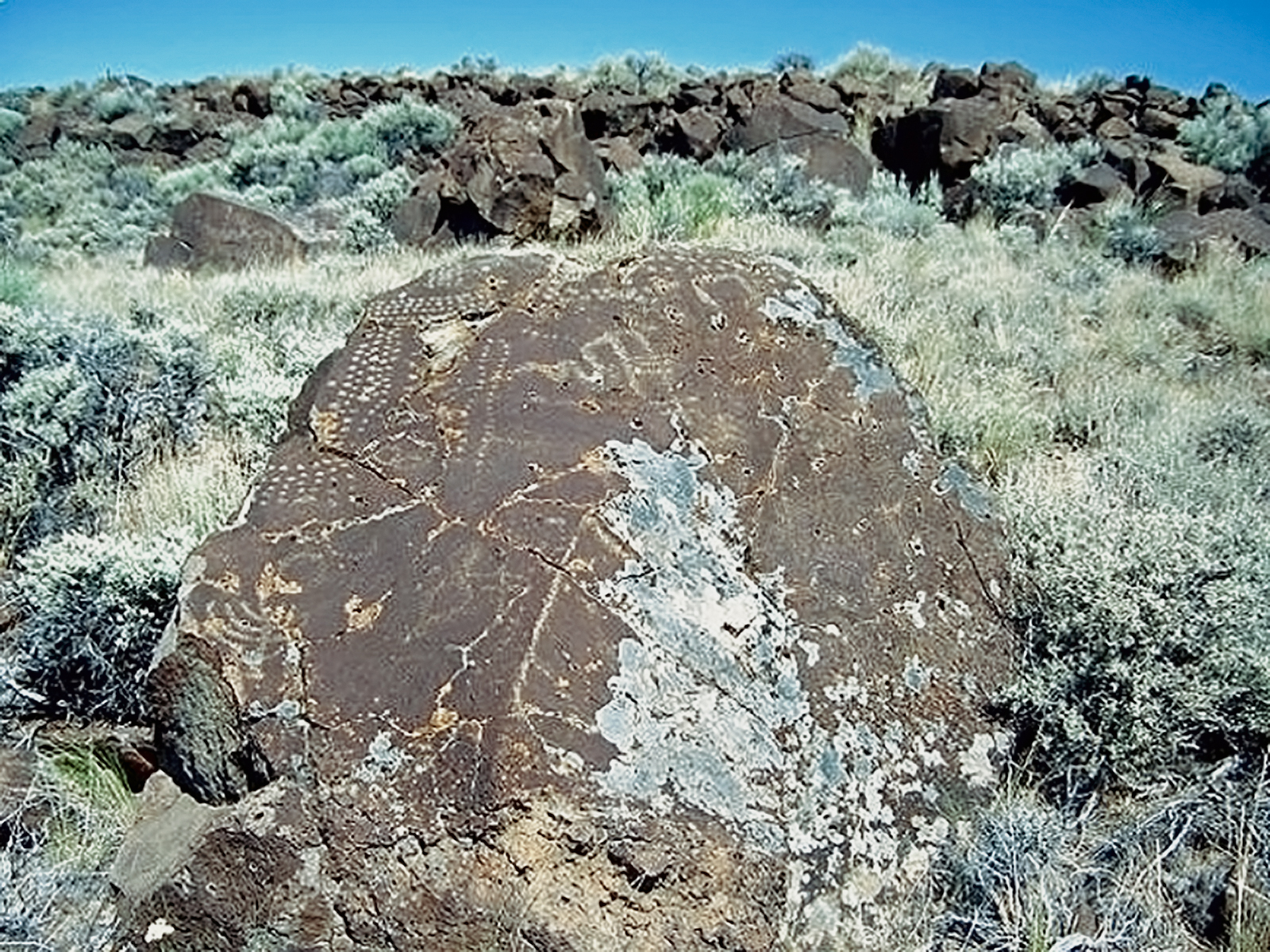
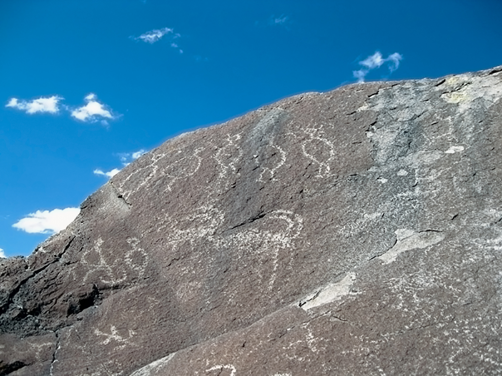
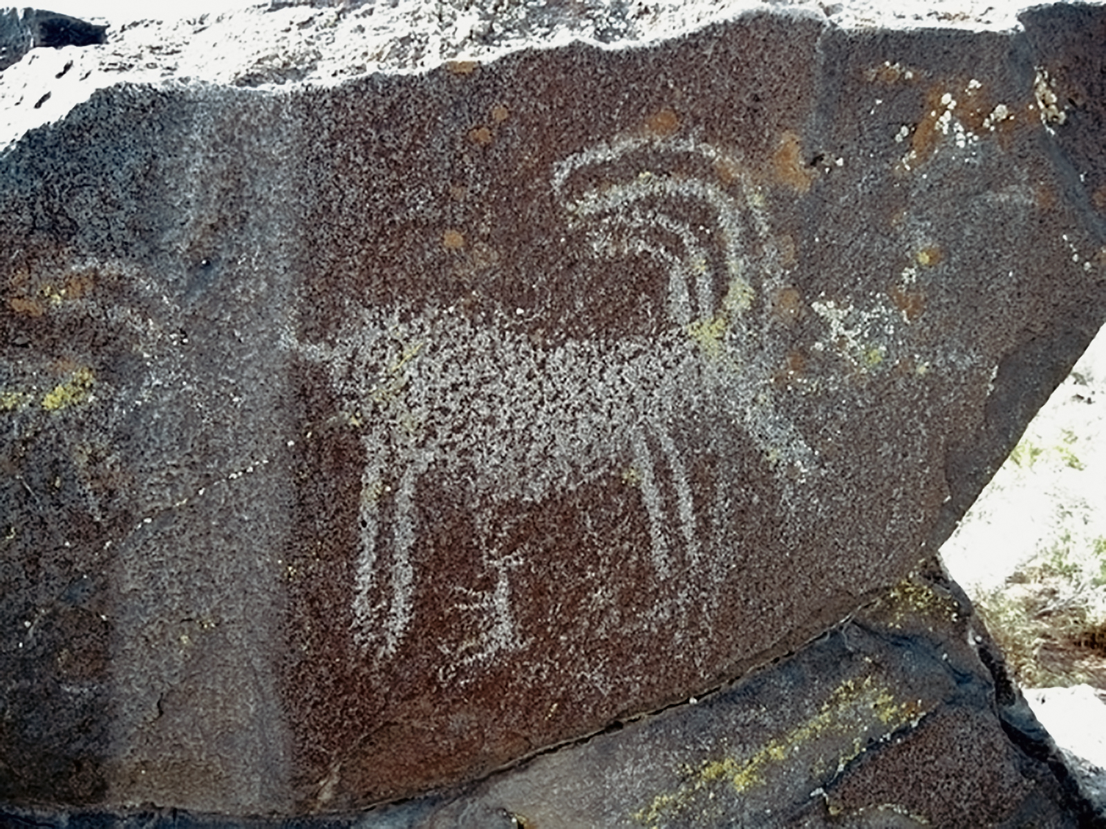
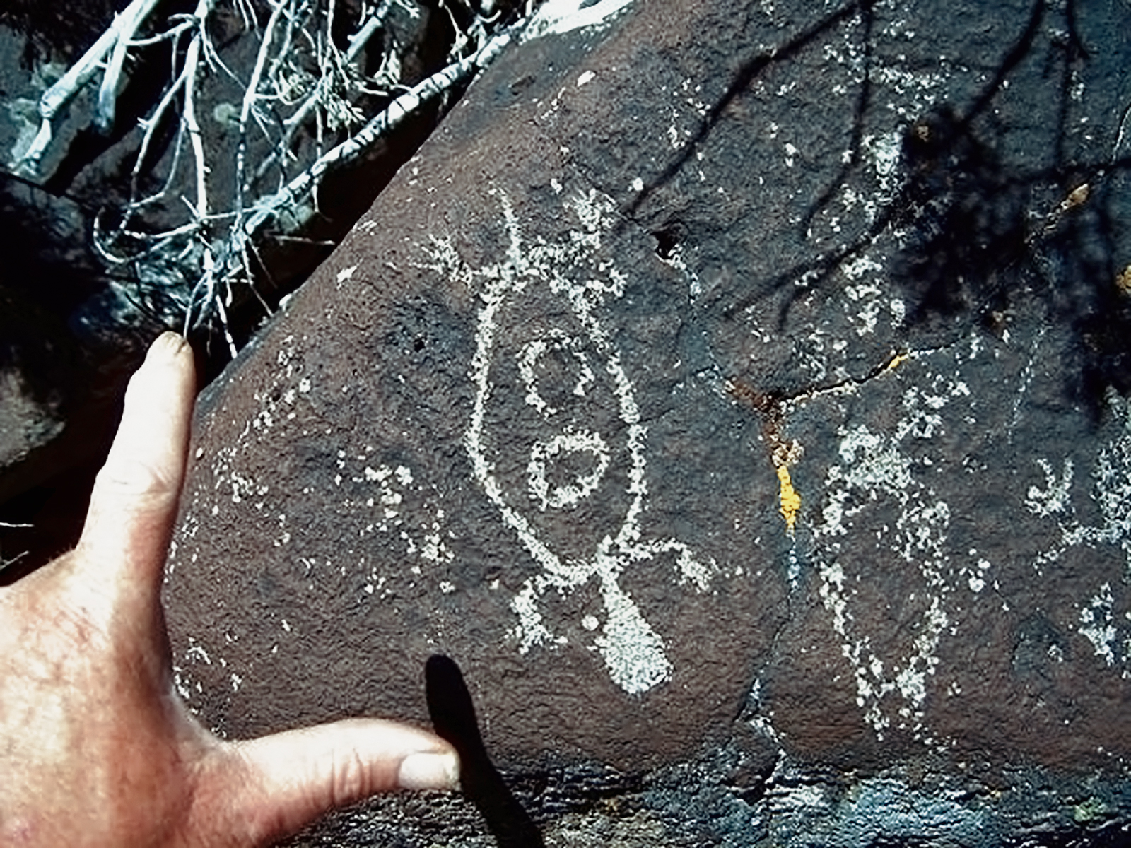
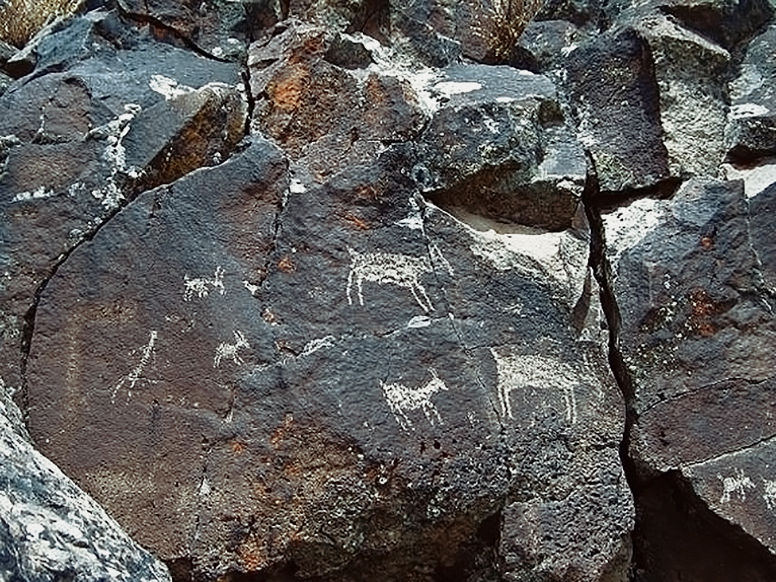
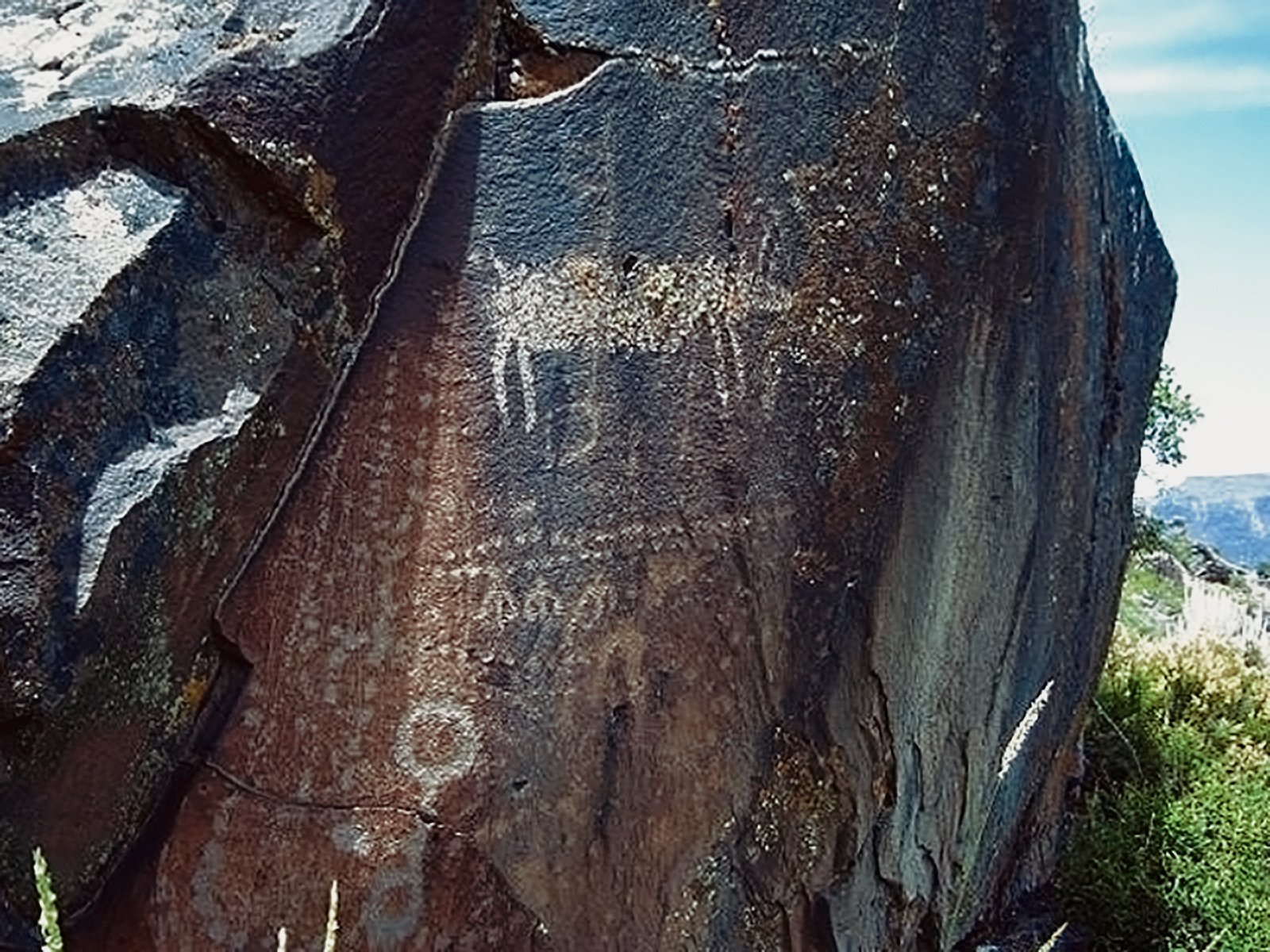
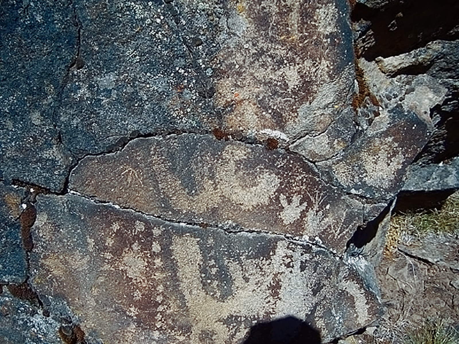
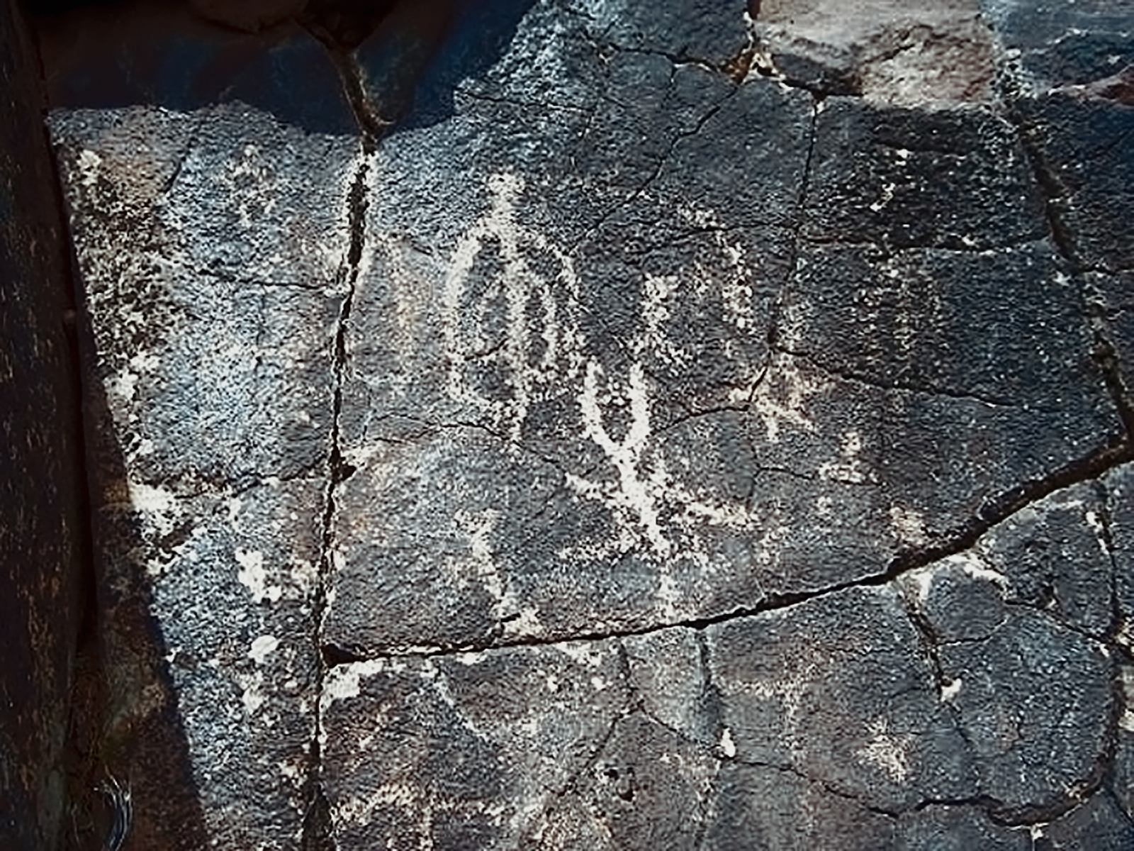
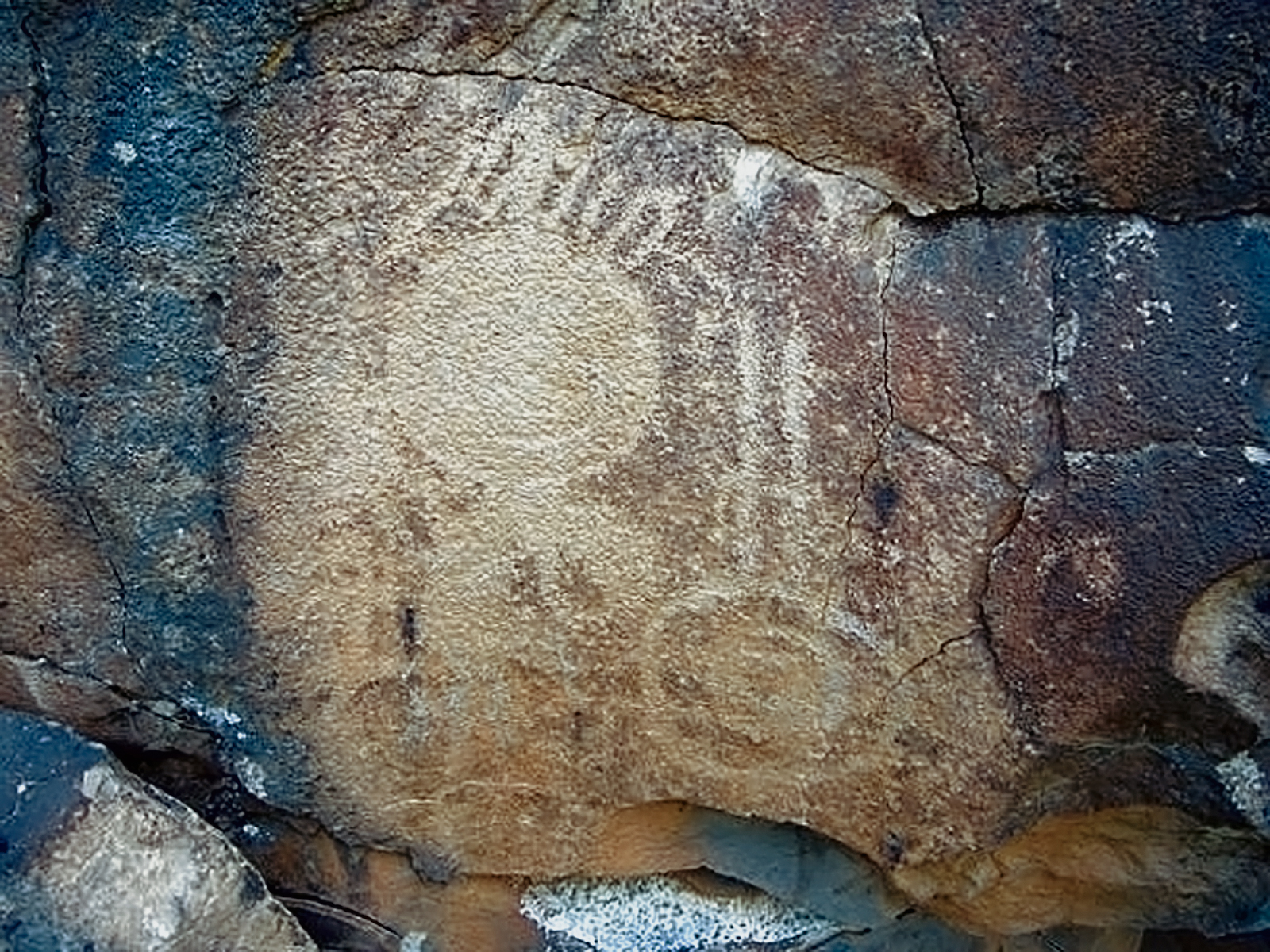
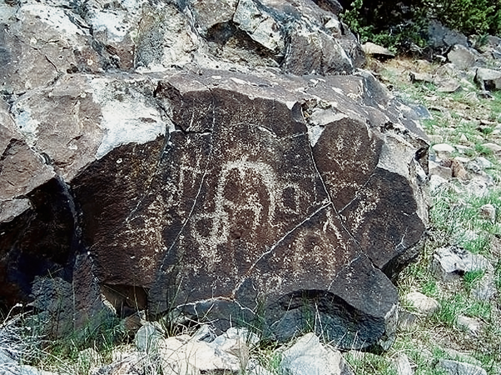
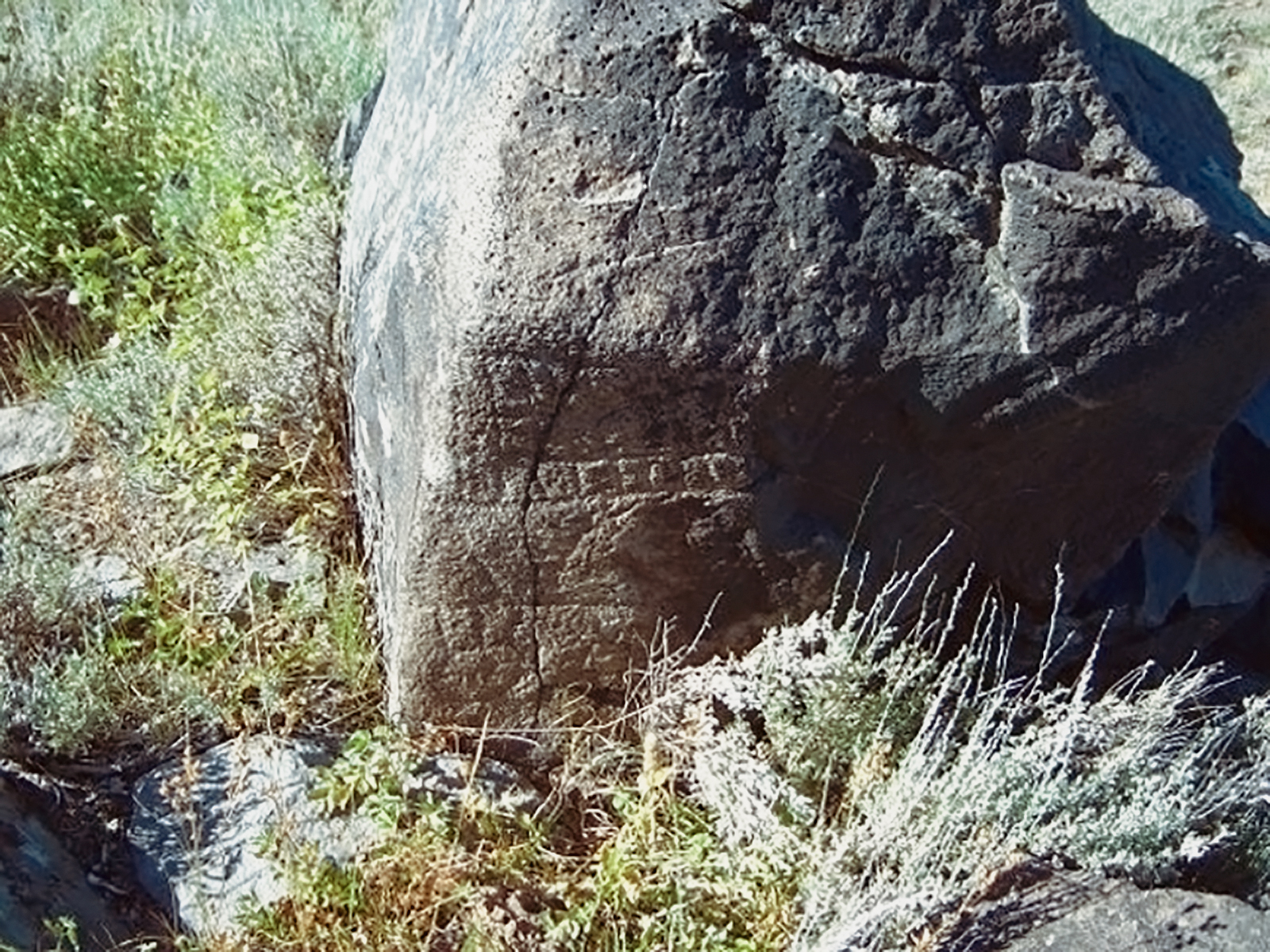
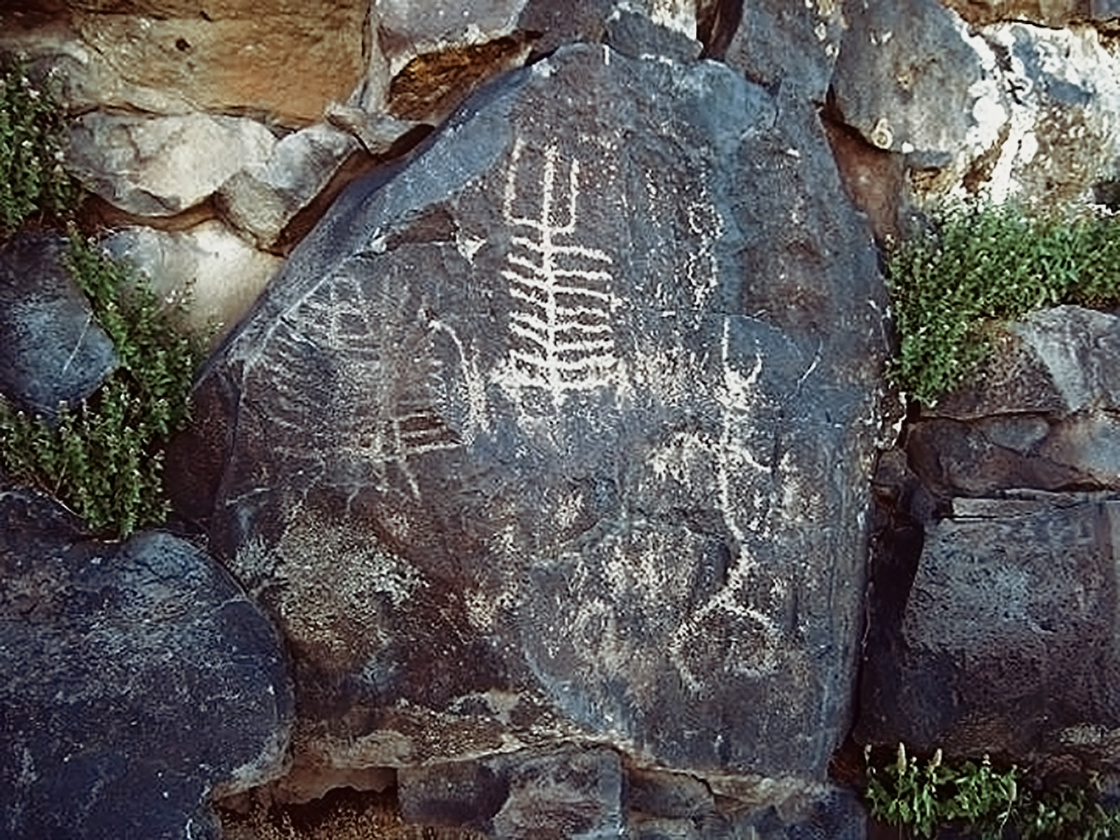
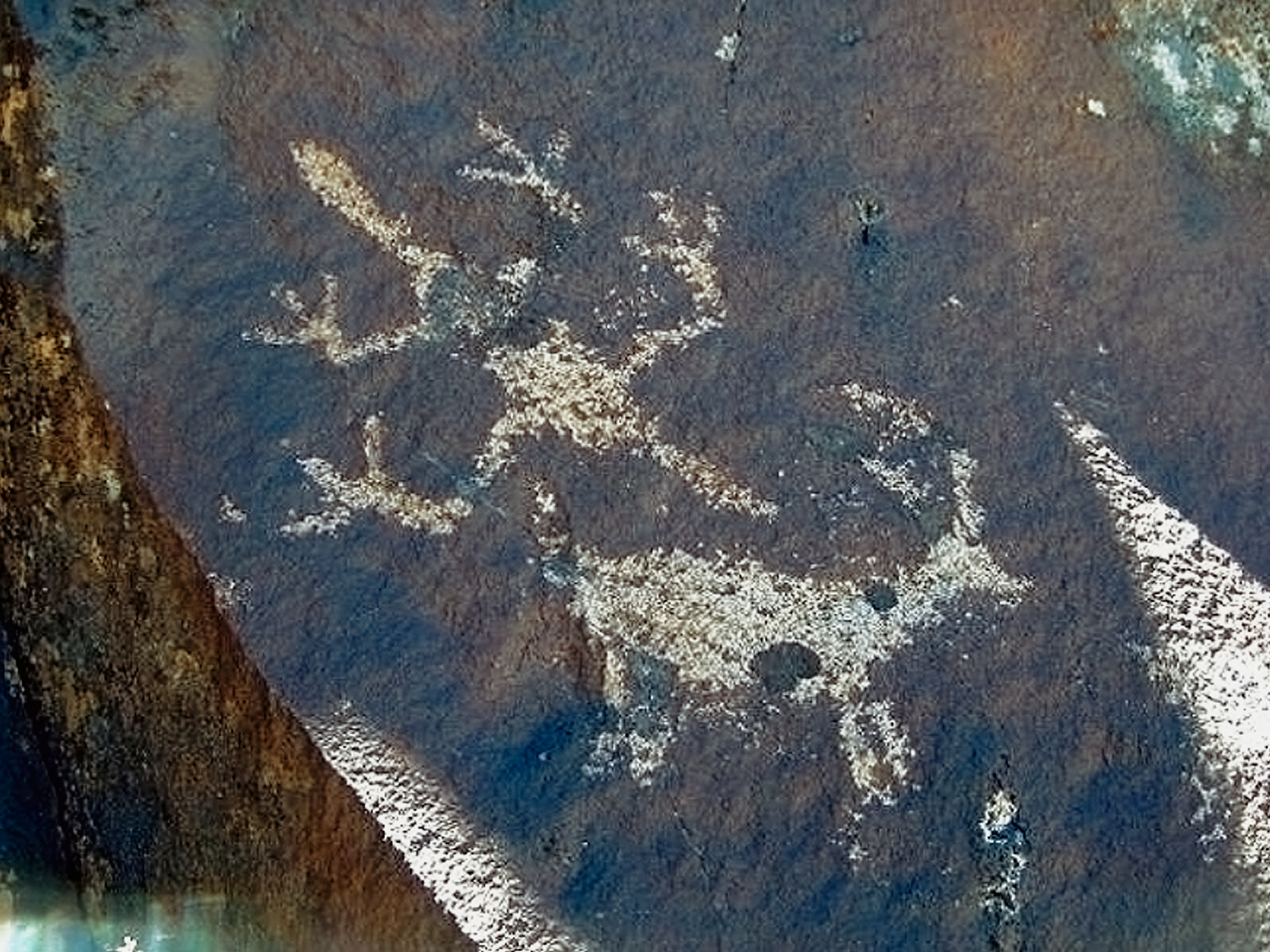
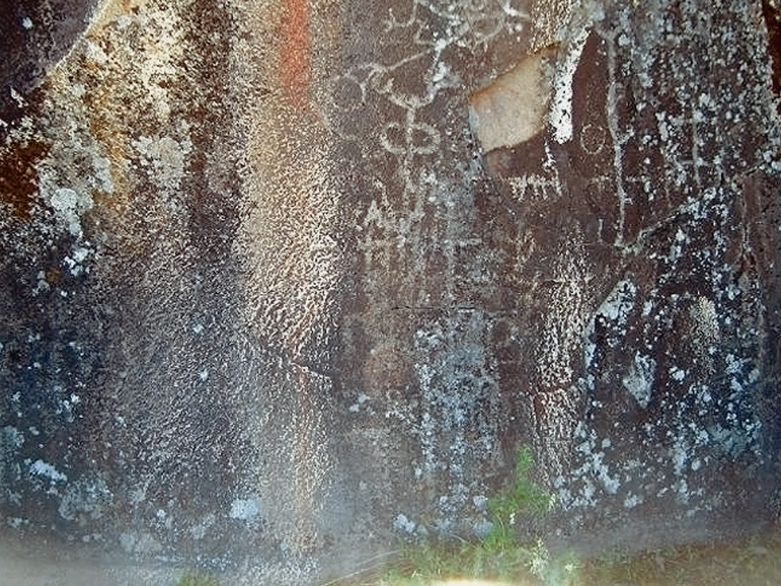
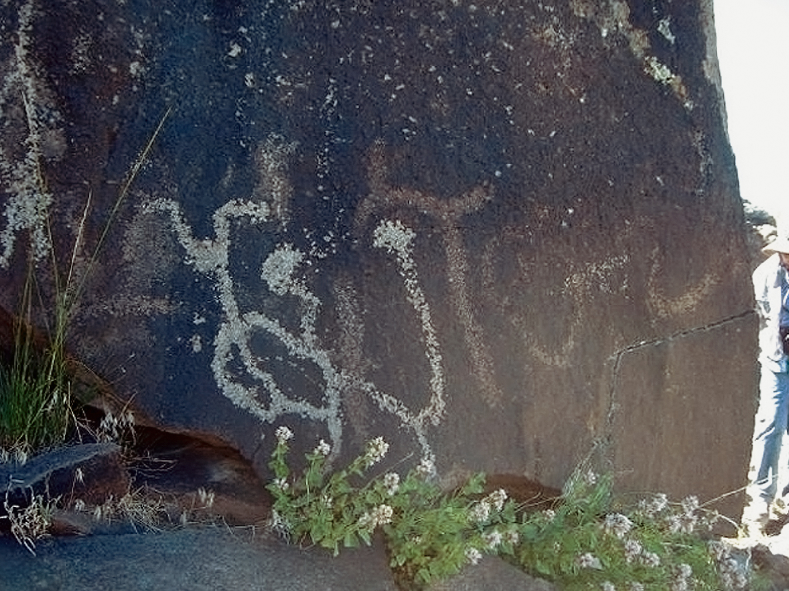
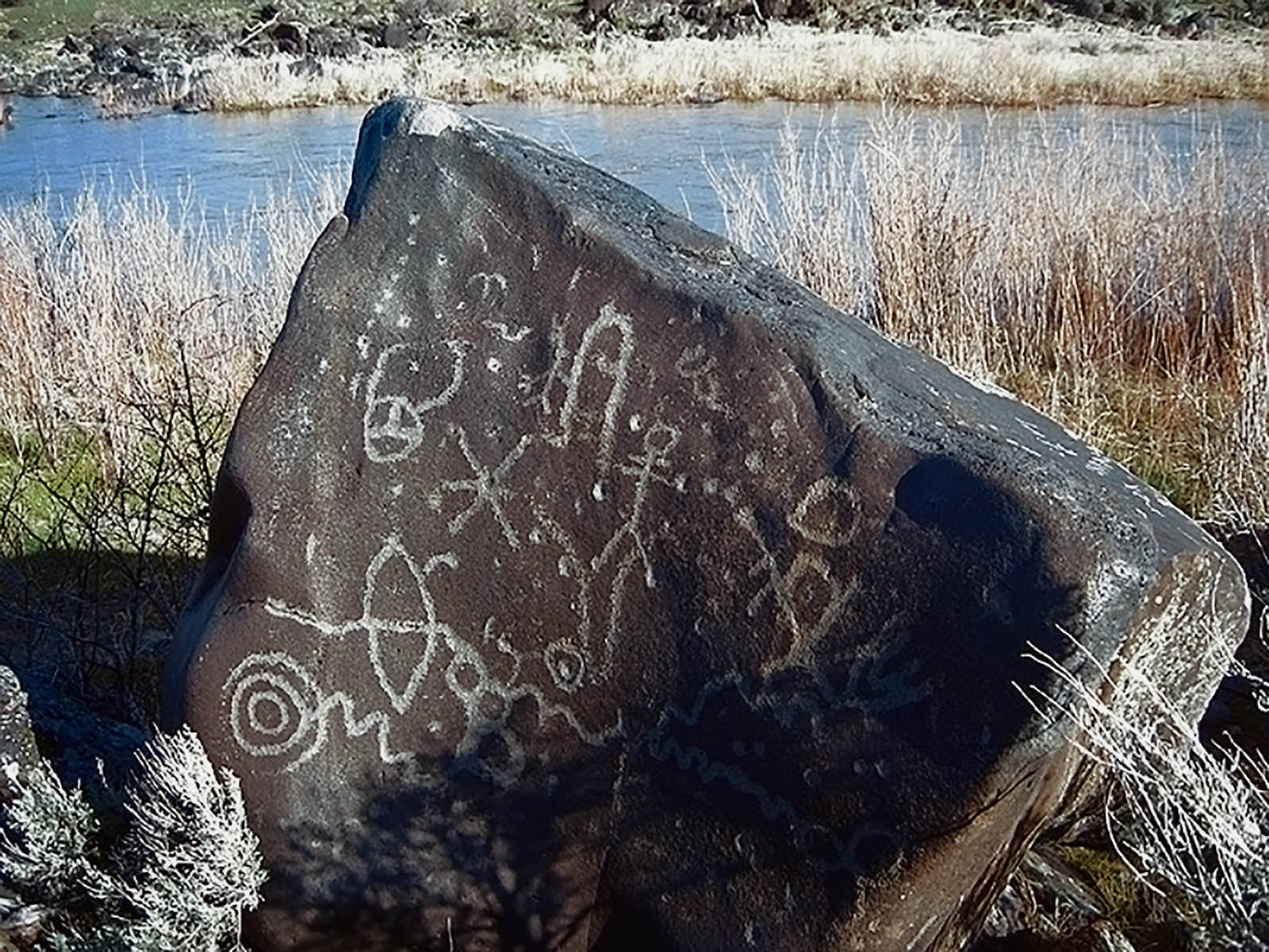
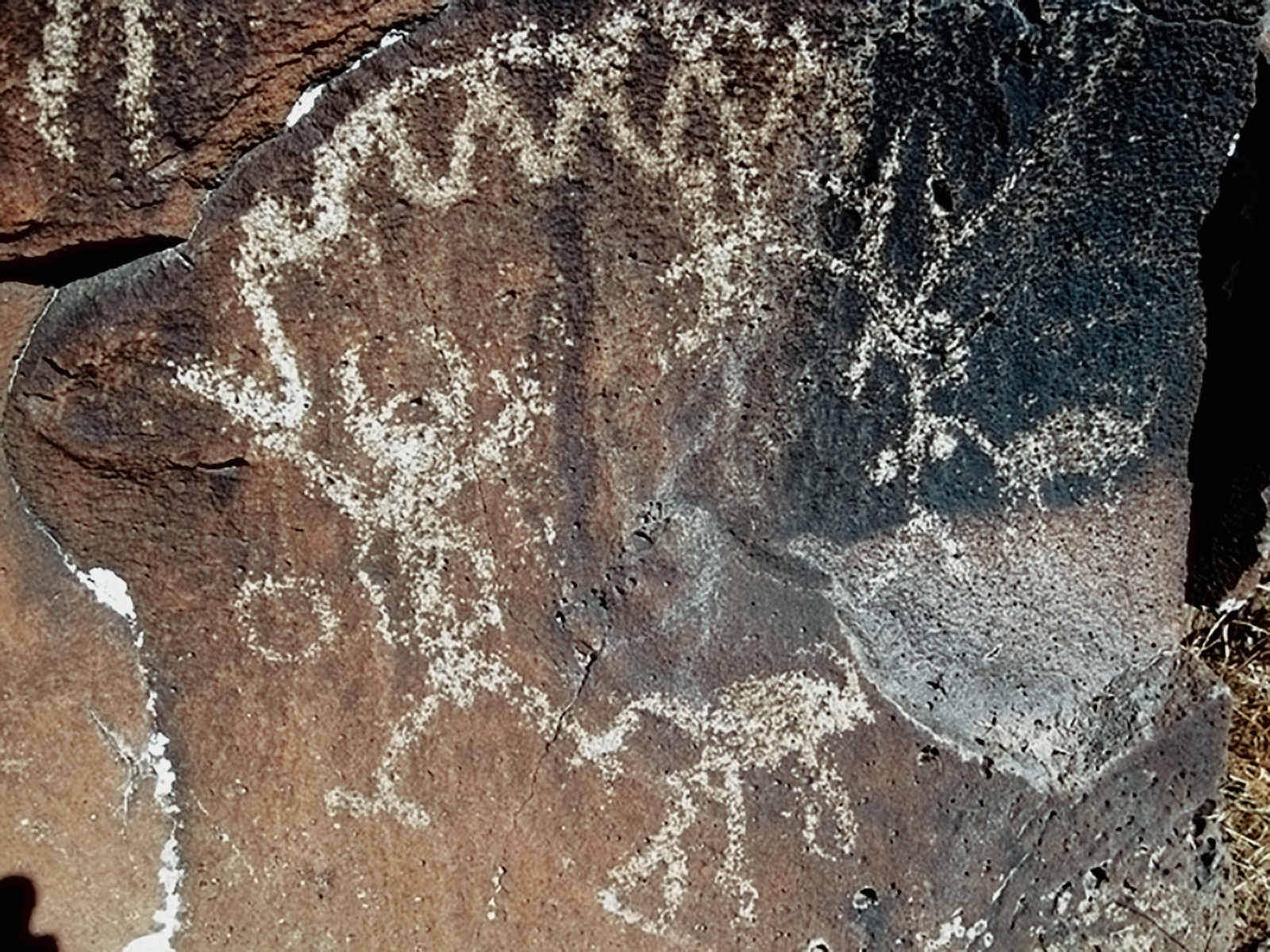
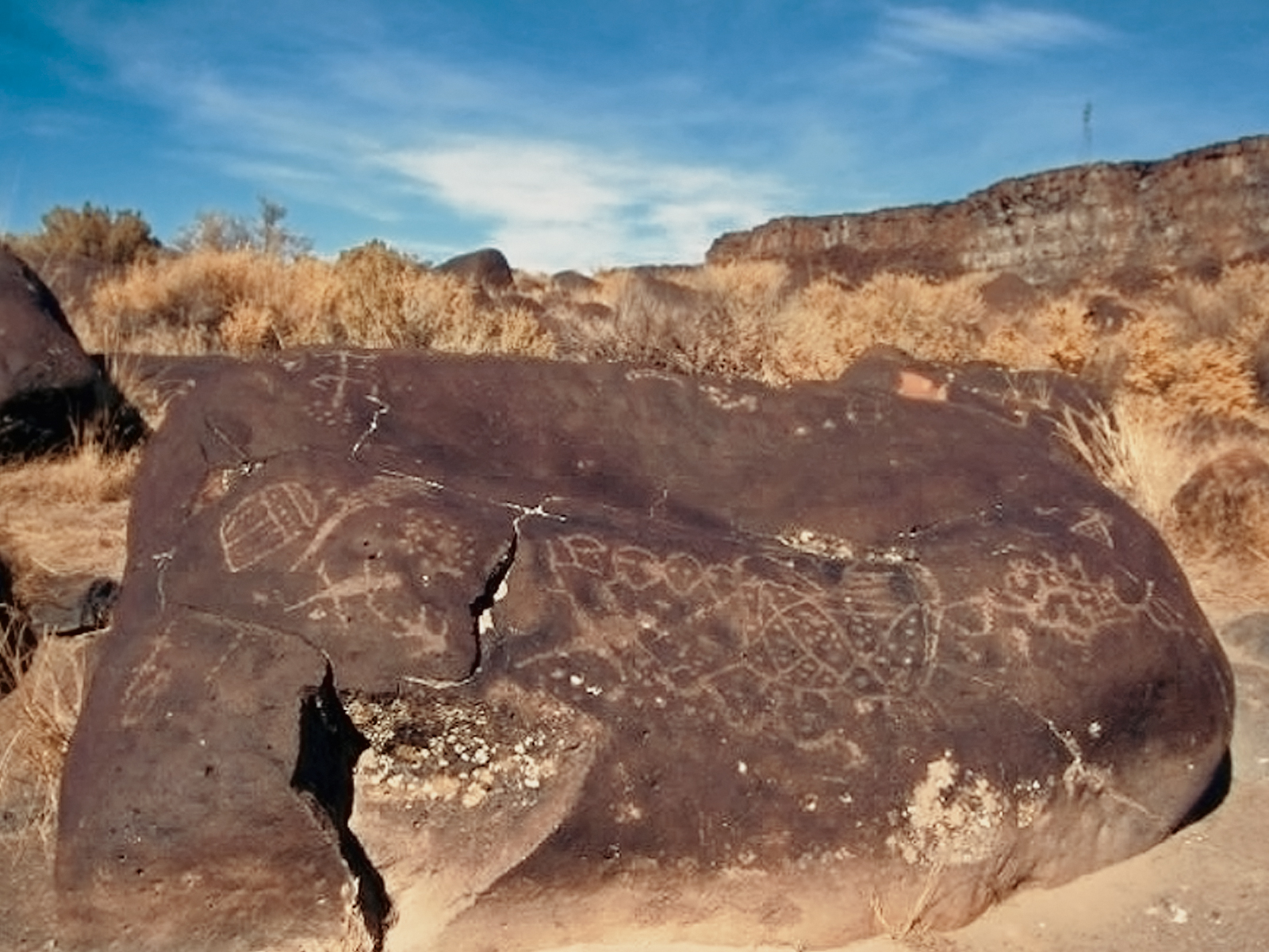
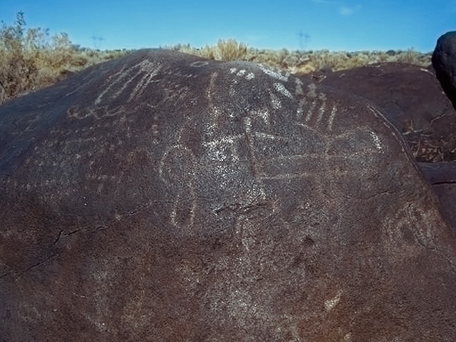
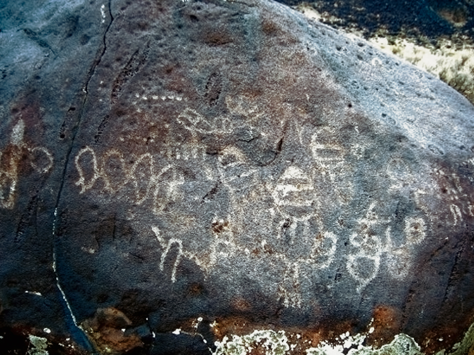
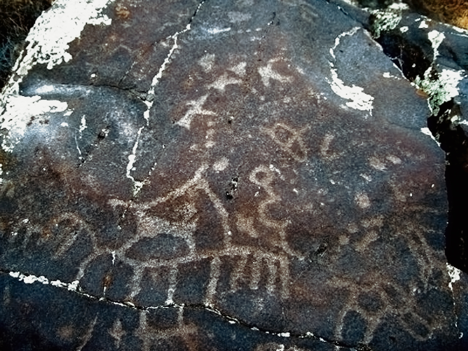
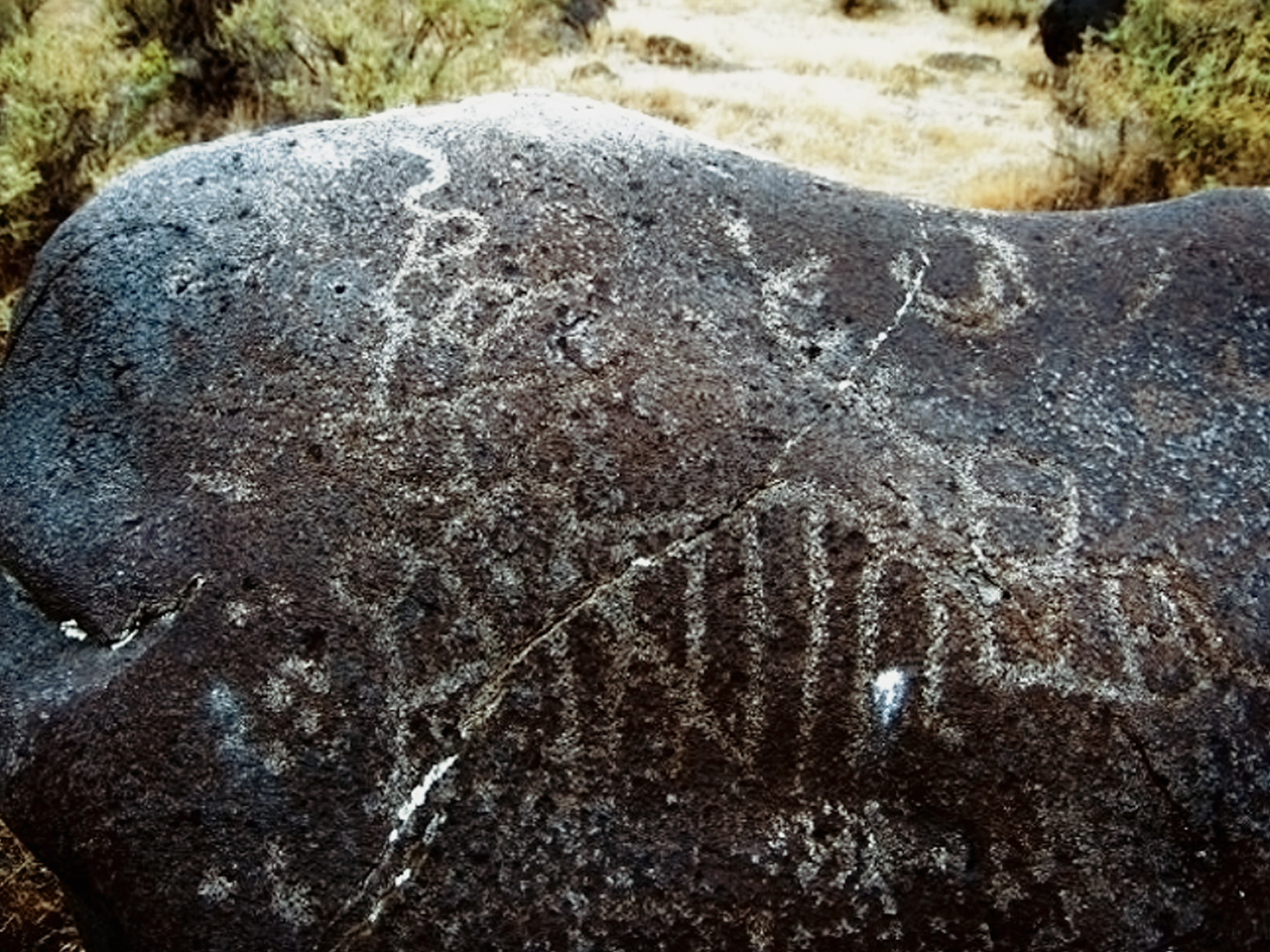
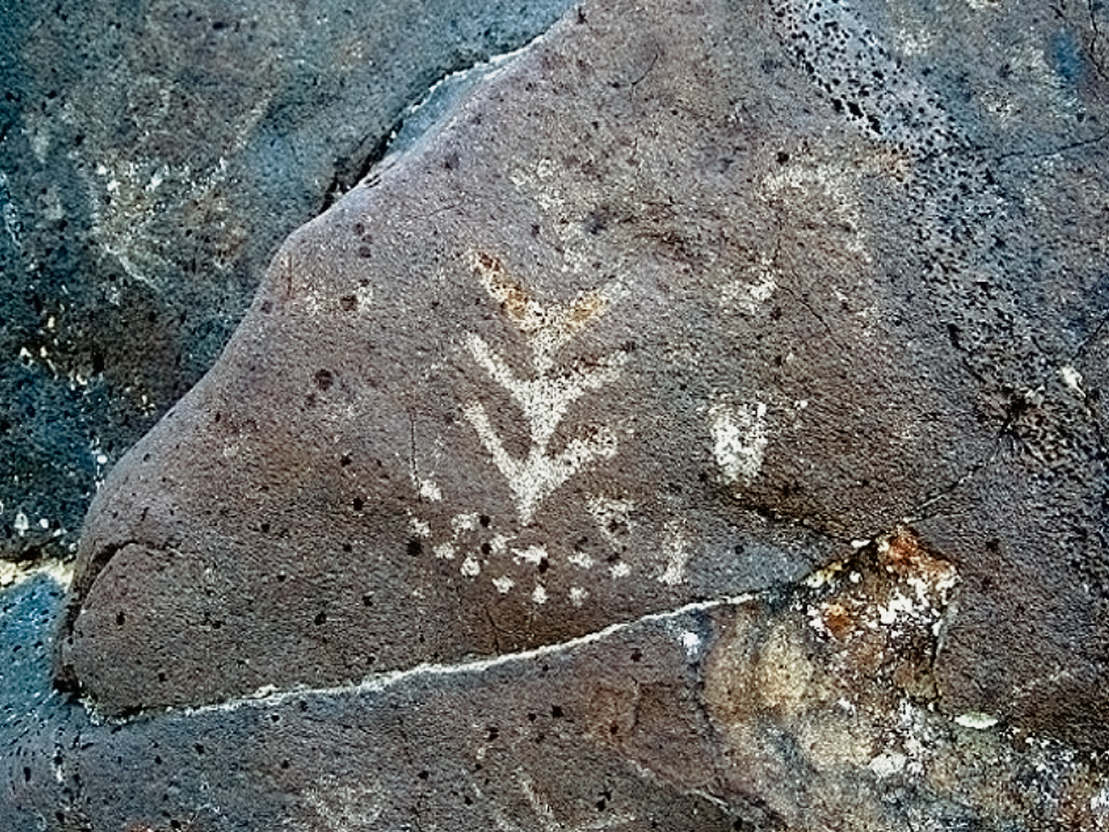
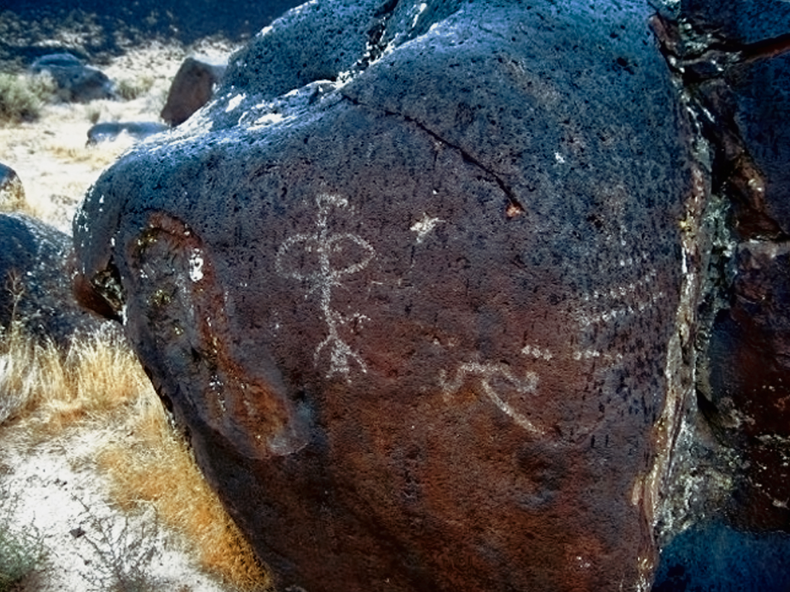
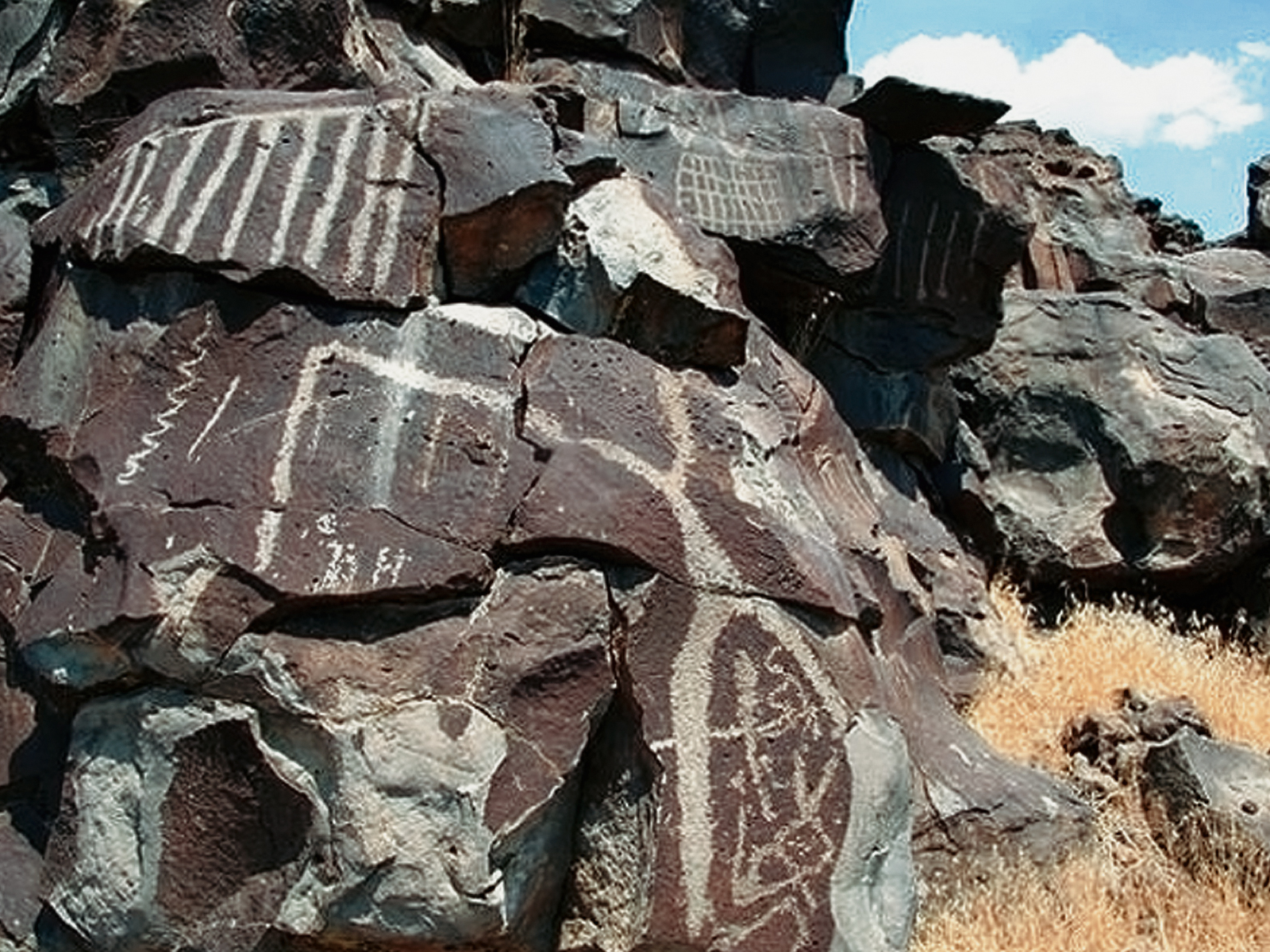
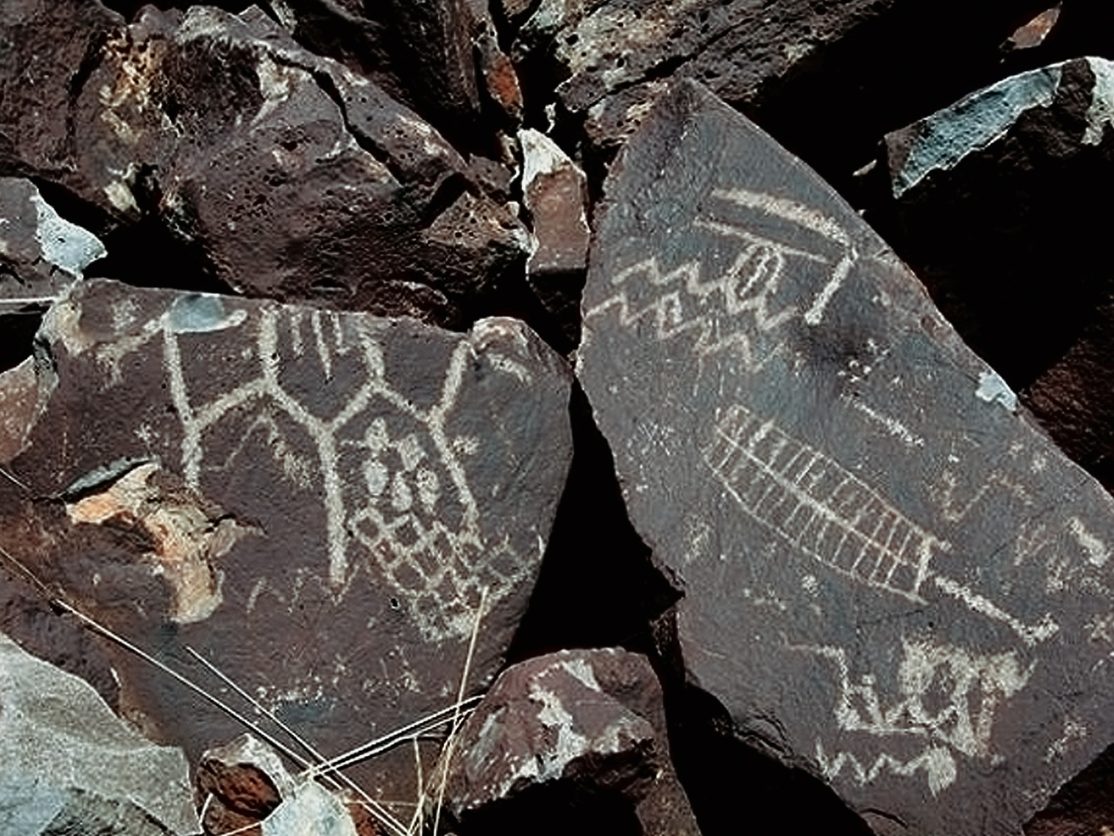
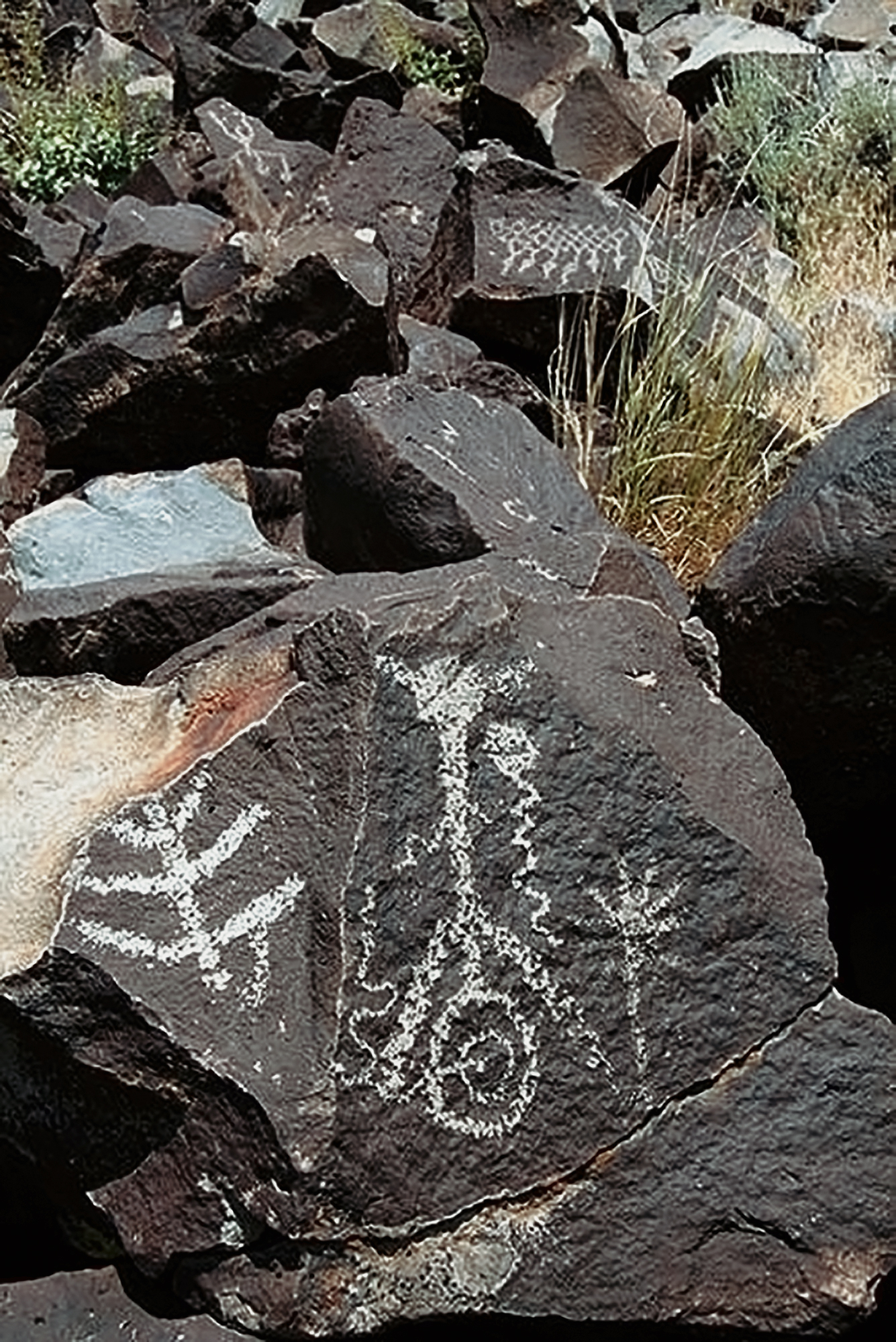
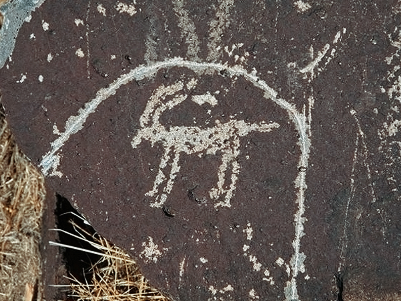
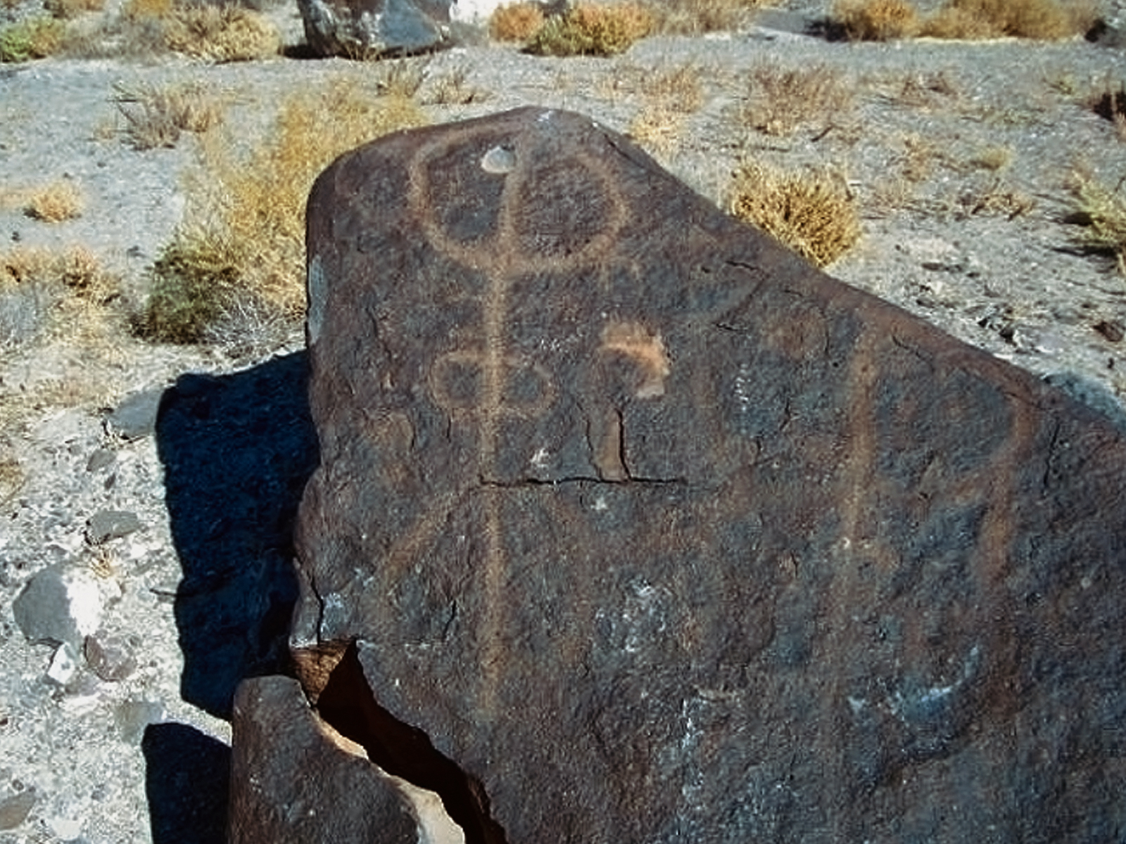
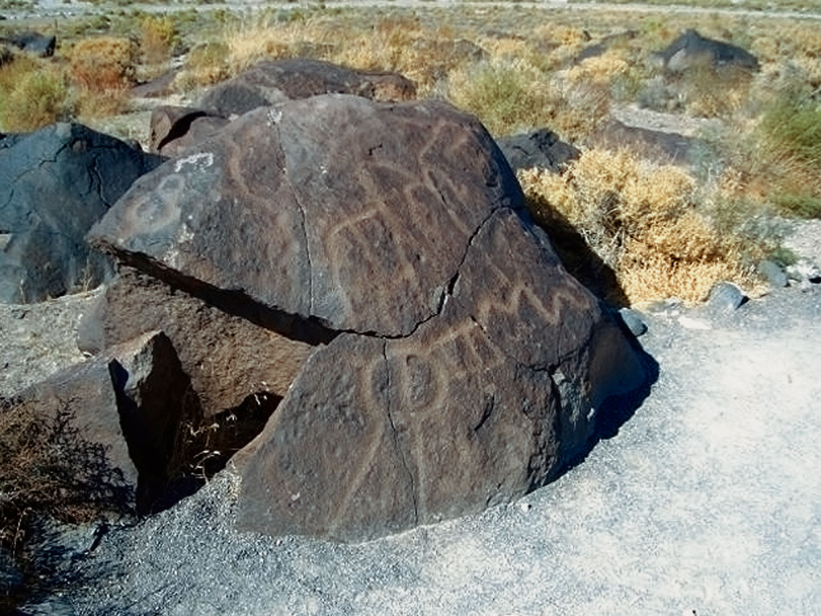
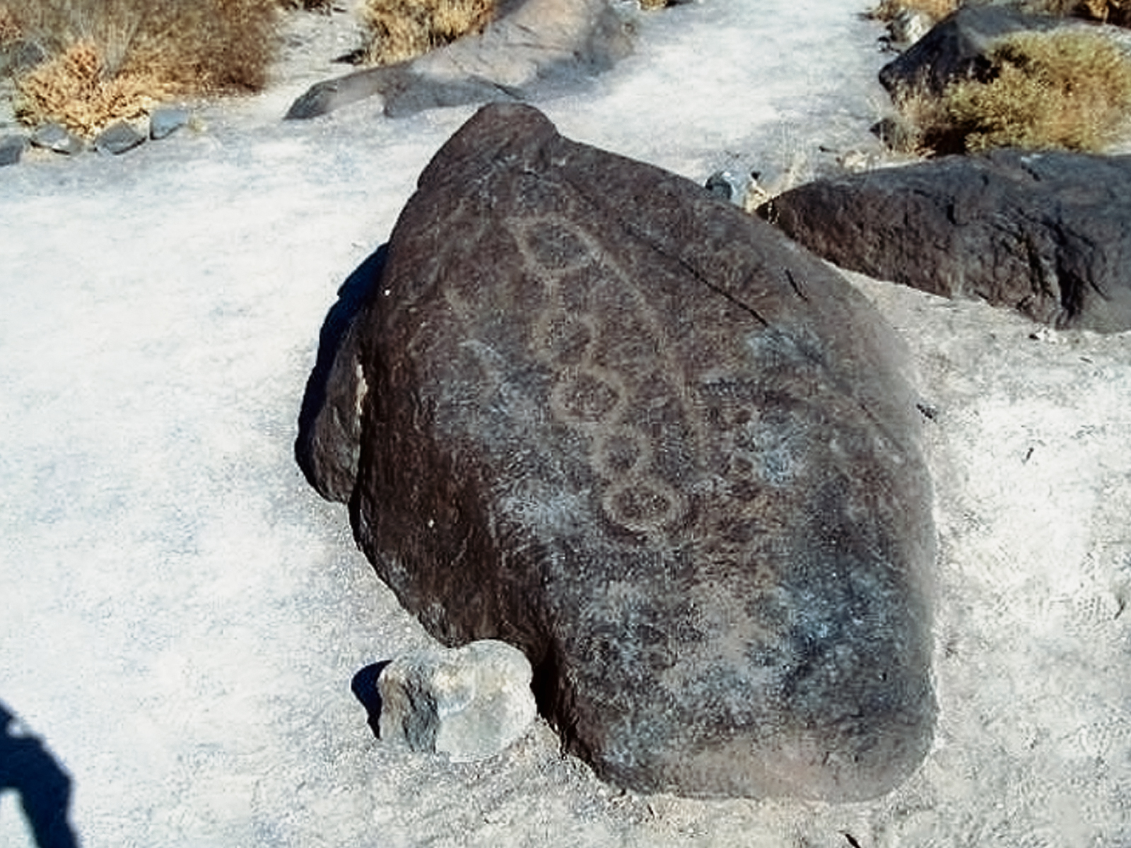
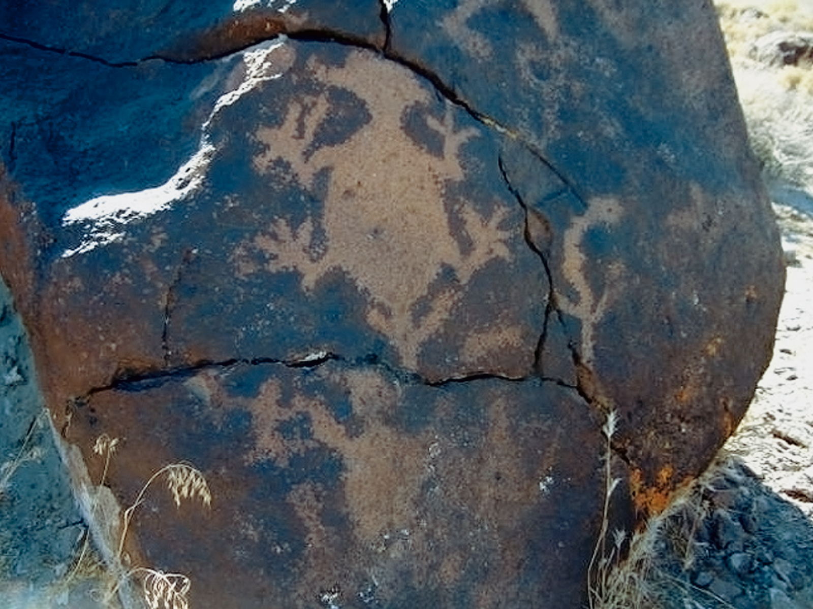
Petroglyphs in the Great Basin styles are found on the basalt rims surrounding many of the pluvial lakes, drainage areas and passageways between different geological altitudes in the area. A few pictographs are also present.
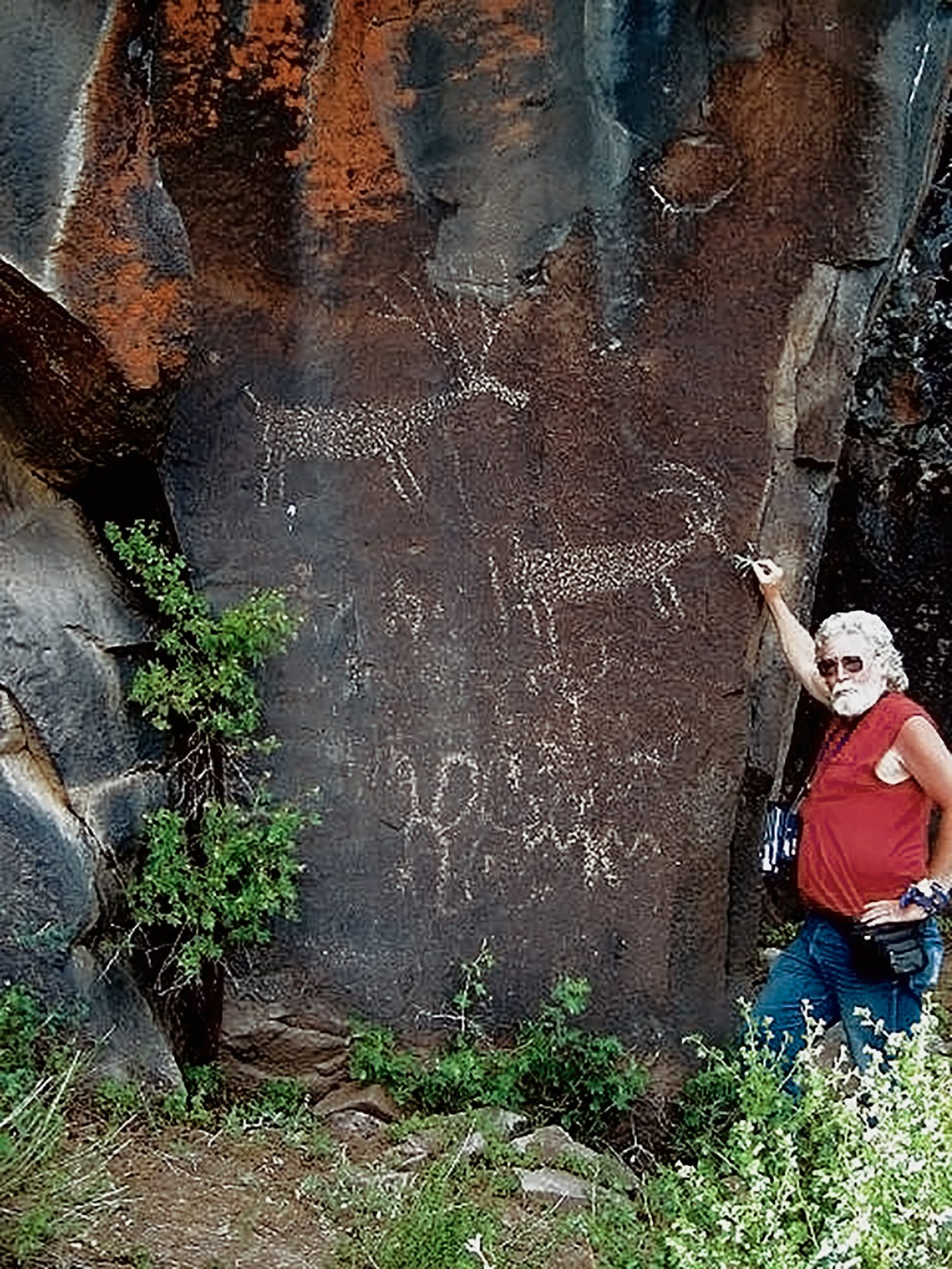
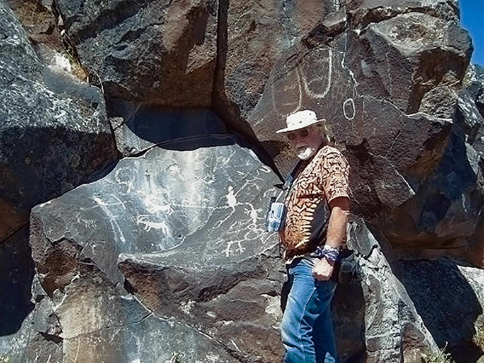
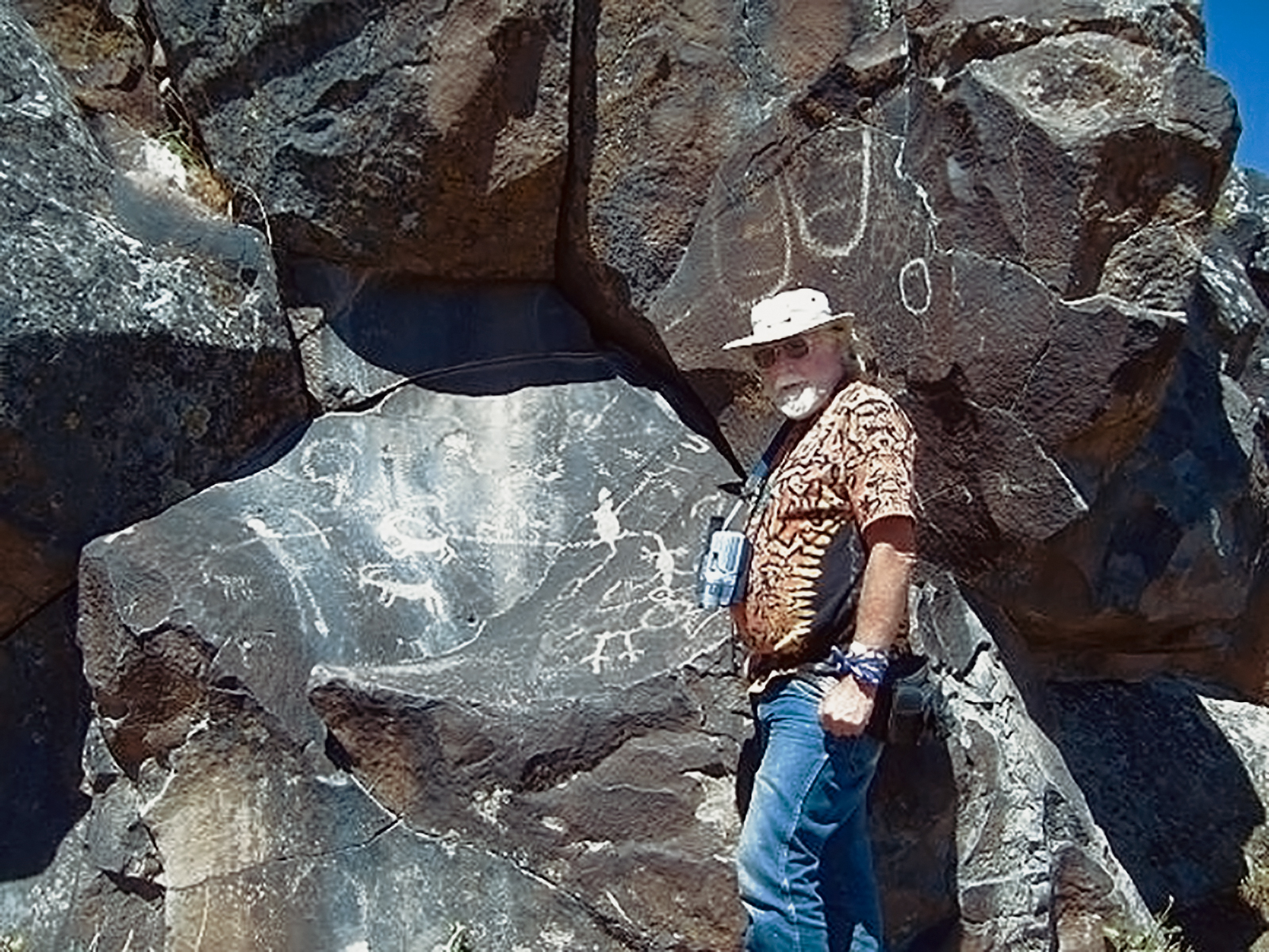
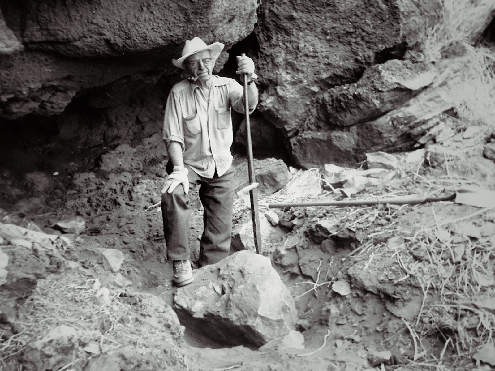
I have had an interest in archaeology for over thirty years. Pursuing those interests has lead to several extended journeys to Mexico, Honduras, Guatemala, Peru, Bolivia, Australia, Indonesia, Thailand, India and Nepal. While, ruins in these places have been my primary focus, rock art has been a peripheral interest. I spent three summers in the mid 1990's exploring the ruins and rock art of the U.S. southwest, visiting major and lesser-known sites in Utah, Colorado, New Mexico and Arizona. More recently I have focused on rock art in Washington, Oregon, California, Idaho and Nevada. In 2006 I engineered a private visit to Little Petroglyph Canyon in the Coso range and visited, photographed and videoed several other sites in the vicinity, expanding my first hand experience of Great Basin petroiconography. I also visited an undocumented site on private land in northern California and a possibly astronomically inspired rock art and cave site in the same vicinity. I visited and recorded photographically several sites in Idaho including the very difficult to reach Wees Bar site on the Snake River in 2007. In 2008 I visited sites in the high Sierras in northern California in the company of members of the Bay Area Rock Art Research Association. In 2009 I visited a number of Loring sites in the Owyhee River drainage, learned the exact locations of many non-Loring sites in said drainage and made the BLM in that area aware of the exact locations of many Loring sites (using their field notes) of which the BLM was unaware. I was assisted in these efforts by OAS member Debra Mitzel. Additionally I visited the majority of publicly displayed rock art along the Columbia River in Washington and photographically recorded a number of sites in the Okanogan River drainage. This was aided by internet research, contact with private individuals and accessing the literature that exists for that area. Research and promotional appeal to locals following the lead of Cressman and Lorings in the news media has lead to discovery and recording visits to several sites that were not recorded by the Lorings or Cressman, and we will continue to employ the method.
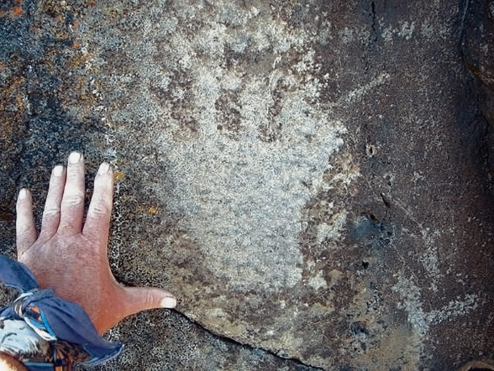
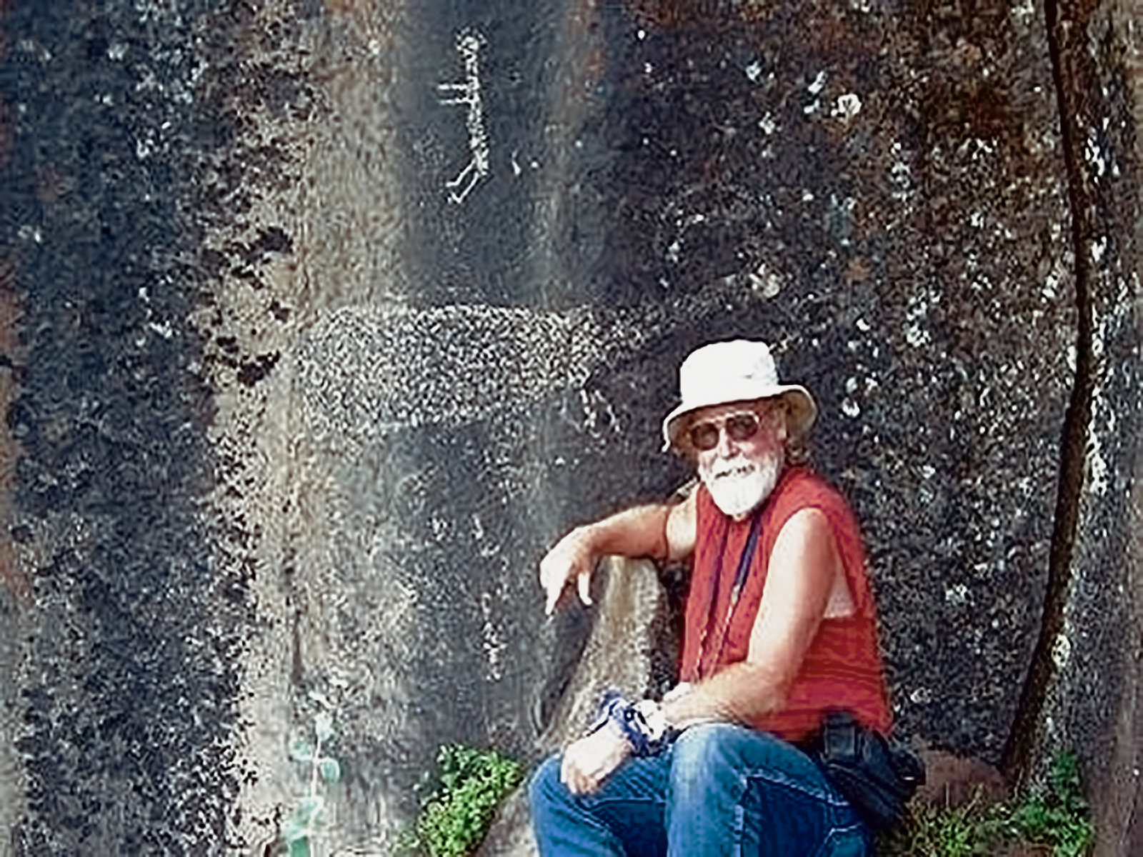
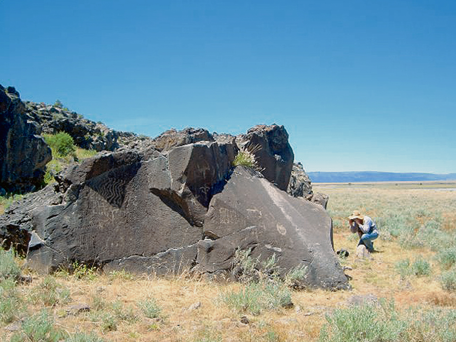
Over the summers of 2002-2010 LeeAnn and I have spent approximately 145 days in the field exploring dozens of rock art sites in Oregon and Washington. We have visited sites in controlled areas such as parks, on public lands and (with proper permission) on private lands. During these visits we have observed proper etiquette concerning such sites, such as not touching or chalking them. We have recorded them photographically with film, digital and video devices. We are very aware of the various challenges involved in this enterprise and methods of overcoming those issues, such as visiting panels at various times of day to obtain optimum lighting conditions, shading them and illuminating them with reflectors. We have also stippled several images, a technique we were familiarized with during the OAS class on rock art recording taught by Dr. James Keyser. These records we have organized in photograph albums and in 2007 I created a website that focuses directly on our Oregon research (www.oregonrockart.com). It has risen to the top in the major search engines and is consistently drawing hundreds of unique visits a day, demonstrating there is considerable interest in the subject world wide. In 2010 I added 30 new galleries bringing the total number of images to around 10,000. These include digital copies of the Lorings black and white photographs I obtained by visiting the archives at UCLA, the new Loring recorded sites we visited in 2009 and a number of non Loring recorded sites that we have discovered using several techniques, visited and recorded. I have also posted a number of cutting edge galleries that allow visitors to see rock art sites in 3-D. I developed a half hour long narrated slide show dealing with Oregon Rock Art in general and presented this at an evening event for the BLM visitor center in Maupin, Oregon in 2008. In 2009 I prepared a paper detailing many of our new discoveries that was included in the OAS publication, Rock Art of the Oregon Country-Honoring the Lorings' Legacy. Screenings published an article I wrote and it was reprinted in the newsletter of the Council of Affiliated Societies as "an example of excellent research".
LeeAnn has spent countless hours matching our images with the line drawings in the Lorings' monographs. Her albums have grown to twenty in number containing approximately three thousand photographs. During 2008 LeeAnn reworked all the albums to include many of Lorings' black and white photographs and many new comments and observations about the visited sites. That work continued in 2010. These were avidly perused by many folks at our 2008 OAS presentation. A slide show of these albums on CD has been placed in the OAS library and we made it available in 2008 to interested parties on the website. We continue to archive our original photographs and video records in the OAS library.
We received Loring and Loring Grants in 2005, 2006, 2007, 2008 and 2009 and delivered our presentations to the OAS early in 2006 and 2007 and in October 2008. They were well received. We continue to work on ways to make these presentations more interesting and educational. In 2008 we exhibited a number of Loring rubbings that were on temporary loan from UCLA. Screenings has published several articles I have submitted detailing our research. I will continue to submit such articles.
In 2010 we self published a small guidebook to sites where people can see rock art under controlled conditions such as museums and visitor centers. It is titled Where to See Rock Art in Washington, Oregon & Idaho. A copy will be placed in the OAS library.
We are in possession of and are intimately familiar with Cressman's seminal work in the field of Oregon rock art and Loring's monograph. We obtained several of Cressman’s other works and have read and digested the information there in. In our personal libraries we have dozens of books and papers concerning rock art and the cultures that created it throughout the world. While in Idaho in 2006, I visited the state's historical library and obtained copies of the Idaho equivalent of Lorings’ work for Idaho and a very comprehensive paper on rock art sites along the upper Columbia River drainage. We are in possession of Dr. Mary Rick's thesis on rock art in Lake County. Also Myrtle Shock's thesis on Owyhee uplands rock art sites. We located and accessed a number of reference books in 2009, among them B. K. Swartz, Jr.'s Klamath Basin Petroglyphs and H. Thomas Cain's Petroglyphs of Central Washington.
During my visit to the Loring Archives at UCLA in 2006 I made copies of most of their original field notes. These documents have been an invaluable aid in locating many of the more difficult to find sites the Lorings visited. In 2007 while at the archives I made over a thousand digital copies of Lorings' black and white photographs. LeeAnn is incorporating many of these in her albums adding to the condition tracking records of the glyphs. And I have added these to www.oregonrockart.com.
Since we were in email contact with Janet Coleman, Lorings’ daughter before she died in 2008, we had hoped to track down the location of materials that she turned over to the state of Oregon after her parents' deaths; and if those materials were located, to access them. In 2007 this lead us to become acquainted with the Oregon State Historic Preservation Office and to make some contacts there. We have analyzed the two thousand page bibliographic database there to determine what useful information it contains. This was accomplished in 2008 and I determined there are about three hundred documents that would be of interest. We hope to hire a professional archaeologist to obtain the relevant information. As of 2009 we still have no funds to hire a professional and there seems no other way of accessing this information. Janet’s son contacted us in 2008 letting us know that he has come into possession of several of the artifacts the Lorings collected, including several rubbings and some of their recording tools. I have requested that he send us photographs of the rubbings and tools so that we may add those to our research. His silence on the matter seems to indicate that he is unwilling to do that.
We will continue to mine the World Wide Web for sites relevant to rock art and all its various facets. In the process, we have spent time at several dozens of the sites, most of which have contributed to our understanding of the art itself and the influences that lead to its creation, as well as various theories of scholars and amateuras to why it was created. We have Google alerts coming to us on a daily basis notifying us of new rock art information as it becomes available. A friend and OAS member who works at a library has tracked down and digitally made available over a dozen rock art thesis and other printed materials on the subject, which has considerably expanded our general knowledge. We will continue these efforts in 2011.
My interest in the diffusionist approach to American archaeology and petroiconography continues to expand. I am fortunate to be in custody of a friend's one hundred plus volume library of diffusionist volumes, including a complete collection of the Occasional Papers of the Epigraphic Society, where in are many interesting analysis of rock art sites. Our website has elicited several responses reporting new finds that may be relevant to this line of inquiry.
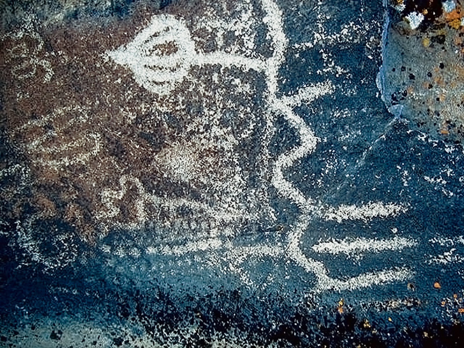
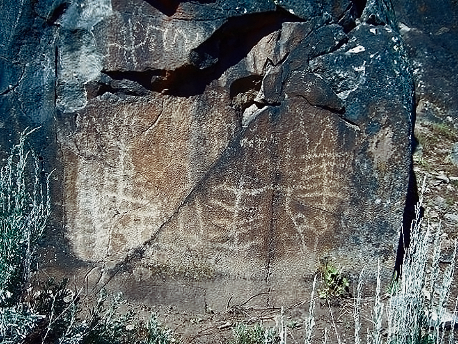
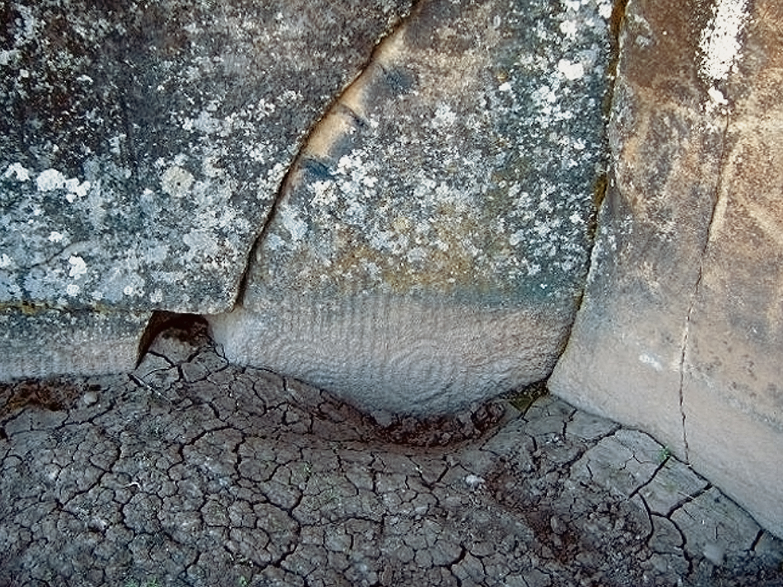
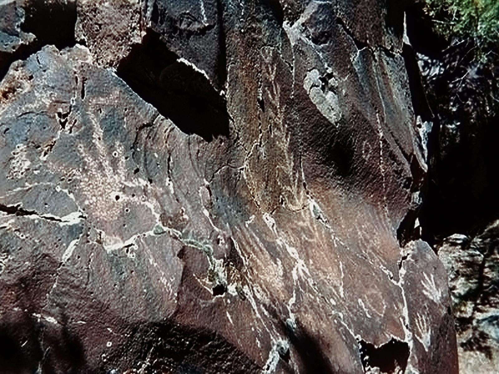
We feel that a comprehensive photographic record will enhance the records of Cressman and the Lorings. Their published records consist of descriptions and line drawings of many sites. We have discovered that there are images that seemingly were not recorded in their records. Additionally, that at least in several cases, their drawing may mislead the observer as to the form of the actual image. This is due in some cases to the inability of their drawings to differentiate distinctly different layers of images on a particular surface. Through field observation and notes and photographic verification we hope that our study will aid future observers in ascertaining a more accurate view of the actual images.
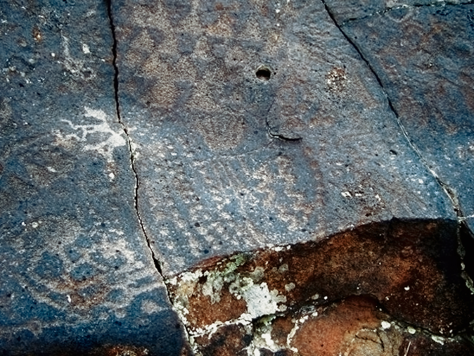
Our research will also take note of the conditions prevailing at the sites we visit: noting such things as the various degrees of repatination, lichen growth, spalling, calcification, vandalism, etc. and how that might affect future study. Variances from Lorings’ observations will be particularly noted.
In 2011 we will continue to attempt to visit sites that we have not yet visited. With the help of Lorings’ original field notes, Google Earth maps, hand held GPS system and our growing familiarity with the territory, we feel confident of accomplishing those goals.
I will continue working on the creation of comprehensive maps of rock art locations that will greatly aid future legitimate explorers, conservators and stewards. The fact that such maps would be available through a reliable "firewall", i.e. the OAS, will aid in the protection of the sites. I will continue to work with the Google Earth software that will facilitate higher print quality and richer annotations to the maps we create. I will continue expanding my skills with the hand held GPS unit so that our explorations may be better documented and presented on maps. I will also continue to search for software that will simplify the process of transcribing photographic images to line drawings of images; there is a great program for doing this to pictographs, I will continue to search for programs and processes that will commensurately do that to petroglyphs. By using the tools available in Google’s Picasa program we have been able to greatly enhance the visibility of many of the images in the photographs we take. LeeAnn has devised a protocol that allows one to greatly increase the visibility of heavily repatinated petroglyphs.
As we continue to refine our use of that program, our photographic records increase their value in contributing to the body of knowledge. I continue to work with various programs in my quest to make 3-D perspectives of rock art sites available for public viewing and enhancement of future research.
Our efforts have brought us into contact with a number of individuals who have knowledge of many Oregon rock art sites that were not recorded by the Lorings. We are actively pursuing those relationships and adding sites thus acquired to our records. In addition, during our Rock Art Recording Expeditions and Excursions, we have already discovered a number of sites and parts of sites that were apparently undiscovered by the Lorings. In our estimation and experience there are at least one hundred sites where rock art exists in Oregon that were not included in the Loring survey. It is our goal to visit as many of those sites as we can discover and record them photographically so that they become part of the archaeological record.
The area of our concentration in these efforts again this year will be the Lake County area that is on the northern boundary of the Great Basin tradition. As resources and time become available, we will continue our exploration of the Owyhee River drainage including parts in Idaho. While other areas of this region are more familiar (the Coso Range, for instance), the amount and complexity in the Lake County area rival any in the world. In the wildest of imaginings, our documentary efforts might lead to the establishment in the area of a world heritage site.
There are approximately eighty-seven Loring recorded rock art sites in Lake County. Additionally we have learned of at least 50 more sites in the Lake county area that have been discovered. It is our intent to visit as many of those as possible, as well as some of the Loring sites we have not visited thus far.
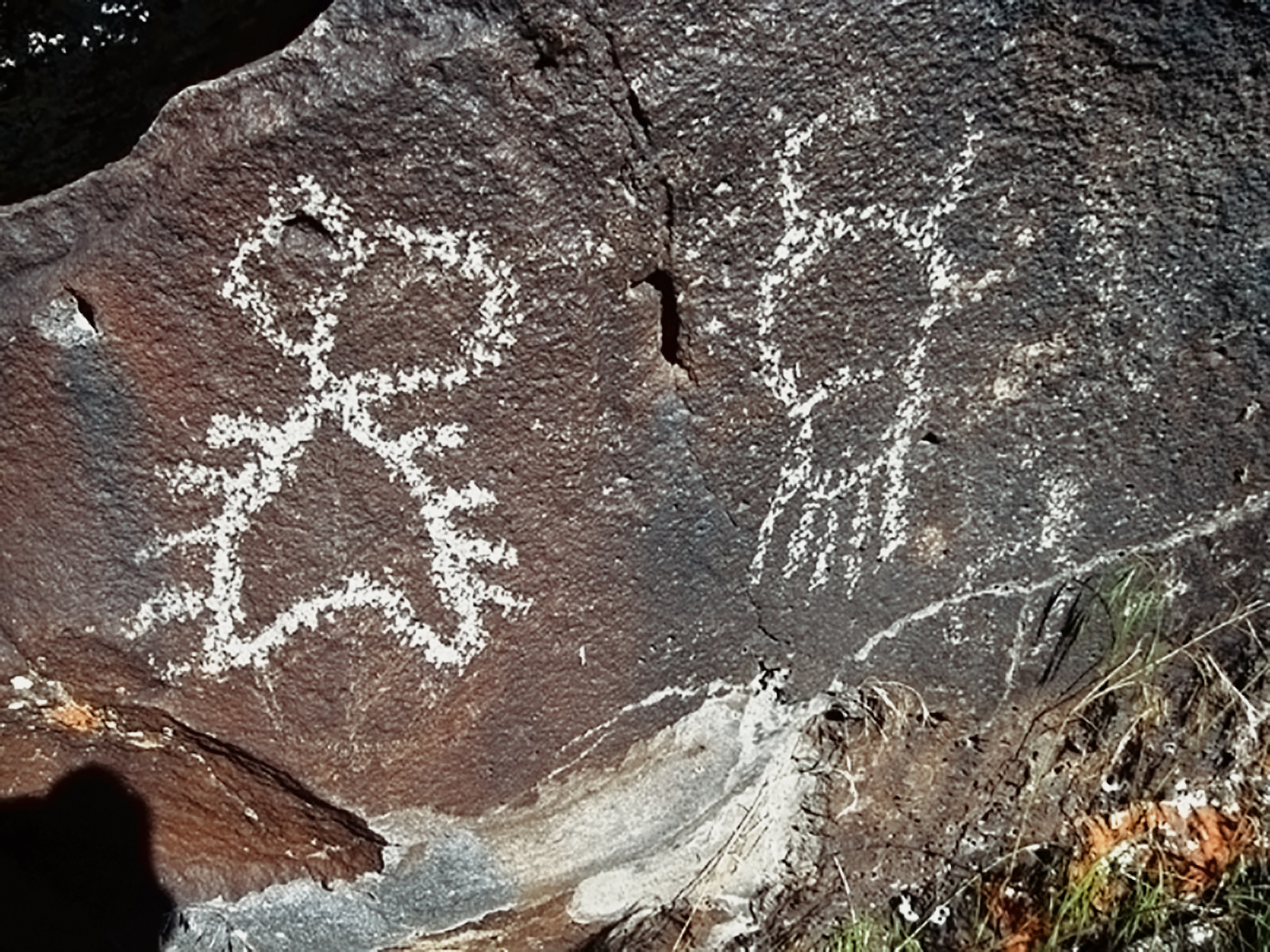
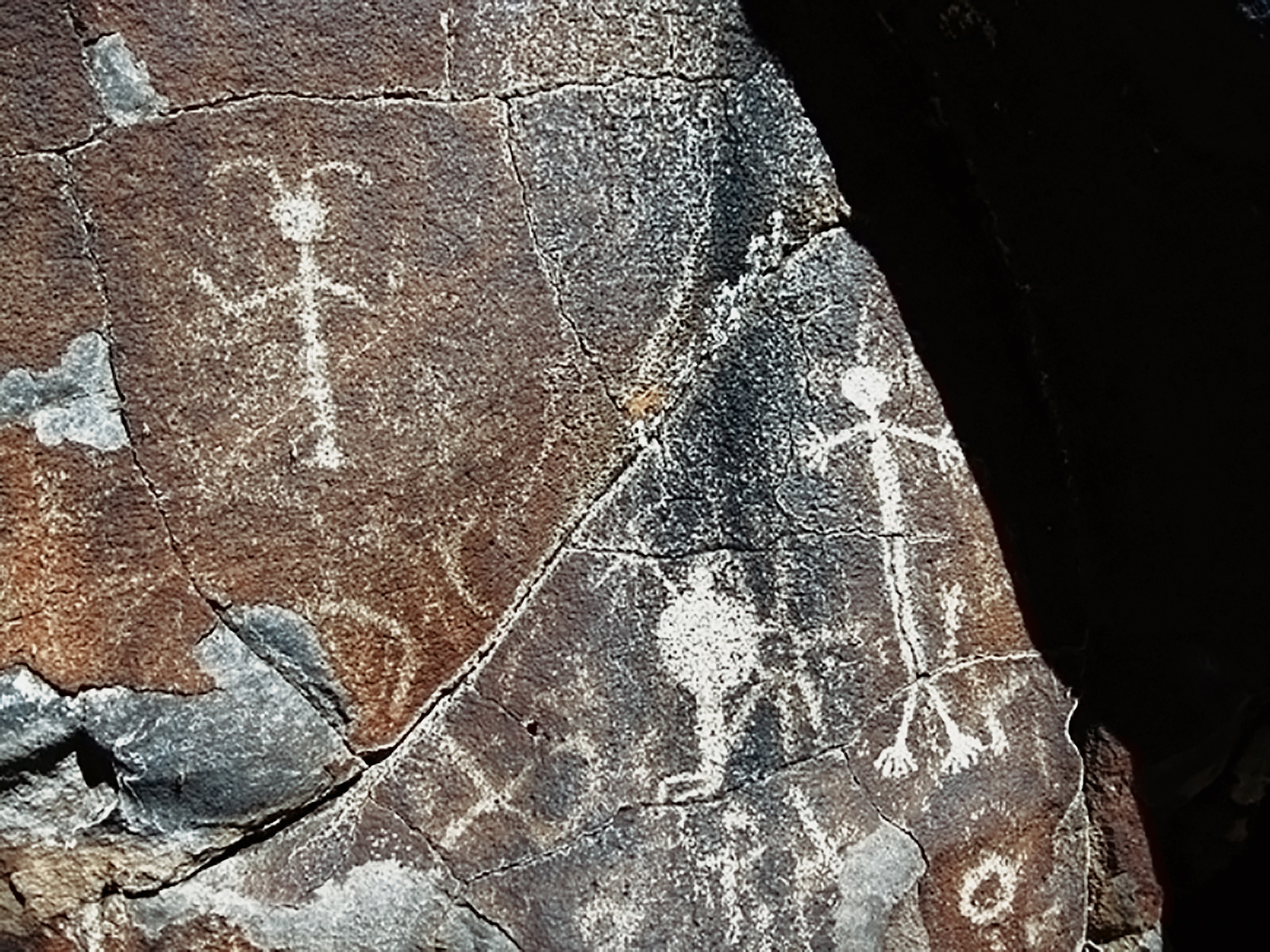
These sites range from a few scattered petroglyphs at some sites to several miles of stone out crops that almost literally have been engraved with images for as far as the eye can see. Since these images are subject to natural and human forces, while enduring, they are not “permanent”. It is therefore imperative that a comprehensive photographic record of these sites be created. As they exist on the northern edge of the Great Basin and greatly contribute to the record for that larger geographical area and quite likely in part predate the eruption of Mt. Mazama, recording and preservation is all the more imperative. Their proximity to very early and important archaeological sites such as the Ft. Rock complex and Paisley Cave potentially gives added weight to their importance, particularly in light of Jenkins' 2009 discoveries at the latter.
We have visited and photographically recorded over a hundred Loring recorded rock art sites and it is our intention to locate and visit as many more of them as possible. We will continue to record and document them as described above. A report consisting of locations (including maps and correlation with Cressman and Loring and Loring site numbers), assessment of condition, photos of visually exciting panels will be prepared. In addition, a VHS and/or video CD will be prepared as a complete record or our explorations and observations. I have acquired software that will move me in the direction of being able to make our observations and photos available in the more modern CD/DVD formats. In 2007 LeeAnn converted to digital photography, enabling her to capture more views of what we see. We will acquire more digital camera chips so that our recording of the sites will be more complete. I will continue to submit articles with photos to Screenings.
LeeAnn will continue to add photos, dates and other information to her albums and add new pages of the sites we visit in 2011. We have devised a method of taking acceptable digital photos of her efforts and those were presented to the OAS and archived in the OAS library in 2008. LeeAnn has integrated many of the Lorings' original photos into her albums and into this digital album. This will make our work available to a much broader audience and serve as a record of encroachment of natural destructive elements, such as lichen, spalling and calcification and human caused influences at the sites.
We have published a couple of photo books through a .com concern and continue to entertain this avenue as a way of preserving and promulgating our efforts. We feel the publication committee of the OAS should consider printing some of our research, especially that of non Loring recorded sites that we record. I wrote a paper following those guidelines in 2009 and it was published by OAS in 2010. We also self published a guidebook for visiting publically controlled rock art in Oregon, Washington and Idaho. Such books aid in preservation efforts through public education. I continue to maintain and add photographs, links etc. to our website www.oregonrockart.com.
We intend to make further attempts to reach and record Loring recorded sites that high water has prevented us from reaching in previous years. And to continue locating, visiting and recording sites that are not contained in the Loring inventory, particularly in Lake County.
In addition we will be concentrating considerable effort to reach as many Loring and nonLoring sites in the Owyhee River drainage as possible since they are part of the Great Basin tradition. Due to weather and road conditions this area presents considerable challenges. After a spring expedition ended with a stuck truck in the middle of a snow storm and a fall expedition that I canceled due to impending inclement weather, the wisest course seems to be to attempt this in mid Summer. This was accomplished with much success in July 2010 and one other OAS member accompanied us.
As in past years, we anticipate making several week plus long expeditions during the summer of 2011. These are camping trips (necessitated by the remoteness and difficulty of access), bracketed by motel stays. During the fall and winter of 2011-2012 we will prepare the material as described above for presentation to OAS during 2012. A copy of our photos, maps, commentary and video will be archived in the OAS library. We will make a presentation to the OAS if it can be scheduled and LeeAnn will make her albums available for viewing during an OAS meeting..
→ Subscribe free to the Bradshaw Foundation YouTube Channel
→ America Rock Art Index
→ The Rock Art of Baja California
→ Baja On Film
→ California Rock Art Foundation
→ Baja In Search of Painted Caves
→ Baja Great Murals Gallery
→ Sierra de San Francisco
→ Baja 2018 Expedition
→ The Rock Art of the Lower Pecos Canyonlands
→ Color Engenders Life
→ The Rock Art of Arizona
→ The Rock Art of Nevada
→ Coso Sheep Cult of East California
→ Coso Range Rock Art Gallery
→ The Rock Art of Moab Utah
→ The Rock Art of the Oregon Territory
→ RAN - USA Colloquium 2018
→ Removal & Camouflage of Graffiti
→ Graffiti Dates & Names
→ Vandalised Petroglyphs in Texas
→ Preserving Our Ancient Art Galleries
→ Bradshaw Foundation
→ Rock Art Network