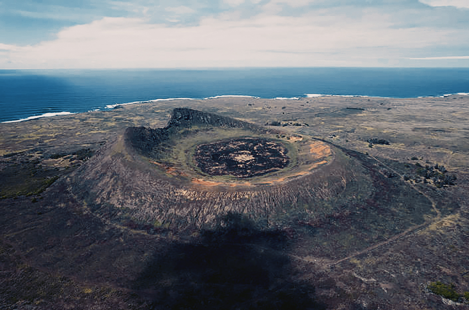


The typical landscape on Rapa Nui consists of rounded extinct volcanoes covered in low vegetation. It is a volcanic high island, consisting mainly of three extinct coalesced volcanoes: Terevaka (altitude 507 metres) forms the bulk of the island, while two other volcanoes, Poike and Rano Kau, form the eastern and southern headlands and give the island its roughly triangular shape. Lesser cones and other volcanic features include the crater Rano Raraku, the cinder cone Puna Pau and many volcanic caves including lava tubes. Poike used to be a separate island until volcanic material from Terevaka united it to the larger whole. The island is dominated by hawaiite and basalt flows which are rich in iron and show affinity with igneous rocks found in the Galápagos Islands.
The three extinct volcanoes are chiefly composed of tuff, a porous rock formed of compacted volcanic fragments, and are joined by their own lava flows which give the island its characteristic triangular shape. Parasitic tuff craters and cones - craters and cones formed on the side of, or near, volcanoes after the original vent has become plugged up - are interspersed in the landscape, which is otherwise dominated by eroded lava fields in which obsidian is commonly found.
Most of these fields are thickly packed with both large and small lumps of cellular and tuffaceous lava that is either black or rusty in colour. Stoneless surface soil is sparse; it is suitable for extensive cultivation mainly in the Hanga Roa and Mataveri area in the southwest, at Vaihu and on the plain southwest of the volcano Rano Raraku, and on the prehistorically cleared Poike peninsula in the eastern corner of the island. Rain collects in the partly bog-covered crater lakes of the volcanoes Rano Kao, Rano Raraku, and Rano Aroi. One intermittent stream, fed by the Rano Aroi crater lake, flows down Mount Terevaka’s slopes before disappearing into the porous soil. Water from the extremely deep crater of Rano Kao, which is about 900 metres wide, is piped to Hanga Roa. The coast is formed by soft, eroded, ashy cliffs, with a vertical drop of about 150 to 300 metres; the cliffs are intercepted by long stretches of low, hard, and rugged lava formations.
There is no natural harbour, but anchorage is found off Hanga Roa on the west coast; off Vinapu and Hotu-Iti on the south coast; and off Anakena and in the Bahía la Perouse on the north coast. Notable among the few small offshore islets are Motu-Nui, Motu-Iti, and Motu-Kaokao (which figured in a local bird cult) near the southwest cape. The only true sand beach is at Anakena; most other beaches are of gravel. Caves abound, many consisting of subterranean rooms joined by narrow tunnels extending far into the lava beds.
[Source: Wikipedia/Encyclopedia Britanicca]
→ Subscribe free to the Bradshaw Foundation YouTube Channel
→ Easter Island / Rapa Nui Index
→ Easter Island / Rapa Nui Introduction
→ Sentinels in Stone
→ The Birdman Motif
→ The Geography of Rapa Nui
→ Sea Creatures
→ Designs Motifs
→ Dr Georgia Lee
→ iLecture
→ Thor Heyerdahl
→ Bradshaw Foundation
→ Rock Art Network
